| This page has pictures that cover the second half of the flight - after crossing the Dumbarton Bridge to the East side of the bay, we fly over the Cargill salt ponds and then back across the bottom the ther bay via the ghost town of Drawbridge and so back to Moffett Field. |
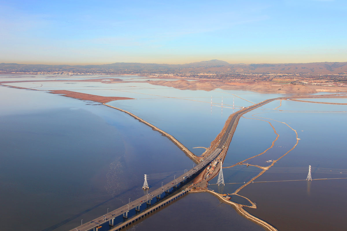 |
| 8096 We approach the east side of the bay as we pass over the end of the Dumbarton Bridge. |
 |
| 8097 Looking south towards the bottom of the bay, we get the first hint of the salt ponds to come. |
 |
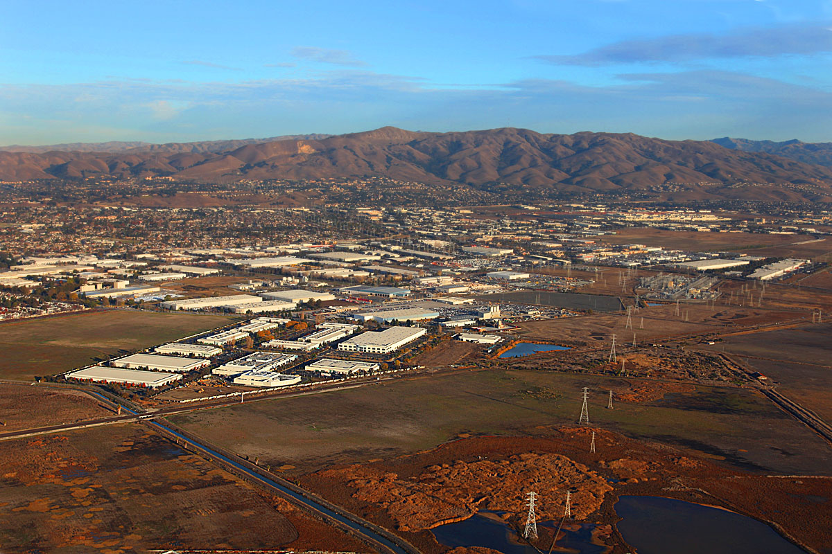
| 8098 Ahead of us lies Fremont and the East Bay Hills. |
 |
| 8099 Looking out of the left, we are passing over tidal wetlands and bird sanctuary. The white line that appears to be crossing the middle of the window is the Hetch Hetchy water line bringing water from the Sierras to supply San Fancisco and most of the peninsula with fresh water. |
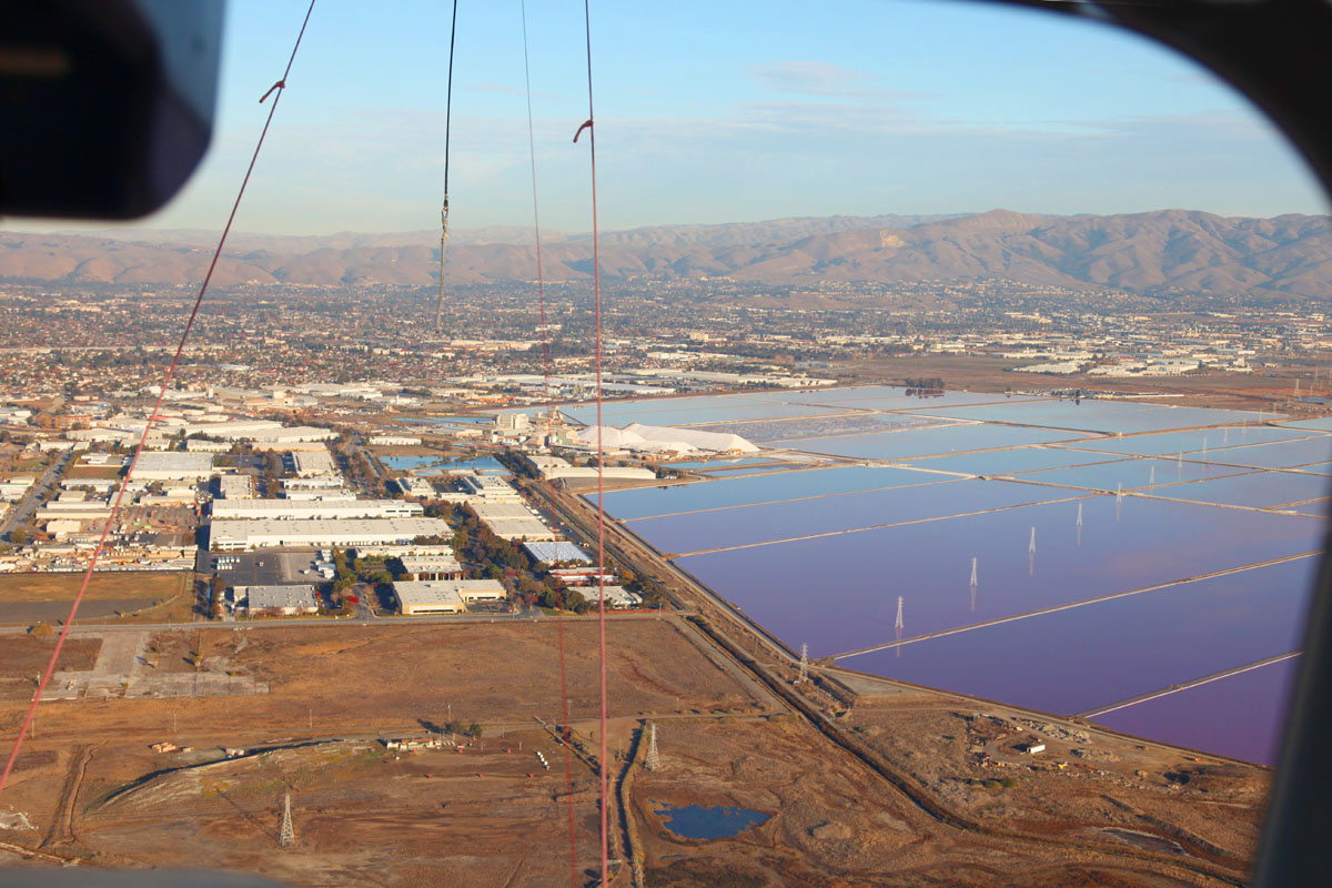 |
| 8101 Looking ahead past the cockpit through the windshield, we see what appear to be huge mounds of white stuff piled up at the edge of a number of rectangular ponds.
Notice that the ponds appear to be a shade of blue (or even purplish bottom right) as we look at them from this angle and with the light coming from behind us. The color will change as our angle of view changes... |
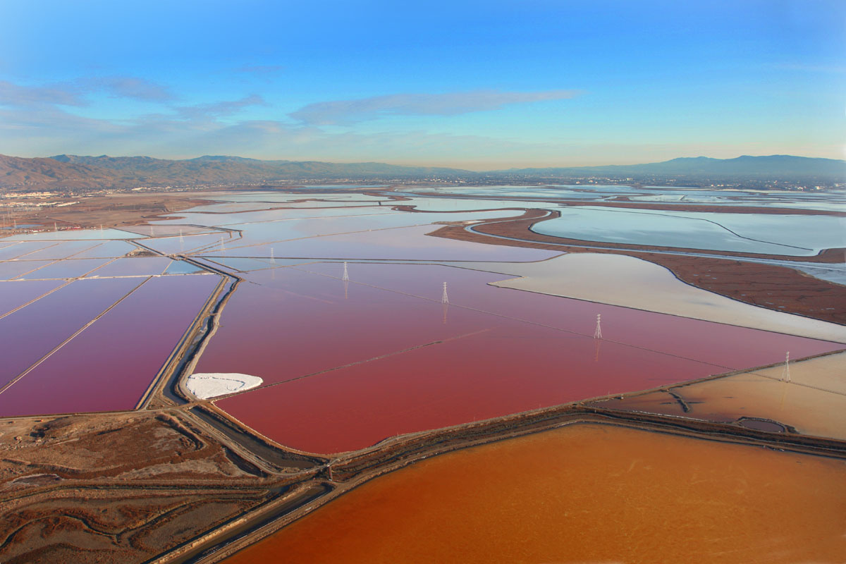 |
| 8102 As we change our angle of view from oblique (left) to vertical (middle), so the blue/purple changes to red/orange/yellow.
The color difference is not solely an effect of the viewing angle although it is enhanced by it - the color originates from the brine shrimp, algae, cyanobacteria and other "stuff" growing or becoming more concentrated as the water in the salt ponds is allowed to evaporate and the brine is pumped from one pond to another to where eventually salt will precipitate out of the saturated solution and be harvested.. |
 |
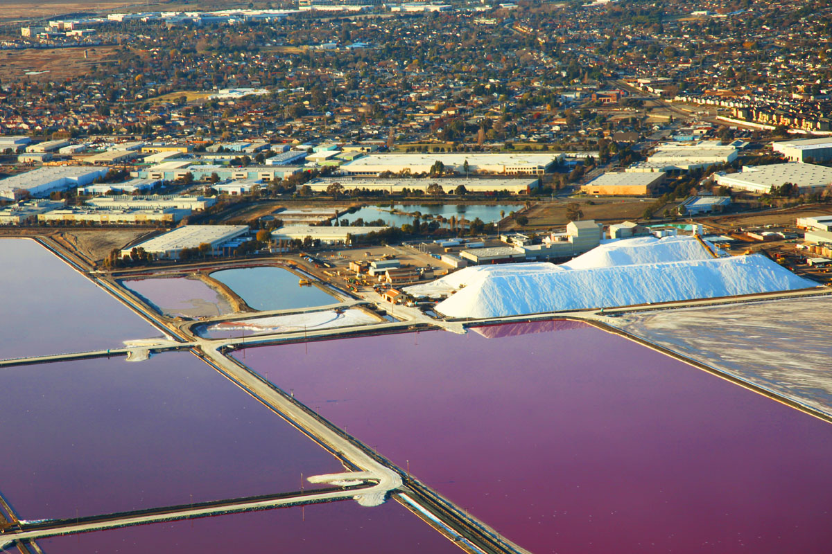
| 8107 A closer look at the harvested salt piles, and the ponds look blue and purple... |
 |
| 8108 A quick glance through the rear window and past the tail wheel shows us the Hetch Hetchy water line crossing the bay, and the end of the Dumbarton Bridge top left. |
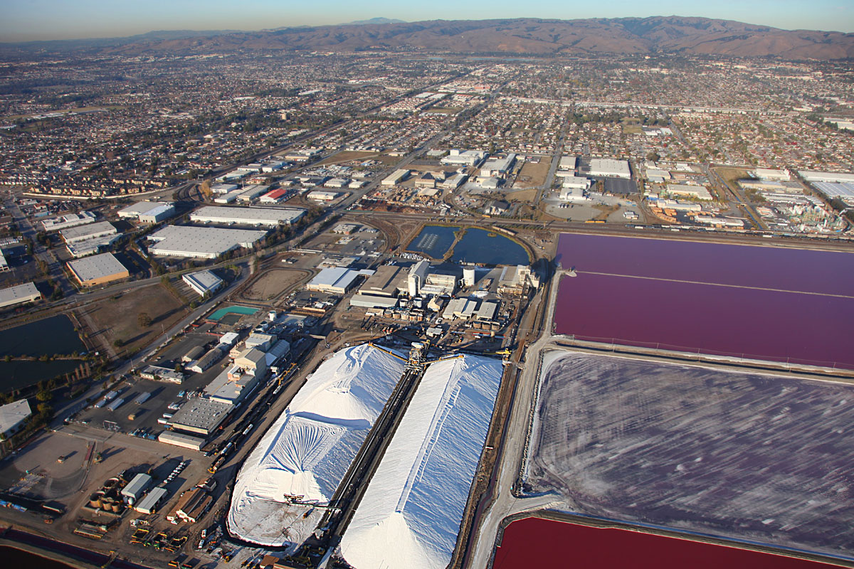 |
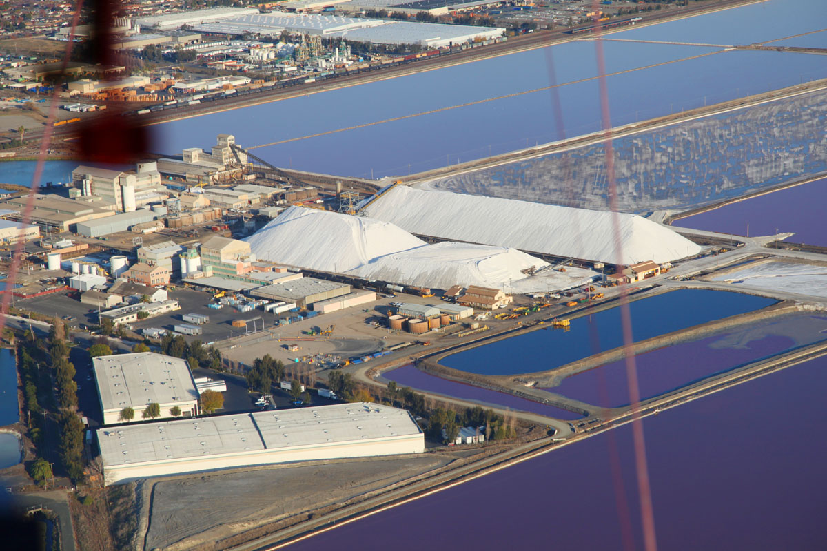
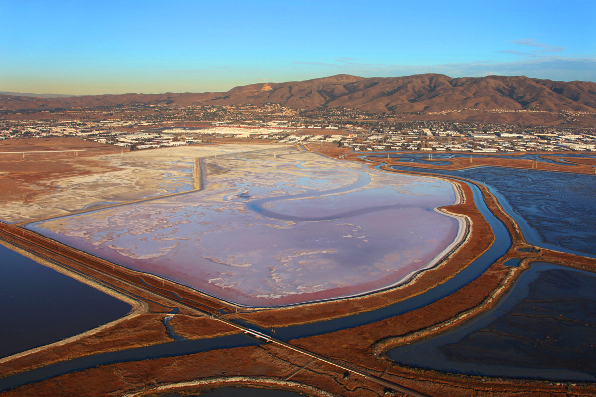
| 8111 The City of Fremont in the background with the salt mounds in front and harvest ponds to the right. The middle pond appears white and fuzzy - this is because it has just been harvested and the salt scraped up - at the rate of about 40 tons/acre (100 tons/hectare) |
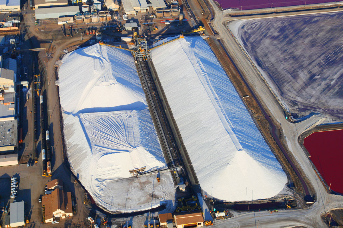 |
| 8110 A closer look at the salt piles. Cargill salt company has the mineral rights to about 50,000 acres, they evaporate about 150,000 acre/feet of water per annum, and harvest about 1.2 Million tons of salt per annum. |
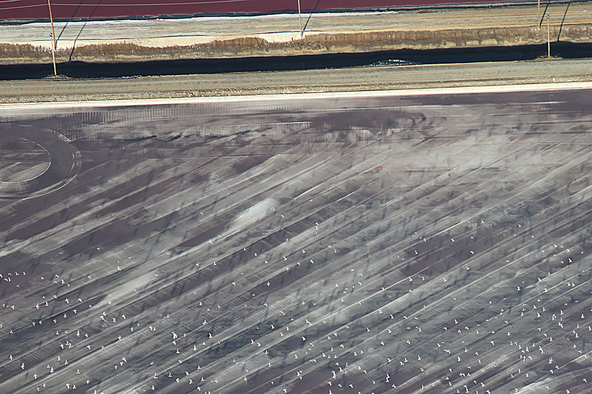 |
| 8113 A closer look at the recently harvested pond - where we have just disturbed a flock of birds who probably imagine us to be some huge predator. |
 |
| 8114 The color of purple or the color of blood... It all depends... |
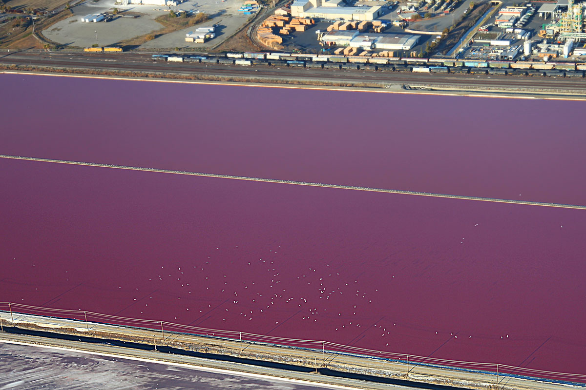 |
| 8115 More purple-to-red depending on angle of view - with disturbed birds in flight. At the top of the image you can see trains of railroad cars waiting to take the salt away. |
 |
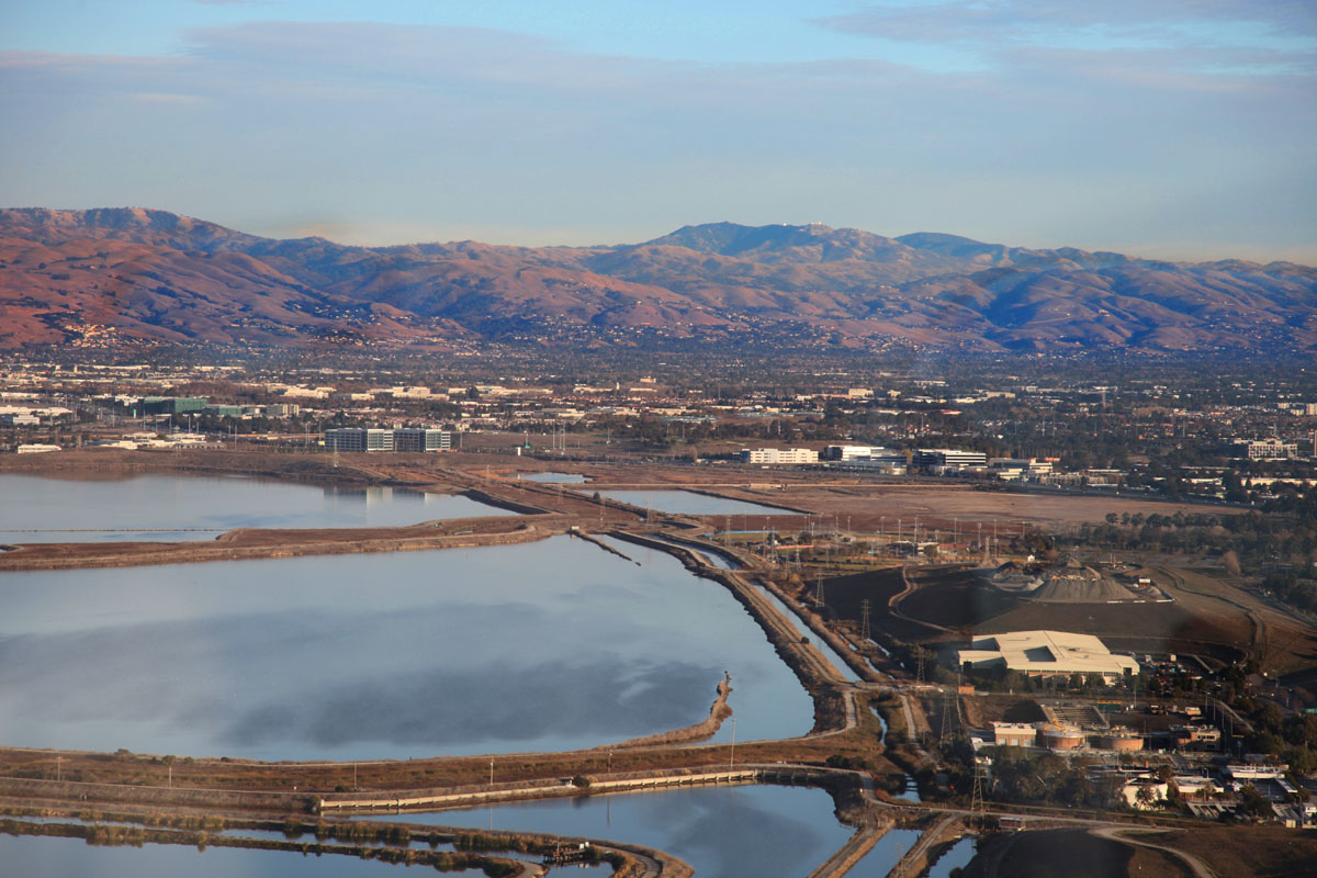
| 8118 Looking toward the East Bay Hills and Mission Peak |
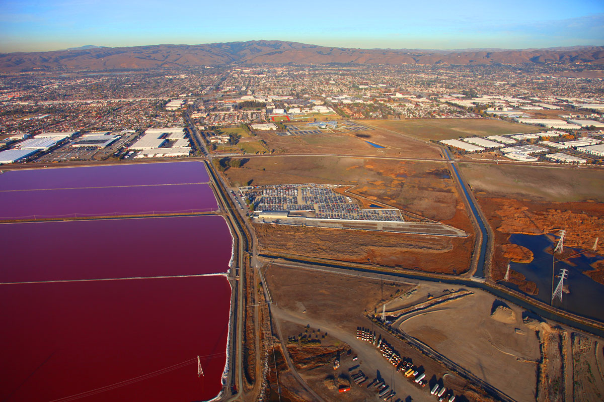 |
| 8119 At the opposite end of the rectangular evaporation ponds (away from the salt pile) appears to be a huge parking lot in the middle of nowhere. |
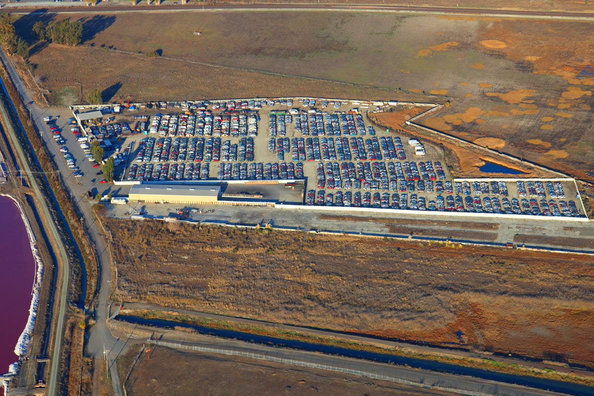 |
| 8120 Closer examination reveals this to be a huge car wrecking/recycling operation with 100's of cars neatly
arranged in rows. Need a spare part? (A quick estimate looking at a full-size enlargement of this picture tells me there are between 1800 and 2000 wrecks in this picture) |
 |
| 8121 Looking back, the blue and purple have swapped places. |
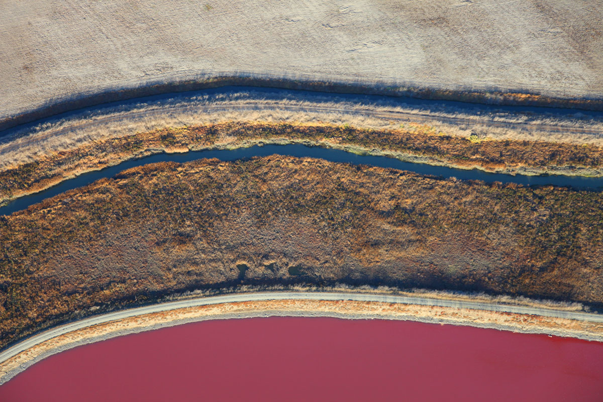 |
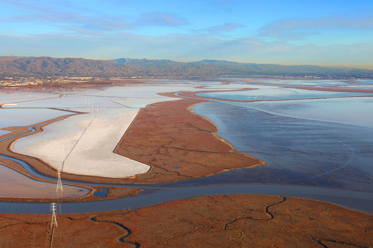
| 8122 Detail showing a recently harvested pond at top, then a slough/creek protected by levees on either side and leading to open waters on the bay, Below that, the deep red of another evaporation pond still concentrating its brine. |
 |
| 8124 Almost ready for harvest, the salt is crystalizing out. |
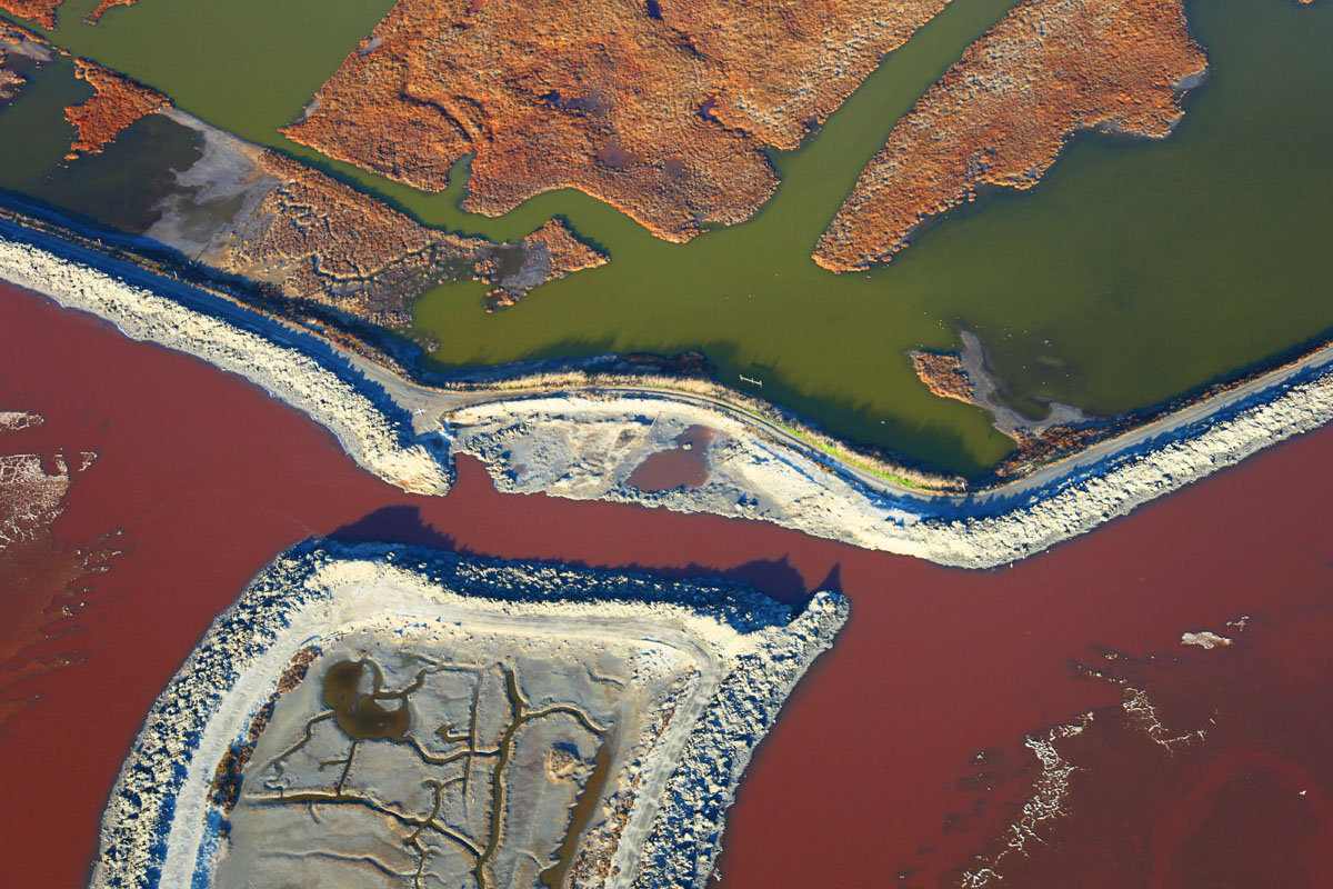 |
| 8125 Green and Red - a levee separates the waters of the bay from that held in an evaporation pond. Levee edges on the side of the evaporation pond are encrusted with salt. |
 |
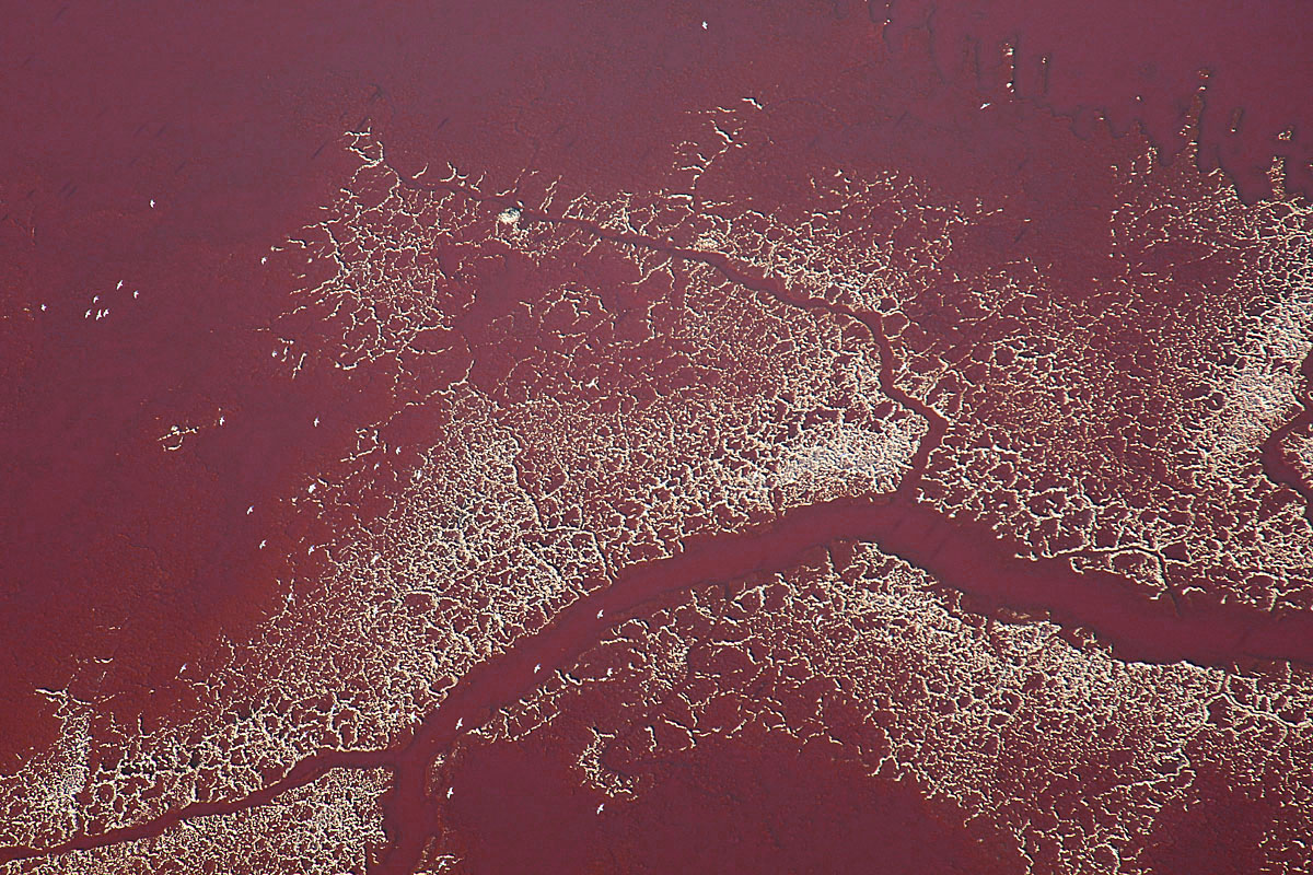
| 8126 All the way from light blue through purple to deep red with tendrils of white salt creating patterns. |
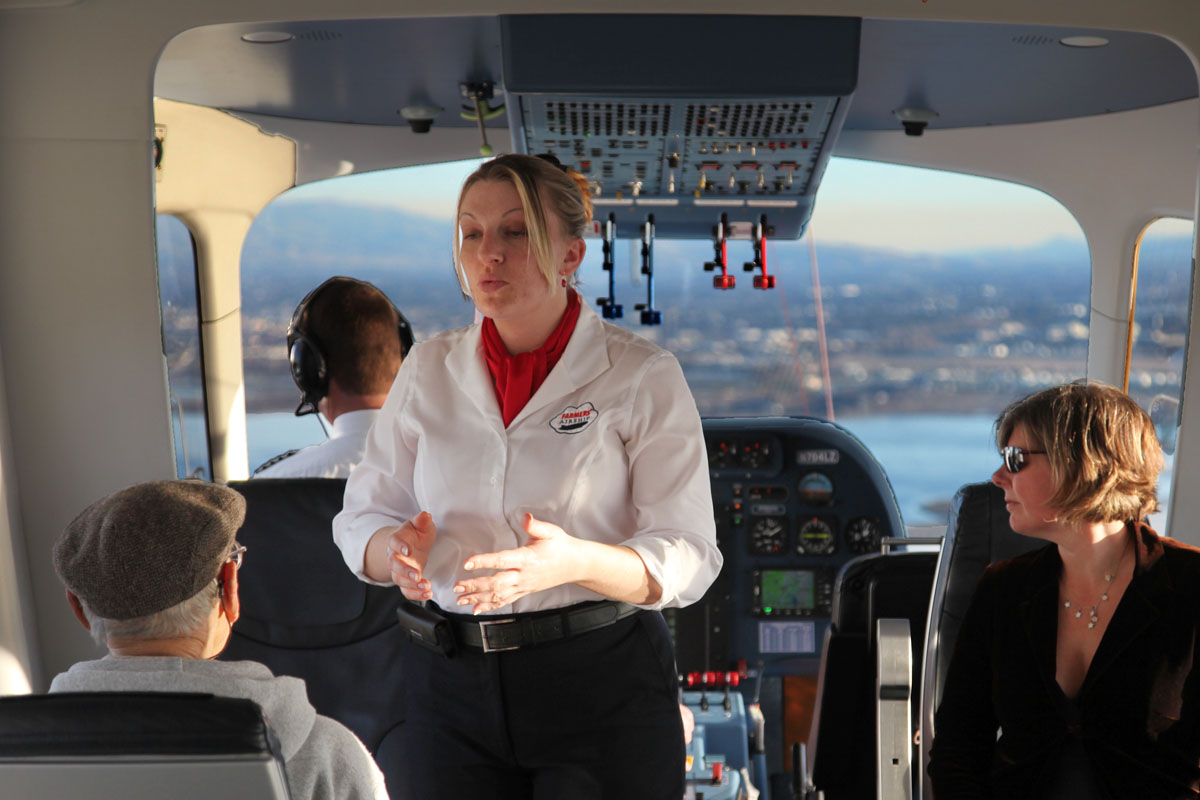 |
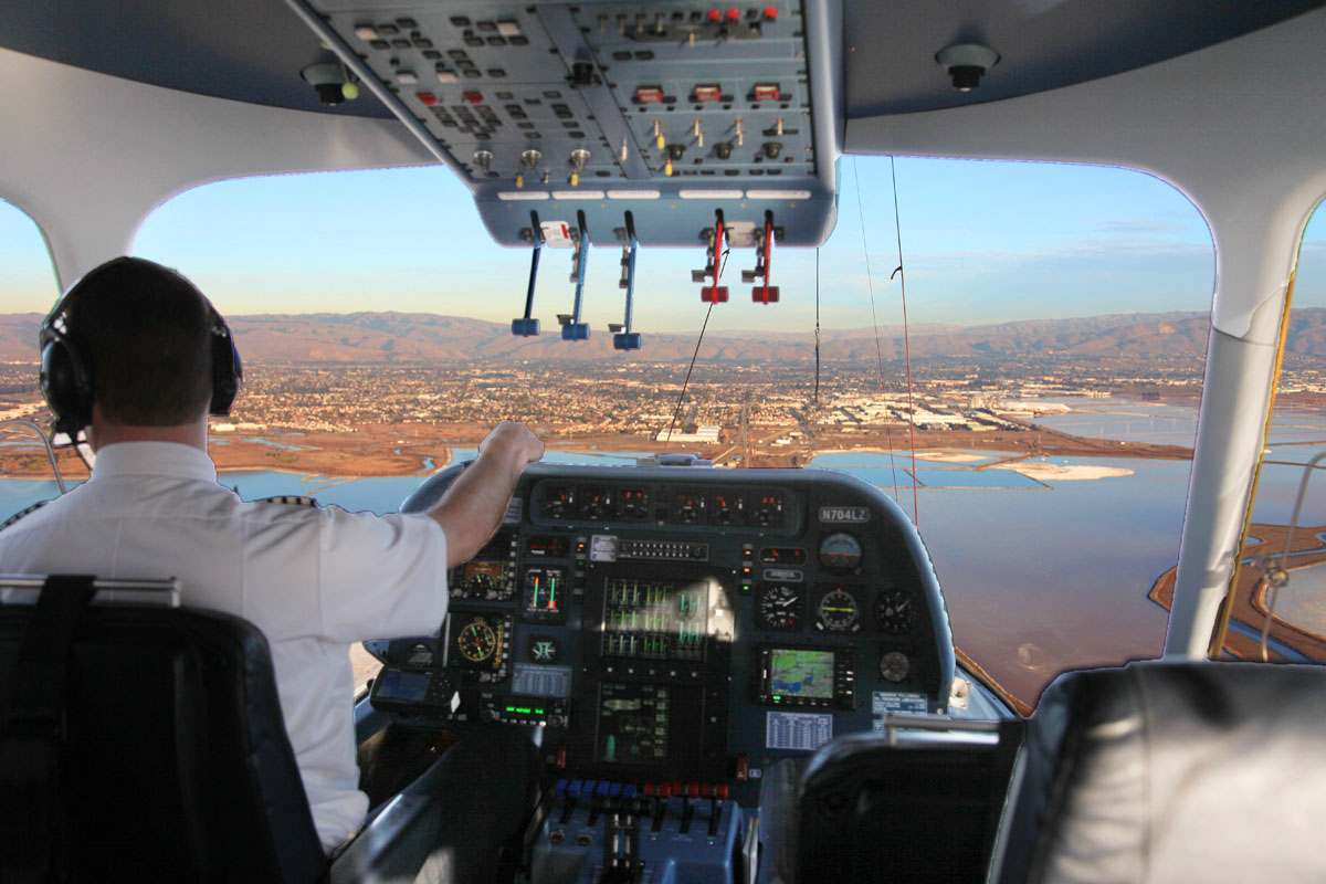
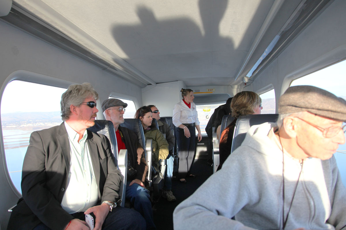
| 8127 Crew member acting as guide answers questions as we head south towards the bottom of the bay. |
 |
| 8129 Below we can see the railway line (crossing lower left corner) that goes from San Jose to Oakland - it crosses the bay through wetlands not accessible to the public. |
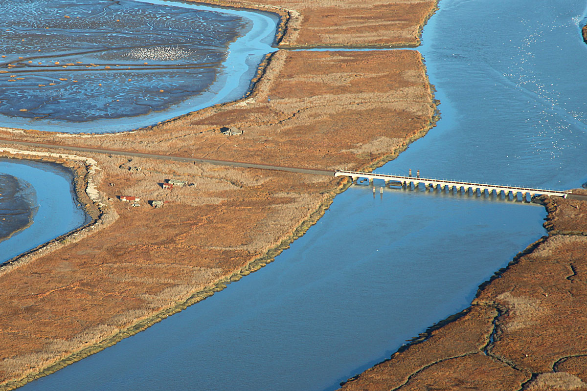 |
| 8131 If you look carefully you can see where the railway passes through the abandoned ghost town of "Drawbridge". This used to be a thriving farming community, beloved by bootleggers during prohibition due to its unique access limitations. However, regular flooding by bay waters caused the town to eventually be abandoned and the wooden buildings are now returning to nature. |
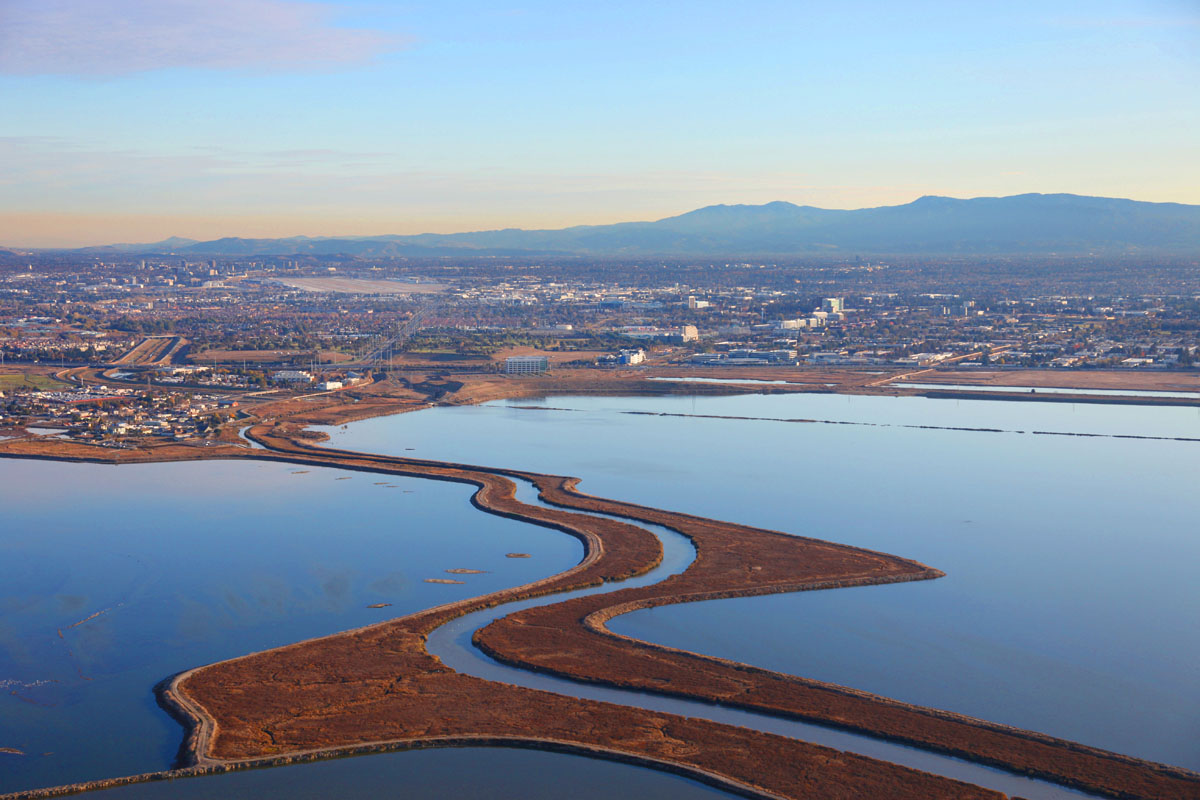 |
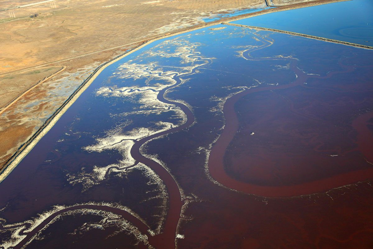
| 8133 At the bottom of the bay lies the little town of Alviso where the Guadeloupe river from San Jose is led out to the open waters of the bay. On either side are former salt ponds
which have now been opened up to natural tidal flow on the way to being reclaimed as natural wetlands.
On the horizon are the coastal mountains behind which lie Santa Cruz and the Pacific Ocean. |
 |
| 8135 San Jose on our left... |
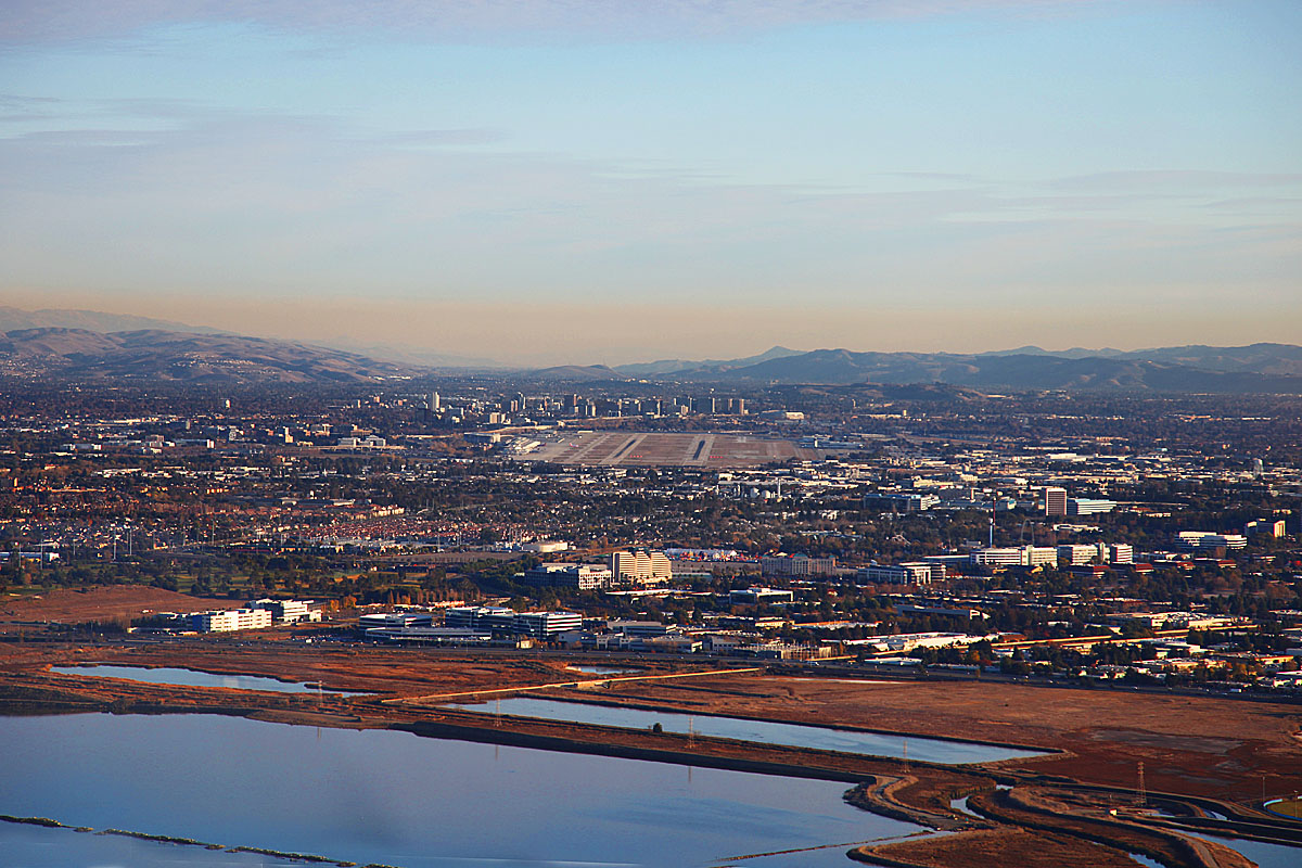 |
| 8136 Looking south straight down the Santa Clara Valley towards Gilroy. We can see the runways of San Jose Airport and behind them the skyscrapers of the city itself. |
 |
| 8138 We reach the western shore opposite the end of Mathilda Avenue in Sunnyvale. The Twin Creeks Sports Complex with all its light masts can be seen just beyond the large mound created originaly as a dump site opposite Crossman Avenue, and with the recycling center on this side of the mound. |
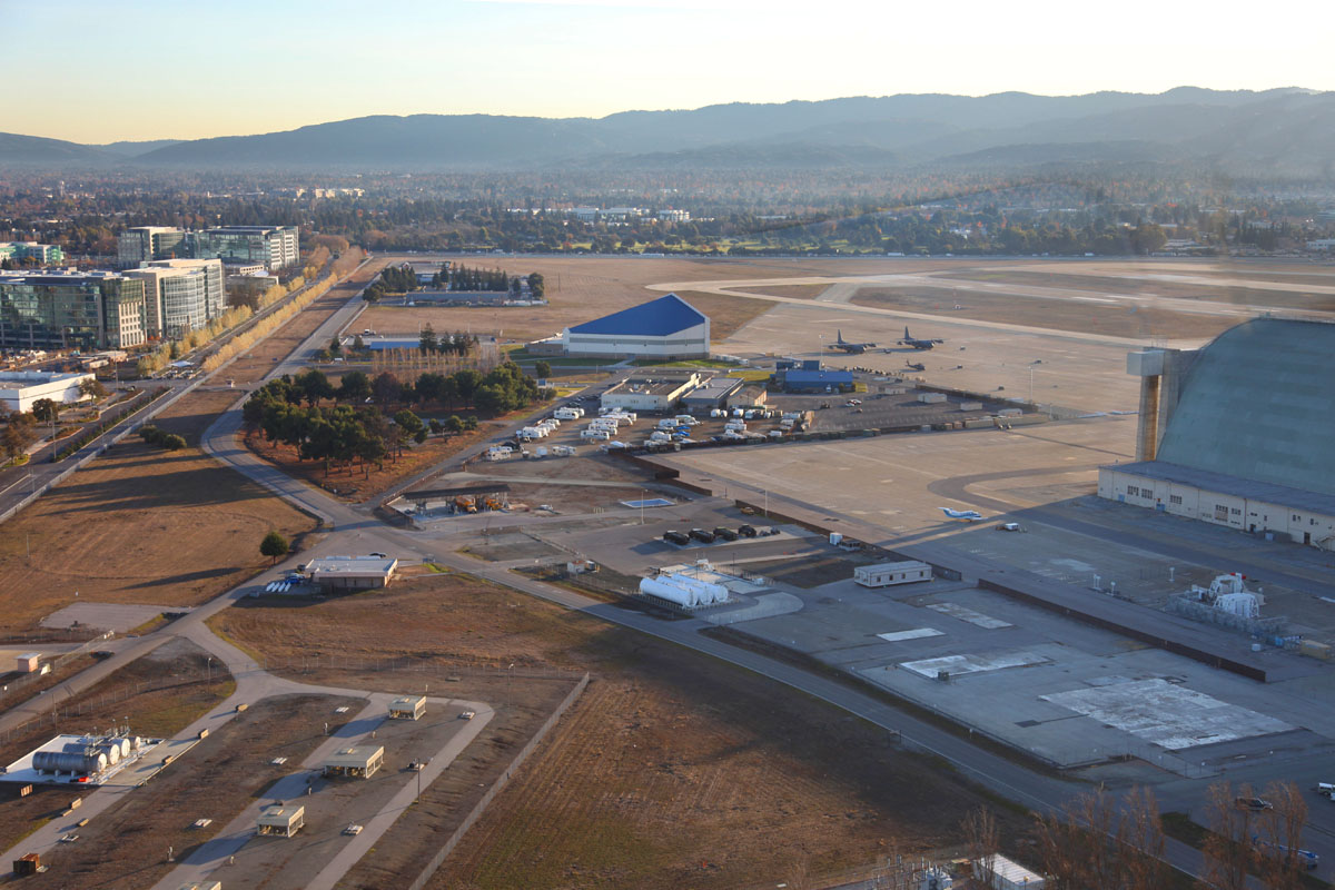 |
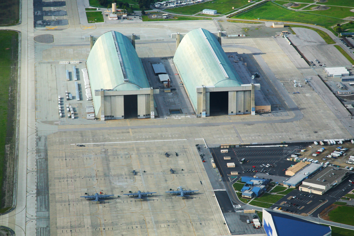
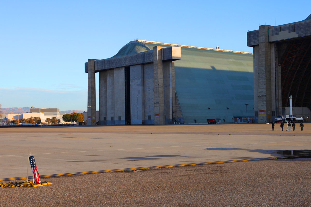
| 8139 Coming in right over the main Lockheed plant, we approach Hangars Two and Three prior to landing. |
 |
| 8825 We are about to land just above and to the left of the two hangars. (Here we are looking north towards the hangars) |
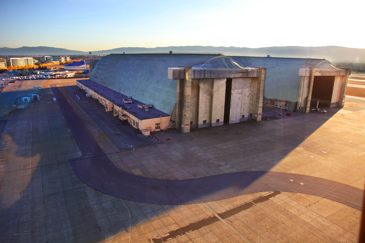 |
| 8141 Here we are looking south towards the hangars, we can see the truck with the mooring mast in the doorway of the second hangar. |
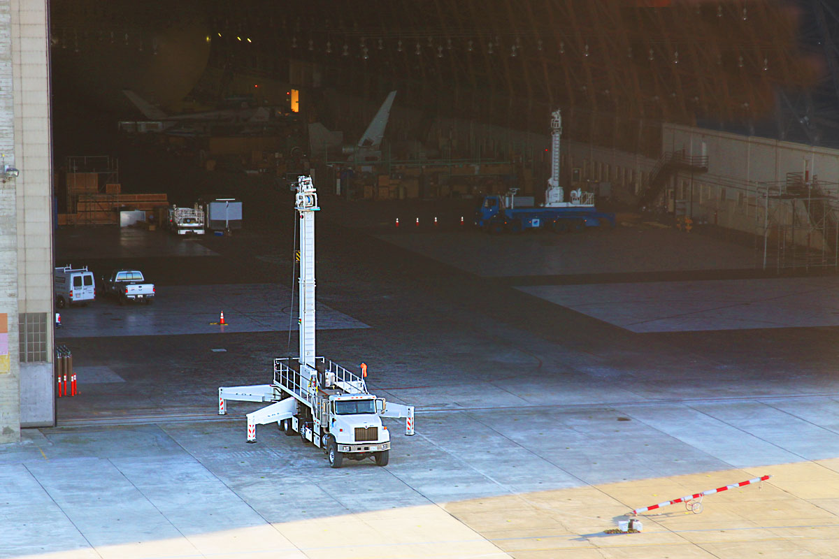 |
| 8143 A closer view of the truck with the mooring mast where the ship will be tied up (and driven into the hangar) when it is done flying for the day. |
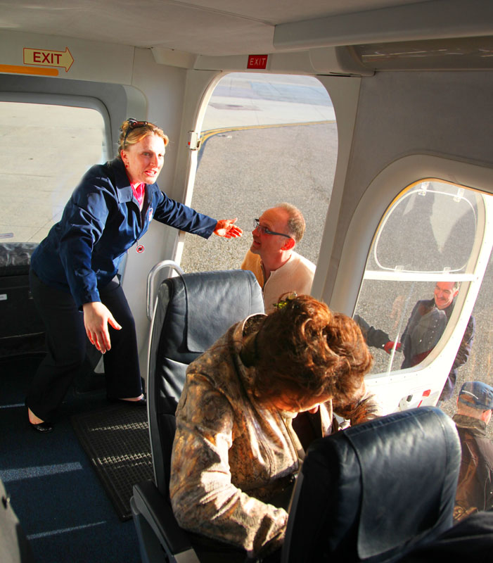 |
| 8148 The dance of the passenger swap is repeated as two are allowed to disembark for every two that come aboard. |
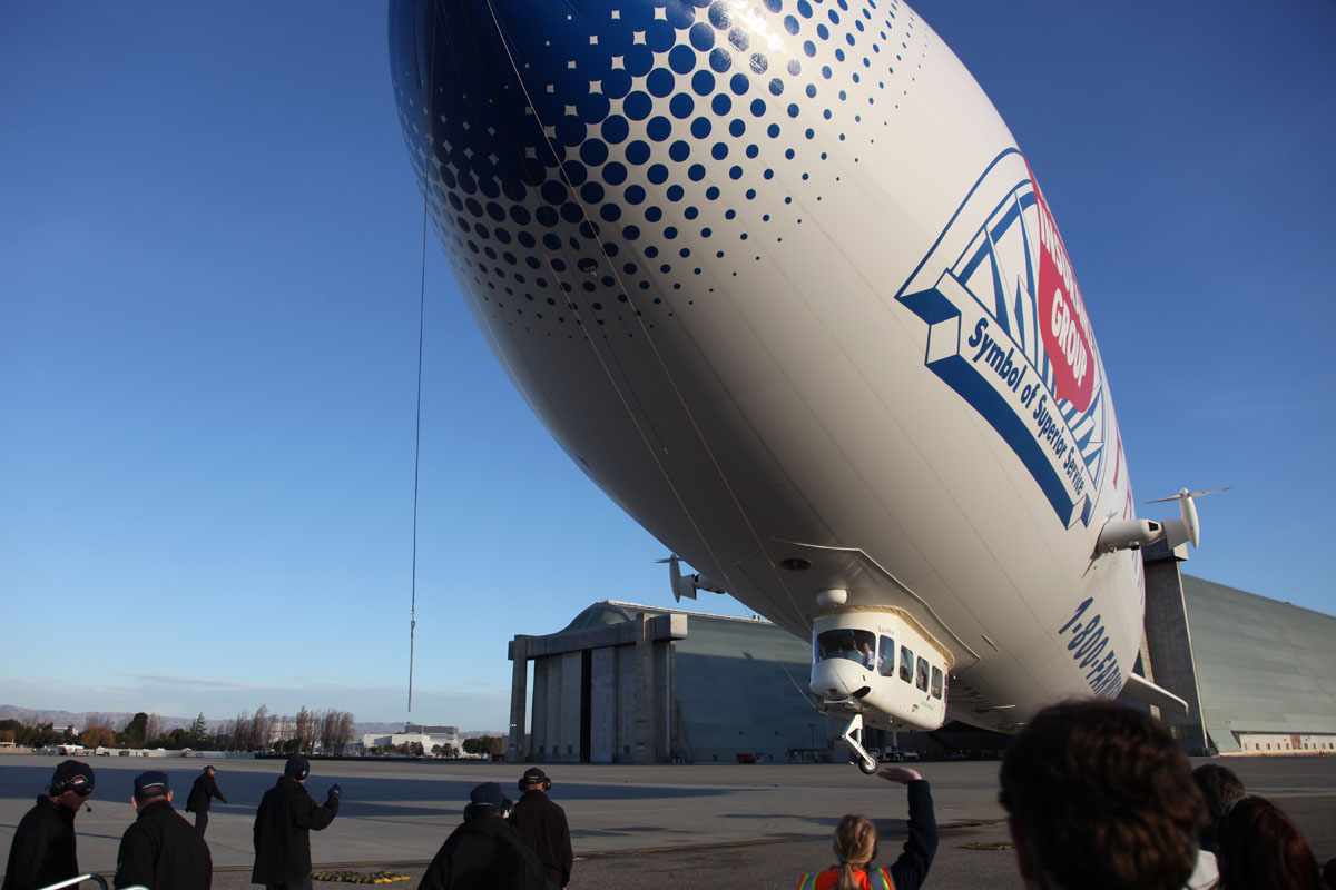 |
| 8150 With a fresh load of passengers on board, the engines which are pointing up have the pitch on their propellers adjusted to pull instead of push and the ship rises. |
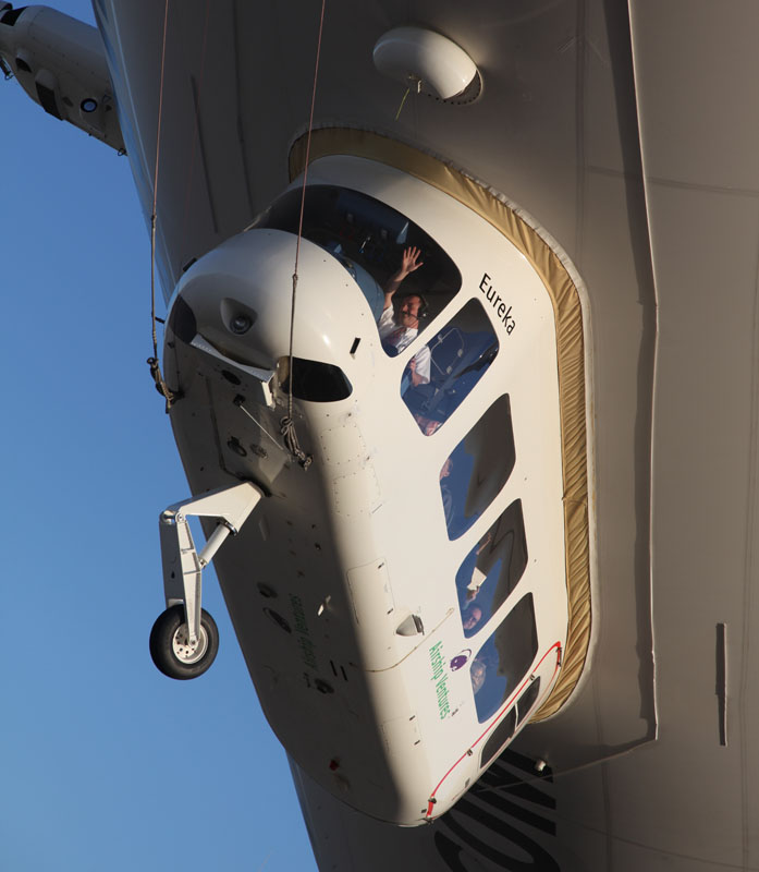 |
| 8151 The pilot waves to acknowledge the shouts of "Luftschiff hoch!" (Up Ship!) from the ground crew - the traditional cry from the ground crew when a Zeppelin is launched. |
 |
| 8152 She rises vertically |
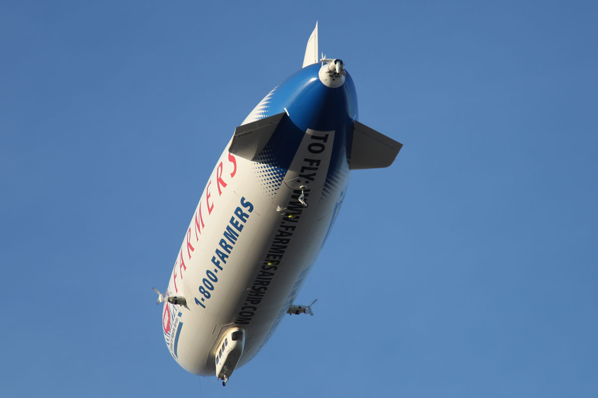 |
| 8156 ...and turns majestically to set out on her next tour with sightseeing passengers |
 |
| 8158 The ground crew walks back to the hangar, leaving the windsock ready for the next landing. |
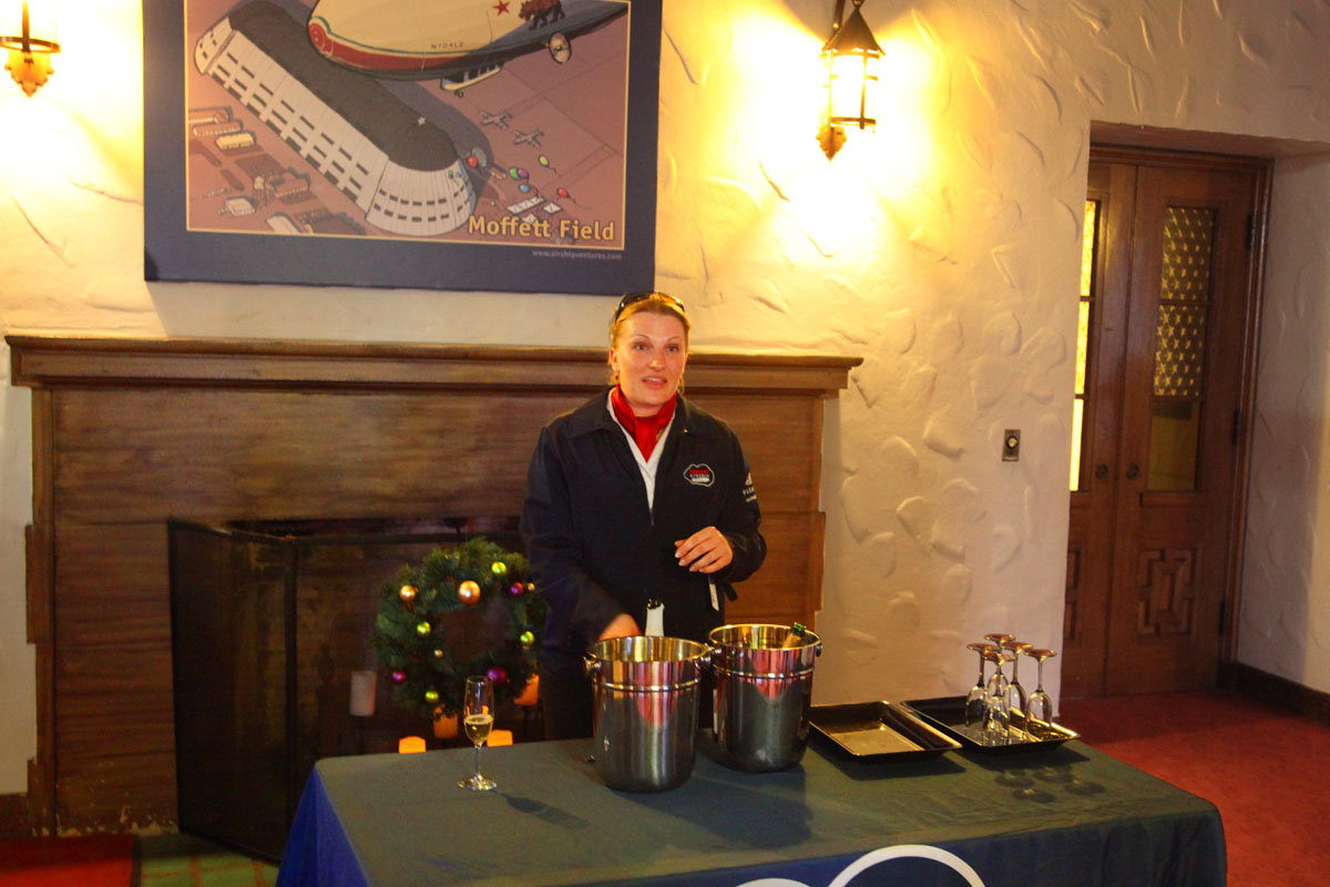 |
| 8161 The van takes us back to the reception area and briefing room where we are treated to the champagne toast that traditionaly marks the end of every successfull balloon flight. |
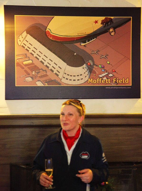 |
| 8164 Cheers! To The Good Ship Eureka! |
|
To return to the pictures of the first half of the flight, click here or you can go back to the Introduction page by clicking here. |