A Quarry is Monitored from the Air
Following are four sets of aerial images of the Lehigh (aka Permanente) Quarry behind Cupertino. The first three sets each contain a series of pictures taken on single flight. These three flights spanned approximately a decade. Lastly there is a series of five images scrounged from Google Earth, and a Project Map showing some details associated with a reclamation plan.
- October 2003
- January 2007
- February 2013
- Google Earth series covering 1948, 1953, 1991, 2007, 2019 + Reclamation Map
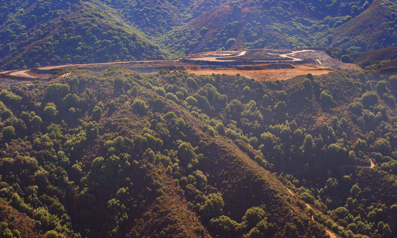
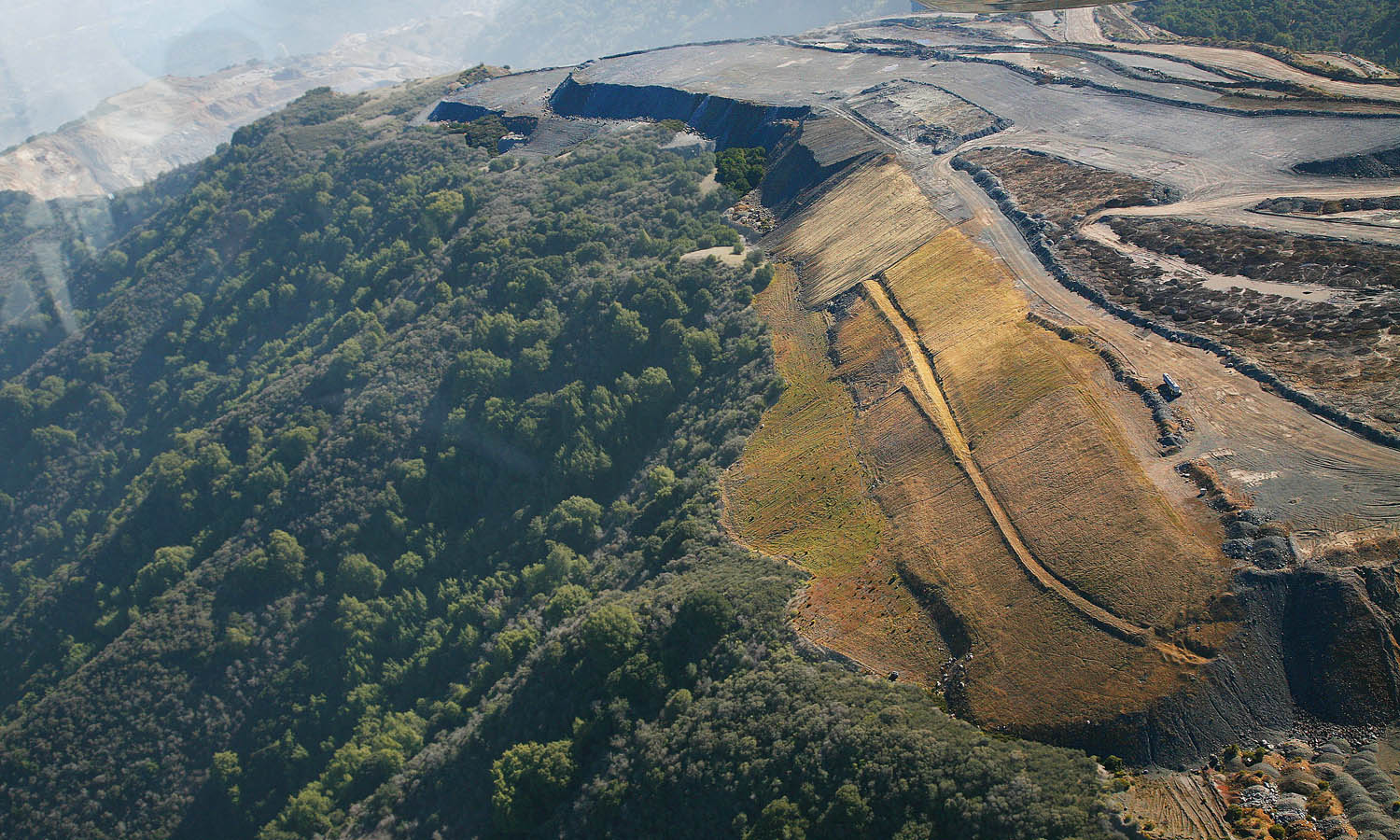
This first set of pictures dates from October 2003.
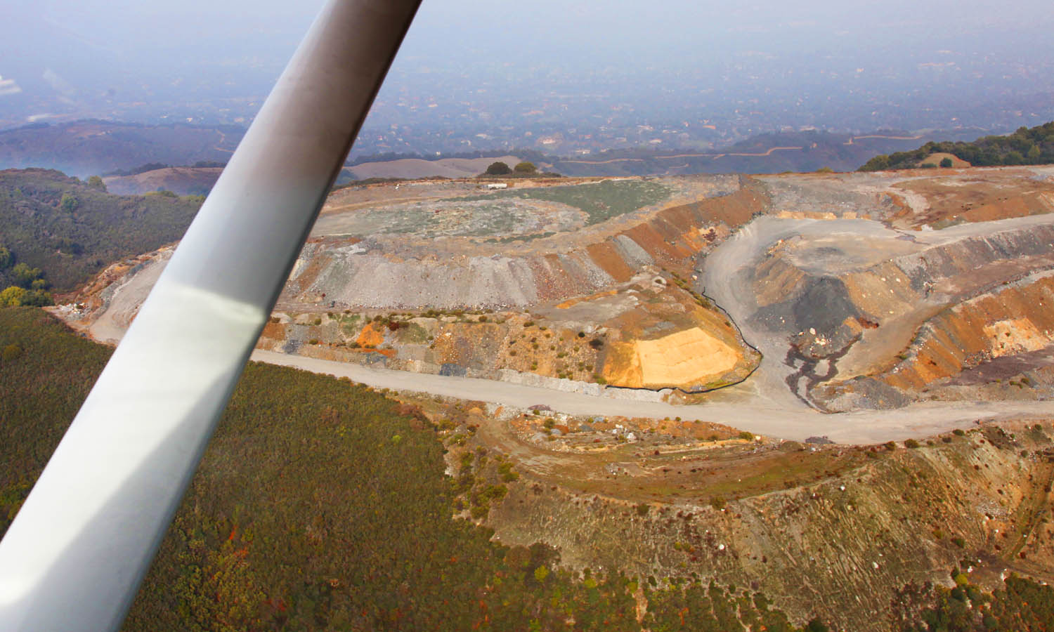
Looking South, towards the western end of the spoils dump which is being spread out over the ridge top and is visible as a scar on the green of the hillside from many points in Silicon Valley. This "view" was once protected by a ridgeline view easement marked on the hillside by four monuments. Part of the ridgeline however collapsed during an earthquake because mining and dirt removal had come too close to the back of it - and the markers can no longer be found. How terribly convenient.
Looking West along the ridge, the San Antonio Open Space Preserve and Los Altos are off the upper right corner. Clearly visible here is the site of one of the landslides where the edge of the "hole" has collapsed and slid down into the hole.
This "overburden" from multiple slides triggered by multiple quakes is now in the way of getting to "the good stuff" and has to be removed and dumped somewhere...
A closer look at the site of one of the landslides with a view of Los Altos Hills over the ridge.
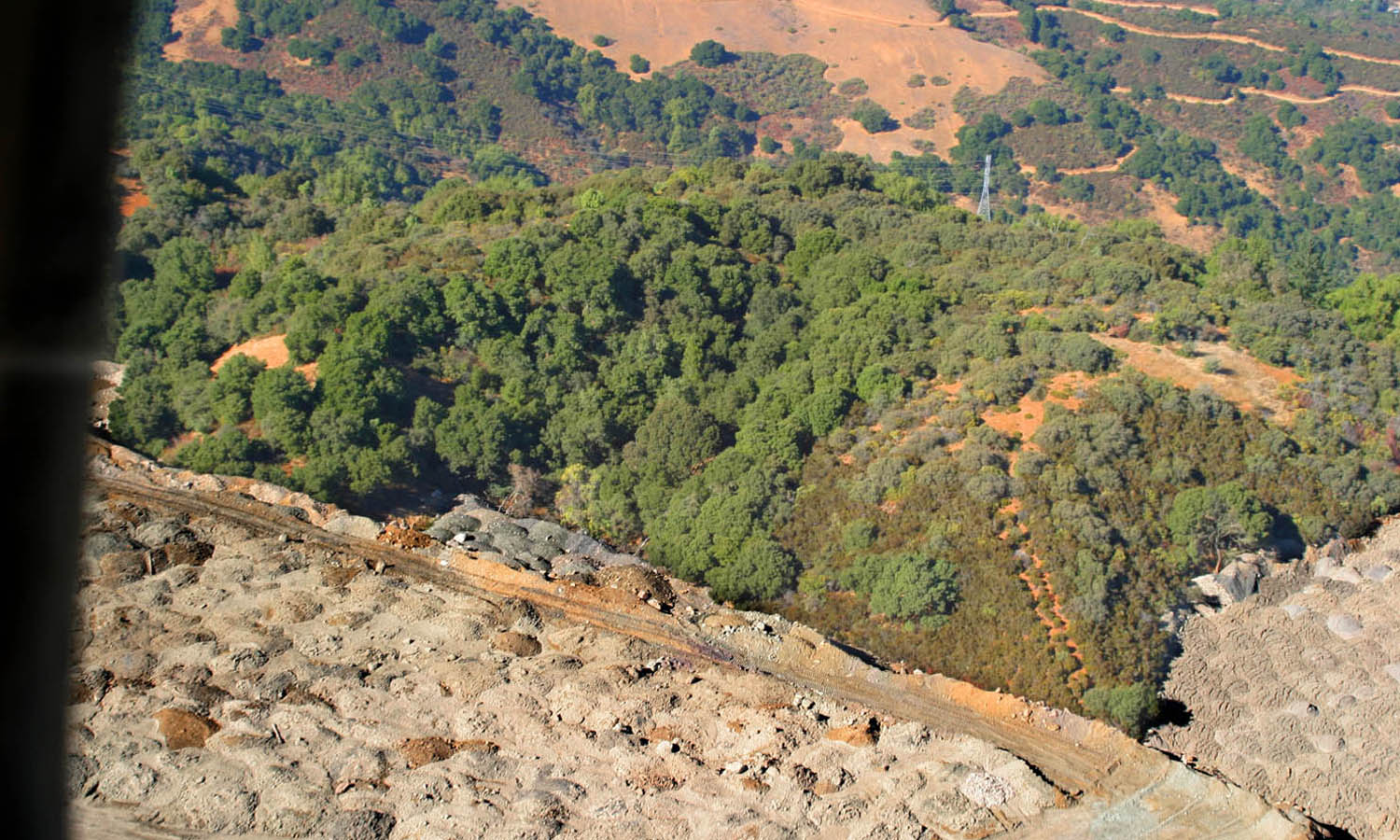
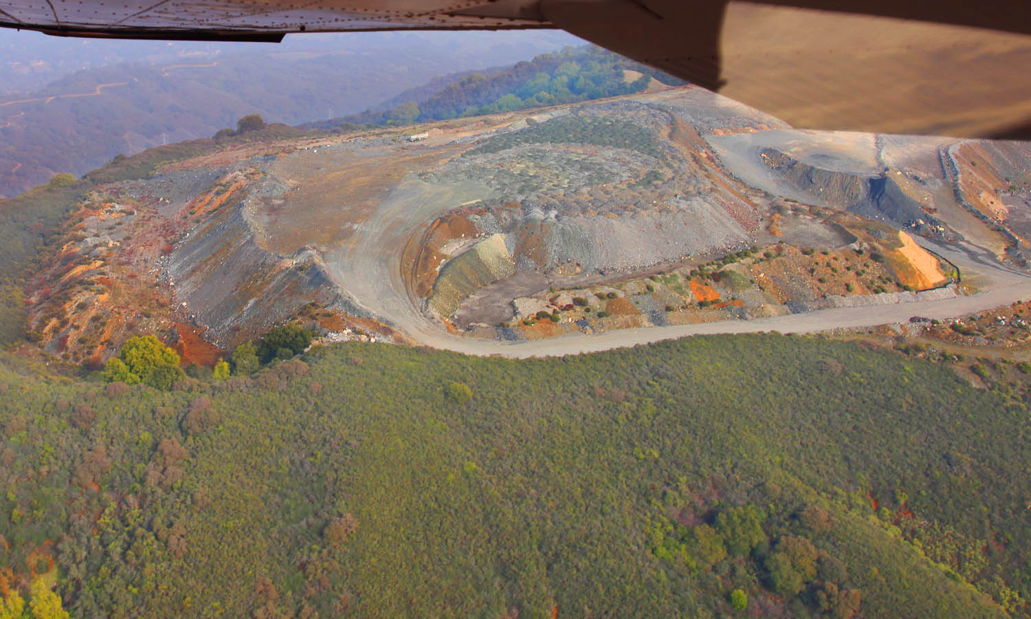
A view of the extreme western end of where dumping is occurring during the period when this flight took place, the water run-off from this area will eventualy find its way into Permanente Creek.
Looking almost vertically down over the North slope of the dump area facing the San Antonio Open Space Preserve (visible at top) with Silicon Valley and The Bay behind it - where water run-off from this area will end up.
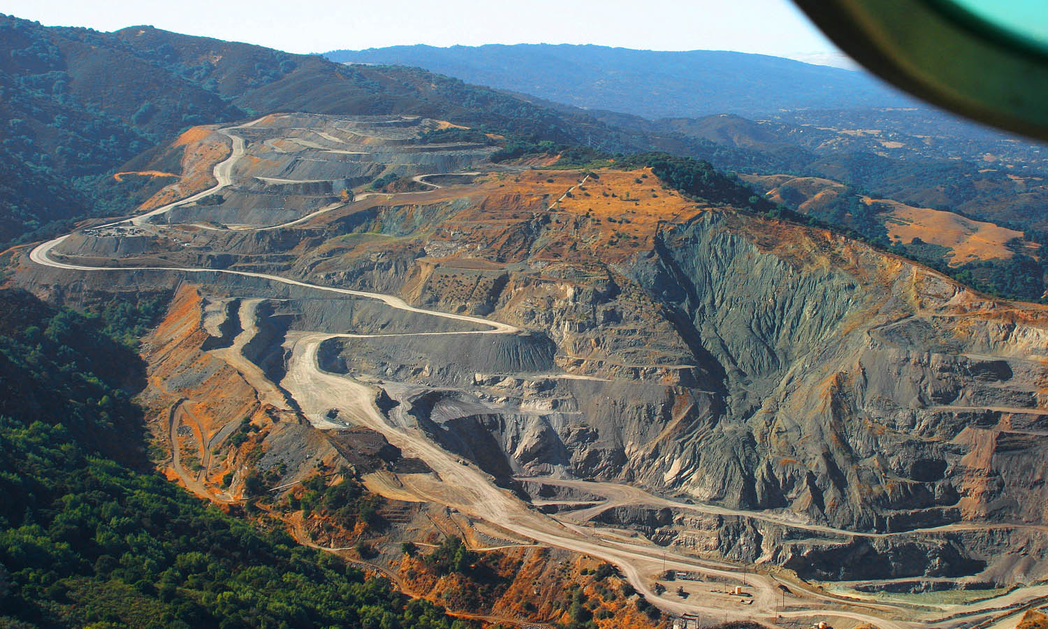
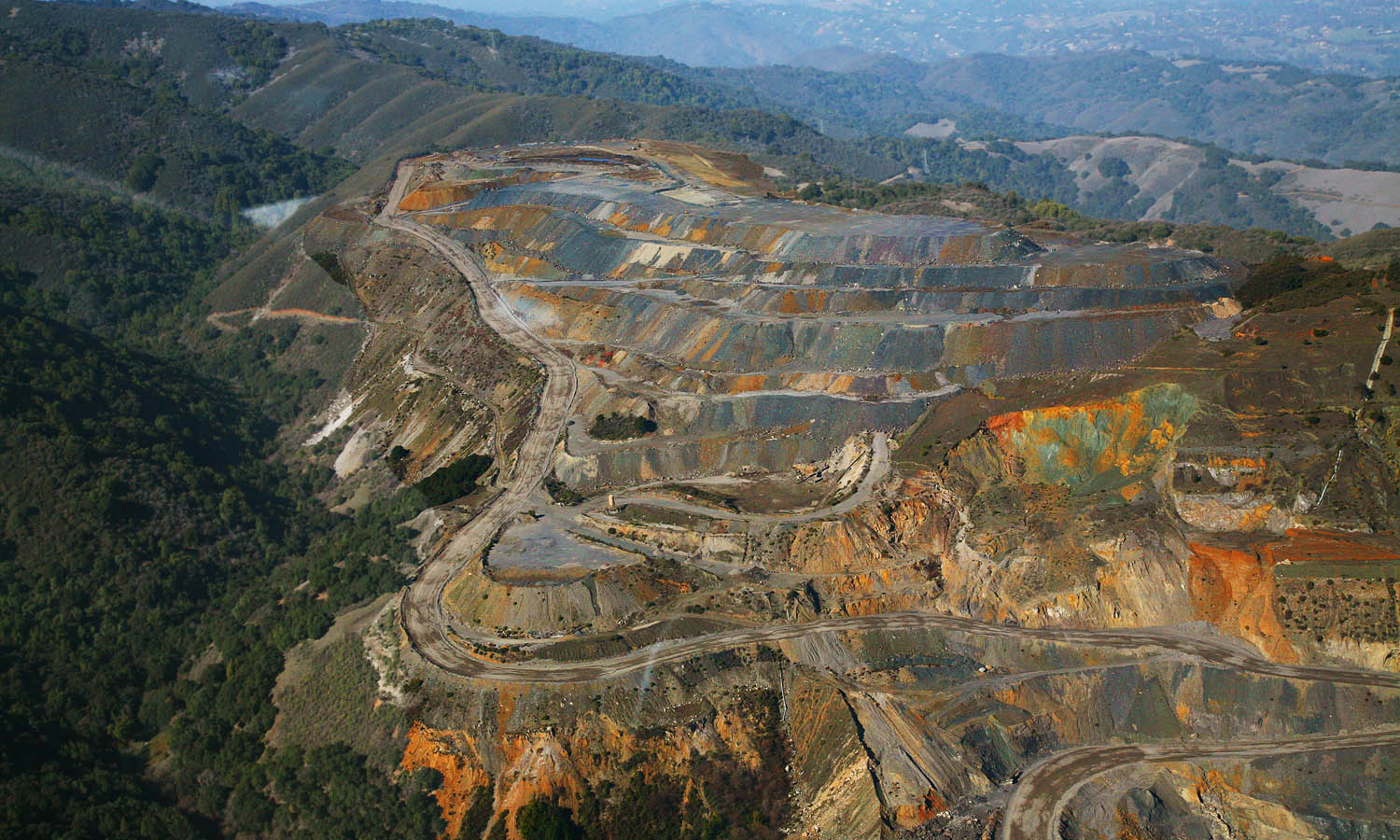
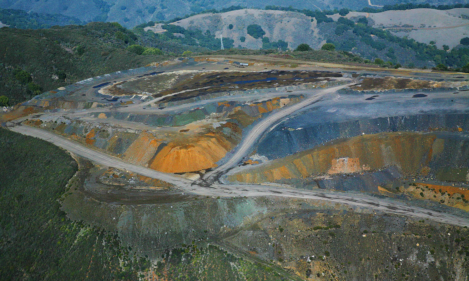
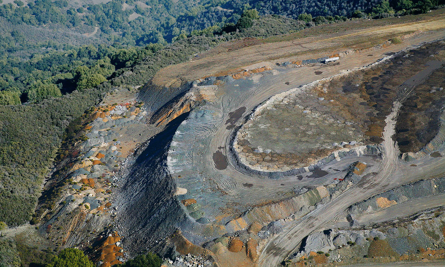
This second set of pictures dates from January 2007
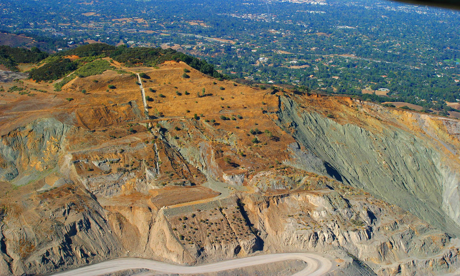
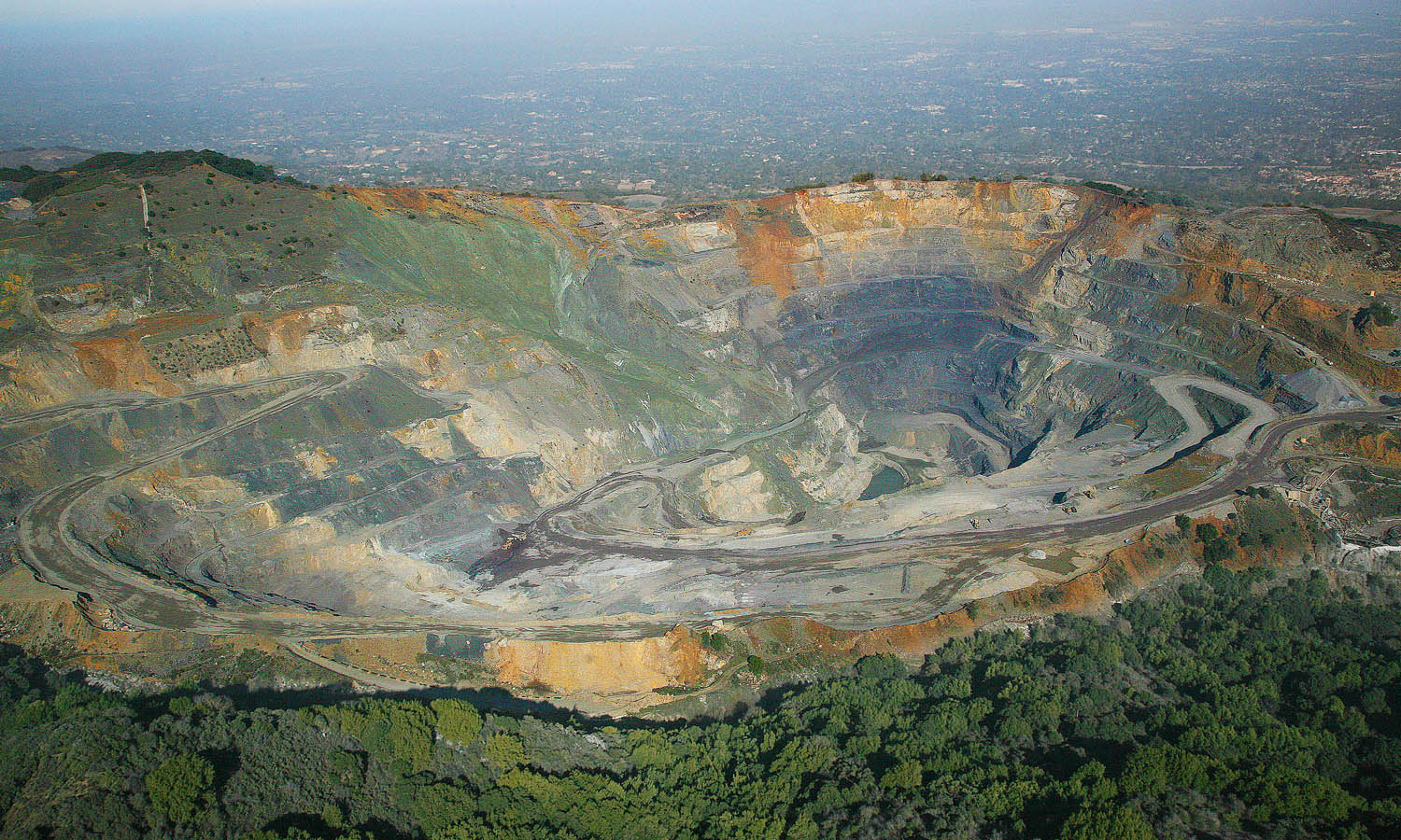
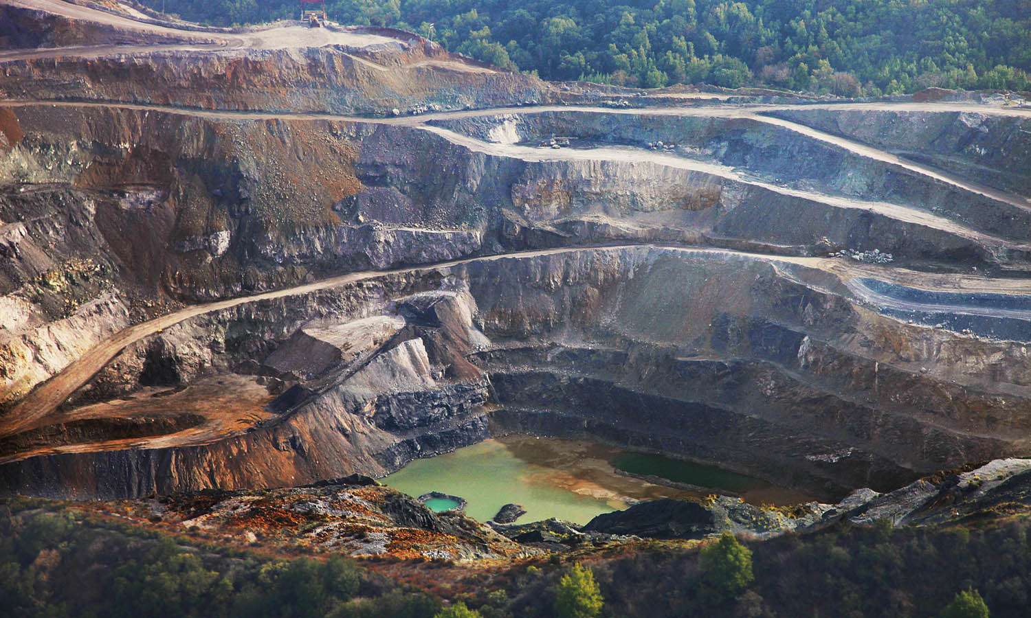
General view of the "main pit" - note how thin the remaining wall of the ridge is looking towards Los Altos (top of picture)
The scar of one landslide is still plainly visible at the upper left side of the hole, but there have in fact been multiple landslides not as readily apparent as this one. One went down the far side of the ridge and ended up on land owned by the Mid-Peninsula Regional Open Space District.
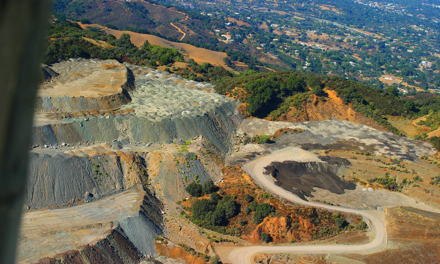
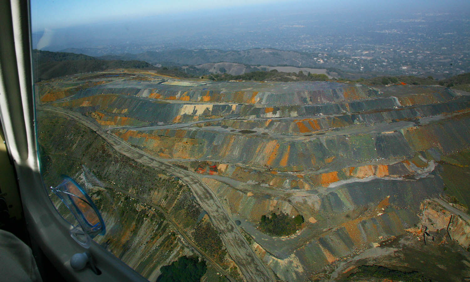
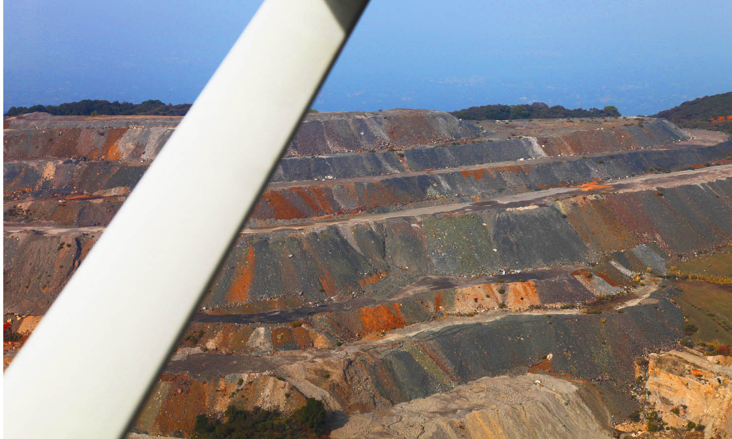
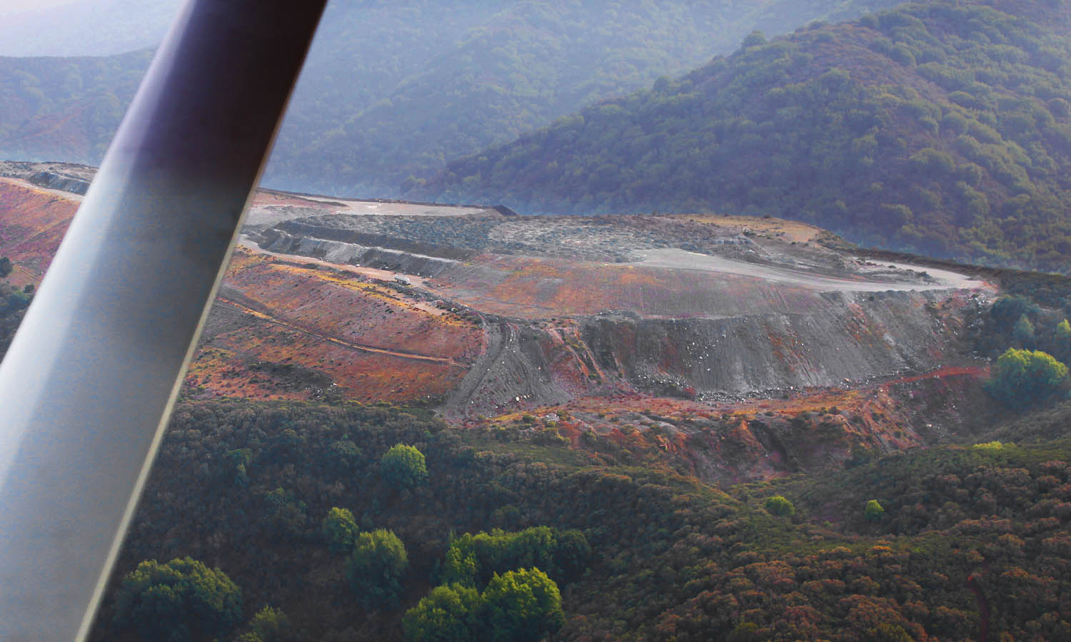
Multiple colors clearly show up in the dumping area - showing that piles are trucked in from various different sections of the quarry
Looking down over the western edge of the dump area - view towards San Antonio Open Space Preserve and Los Altos to the left. Rain water falling on these porous piles of rock might actually leach out some interesting chemical compounds and then collect and carry them off via a convenient creek to the Bay via Los Altos and Mountain View. What a surprise...
The ugly scar over what was supposed to be a view-protected ridgeline will be hydro-seeded to establish some cover vegetation.
Five years later, it would appear that hydro-seeding rock quarry-spoils doen't seem to work - the world is full of surprises. So much for "Restoration Plans"...
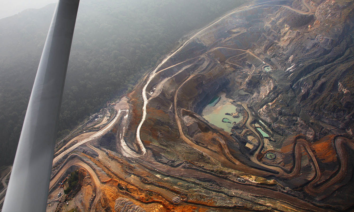
A view of the back side of the quarry - just as impressive...
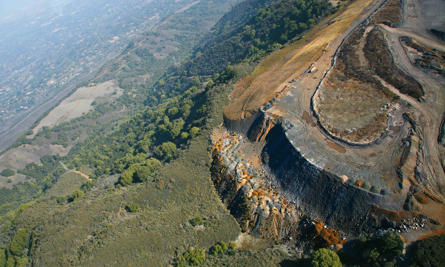
A lateral view over the western end with San Antonio Open Space Preseve to the North behind.it.
Looking down vertically over the western end - the water run-off channel at the toe of the slope can be clearly seen. It flows generaly north (top of picture) and will end up flowing into Hale Creek or Permanente Creek.
This third and last set of pictures was taken in February 2013
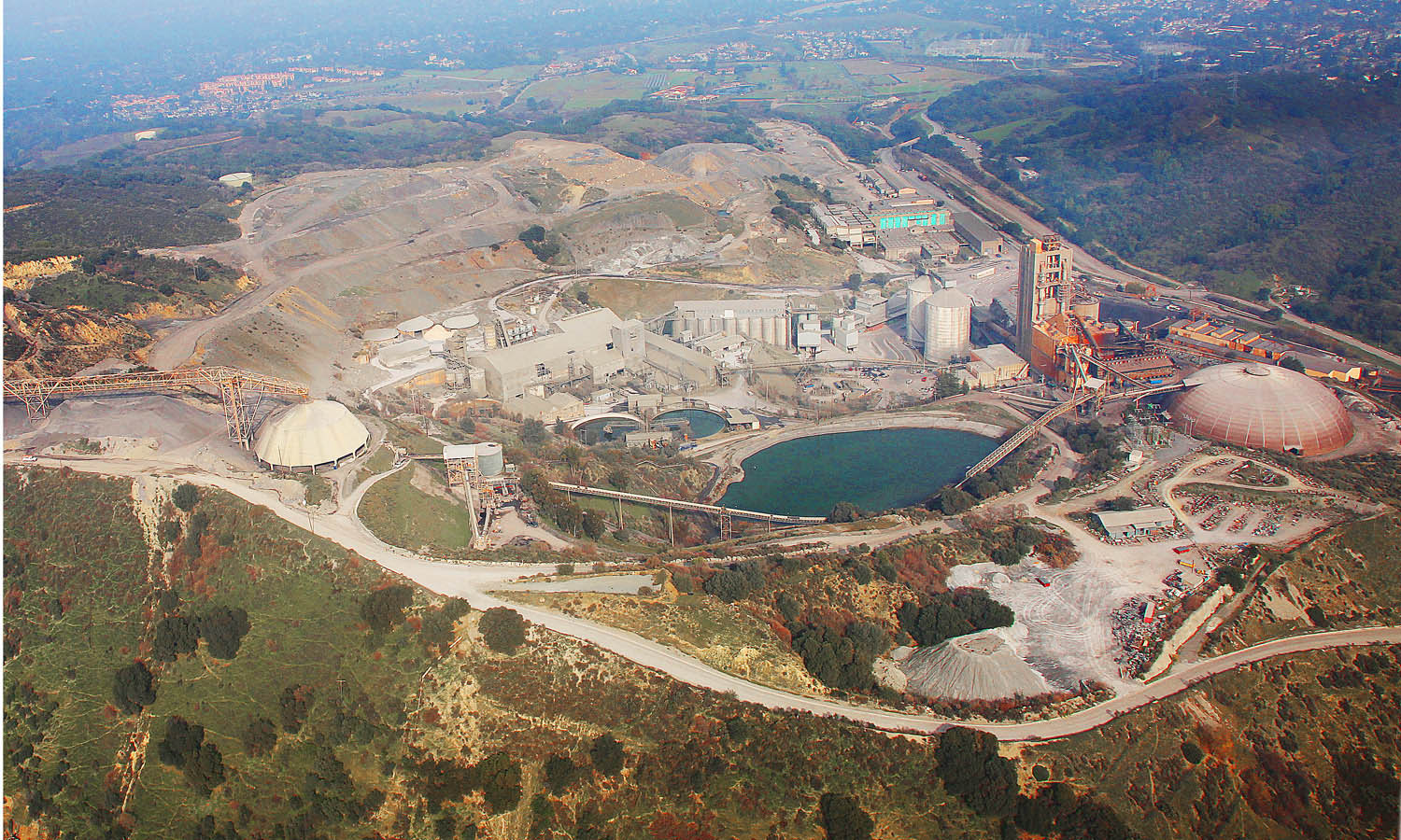
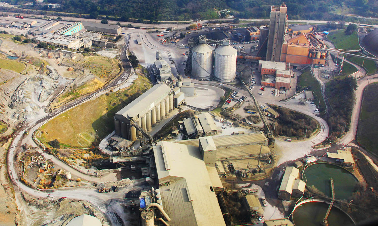
View of the main factory complex
A closer look at of the main factory complex
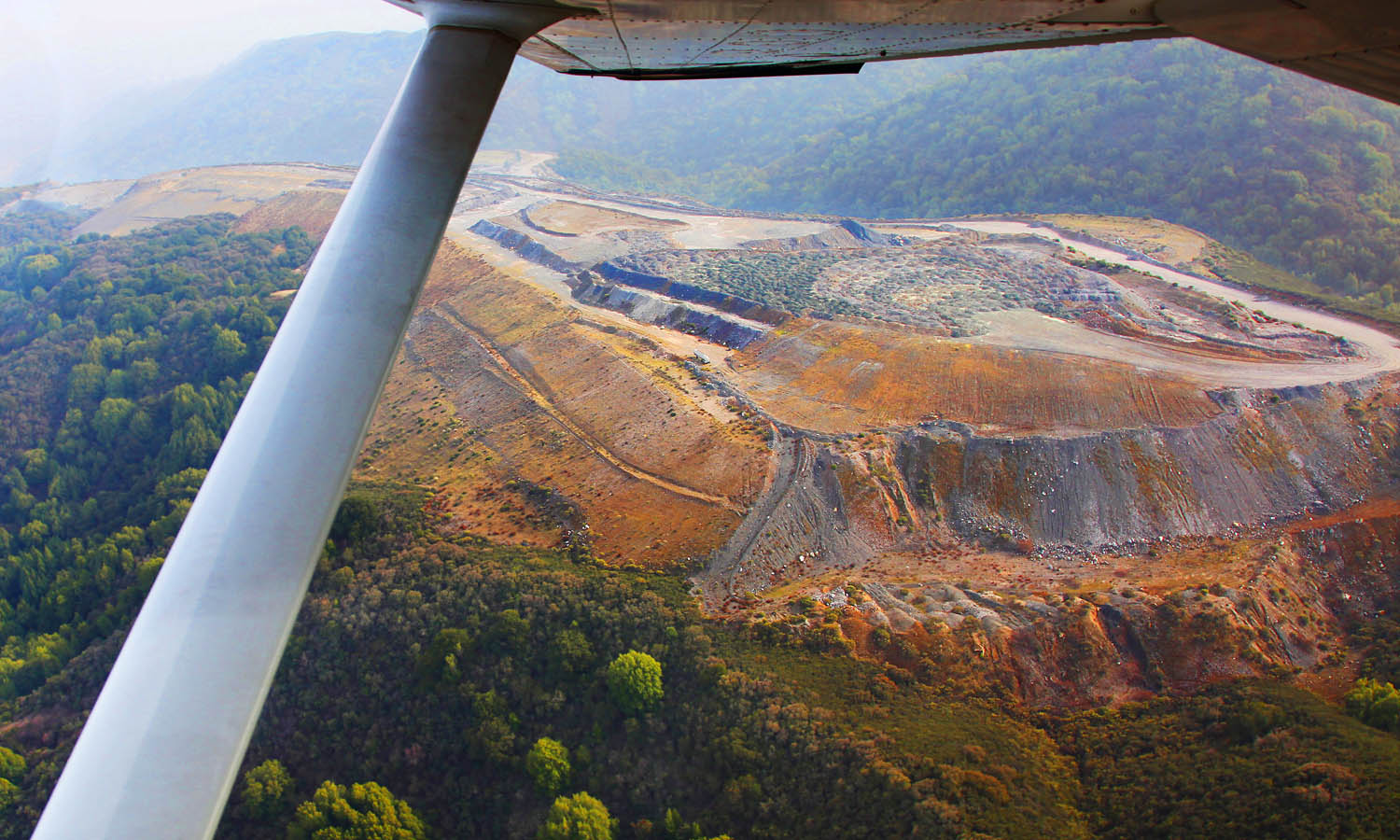
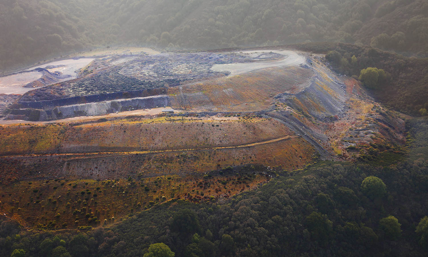
The western end of the dumping area - it is still pretty much as denuded of vegetation as it was a decade earlier. So much for assurances of returning the terrain to a natural look...
Pretty colors on the terraced slopes of a ridgeline that has been ravaged.
A view over another dump area
Over the western end again looking towards Los Altos and Mountain View. The forested slope in the foreground gives some idea of what this area used to look like.
Over the western end again looking in the direction of the ocean
After over a decade, a few scraggly bushes have managed to establish themselves on an almost-bald slope. Does this pass for "restoration"?
A view inside the main pit.
Once upon a time, this was a natural hilltop covered in forest - where Native Americans, Bears and Mountain Lions lived together over the centuries...
Following are five historical images scavenged from Google Earth - dated respectively 1948, 1953, 1991, 2007, and 2019.
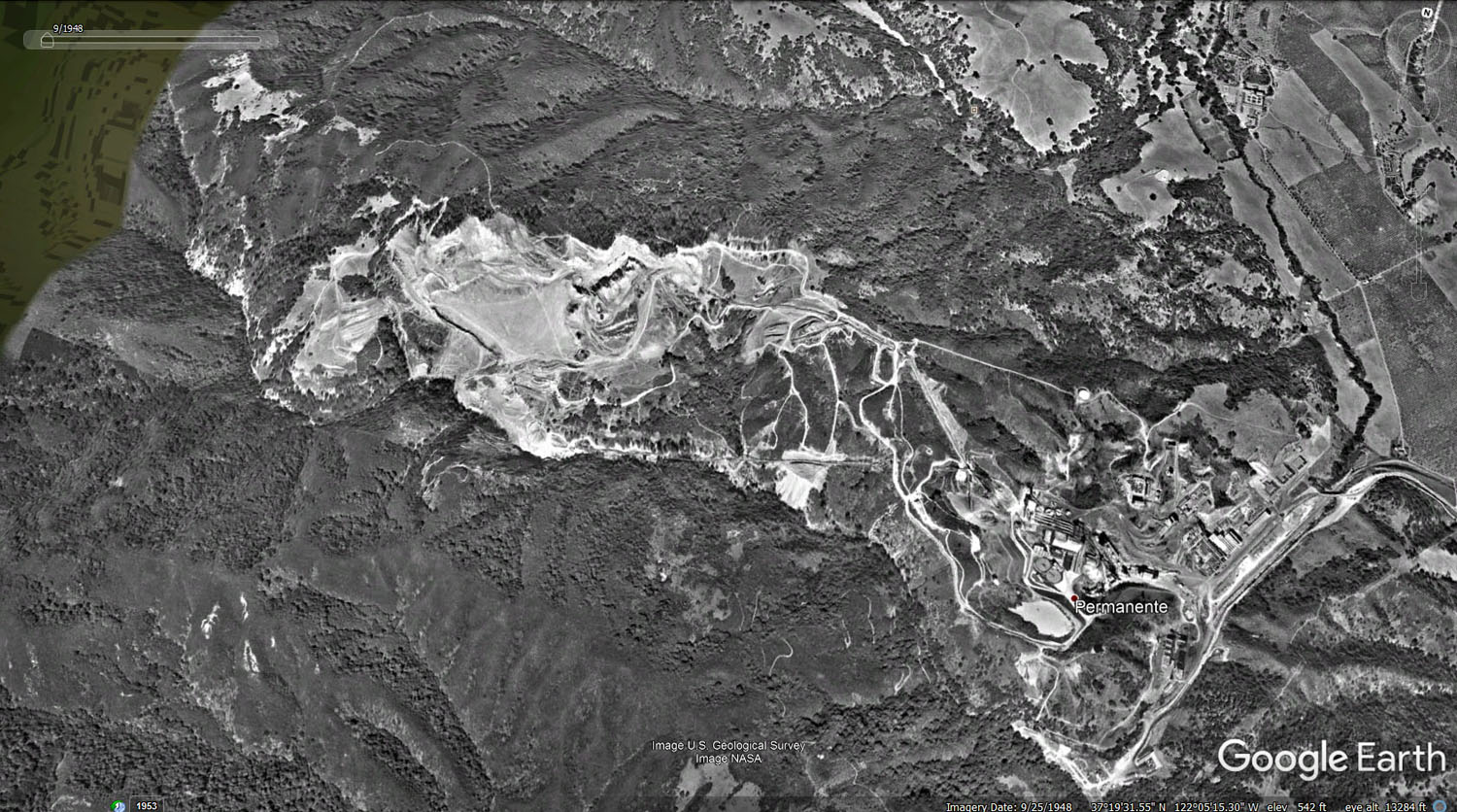
Aerial Photo - dated Sept 1948
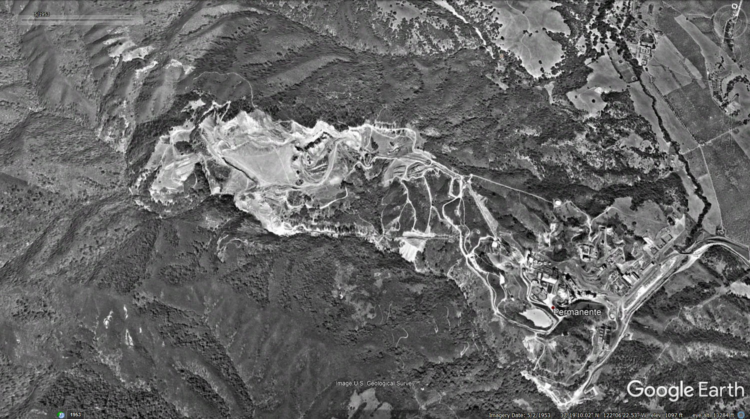
Aerial Photo - dated May 1953
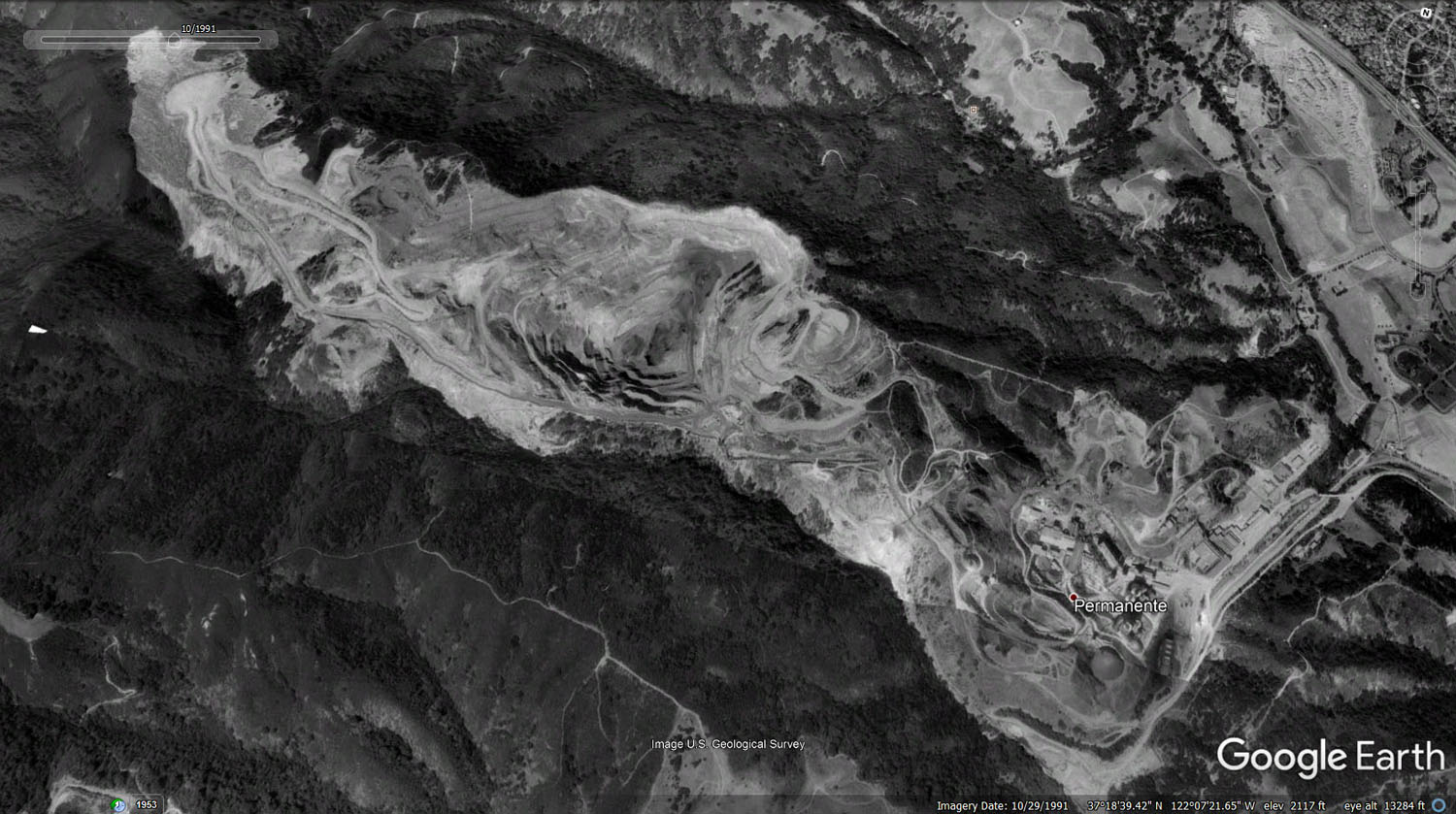
Aerial Photo - dated Oct 1991
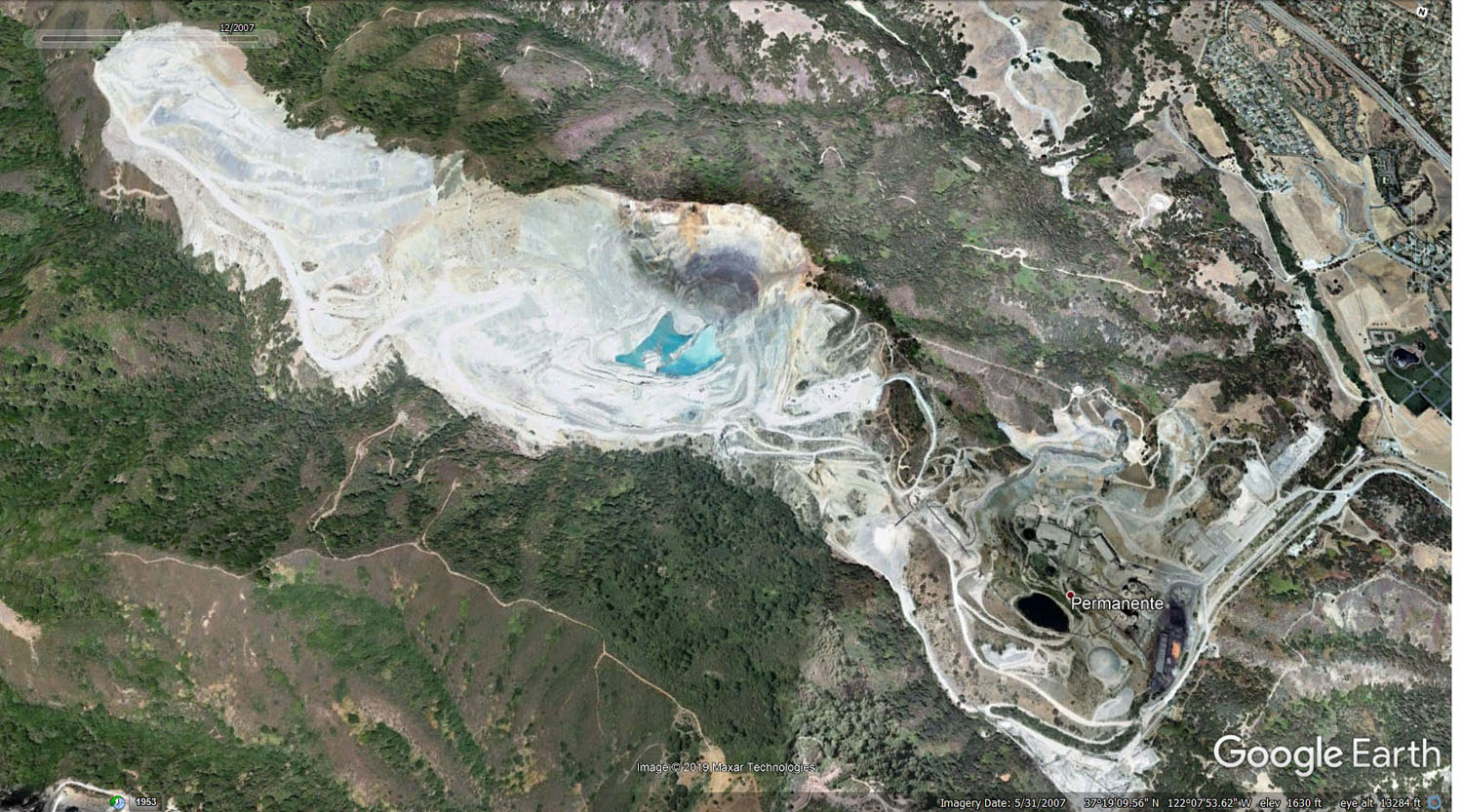
Aerial Photo - dated May 2007
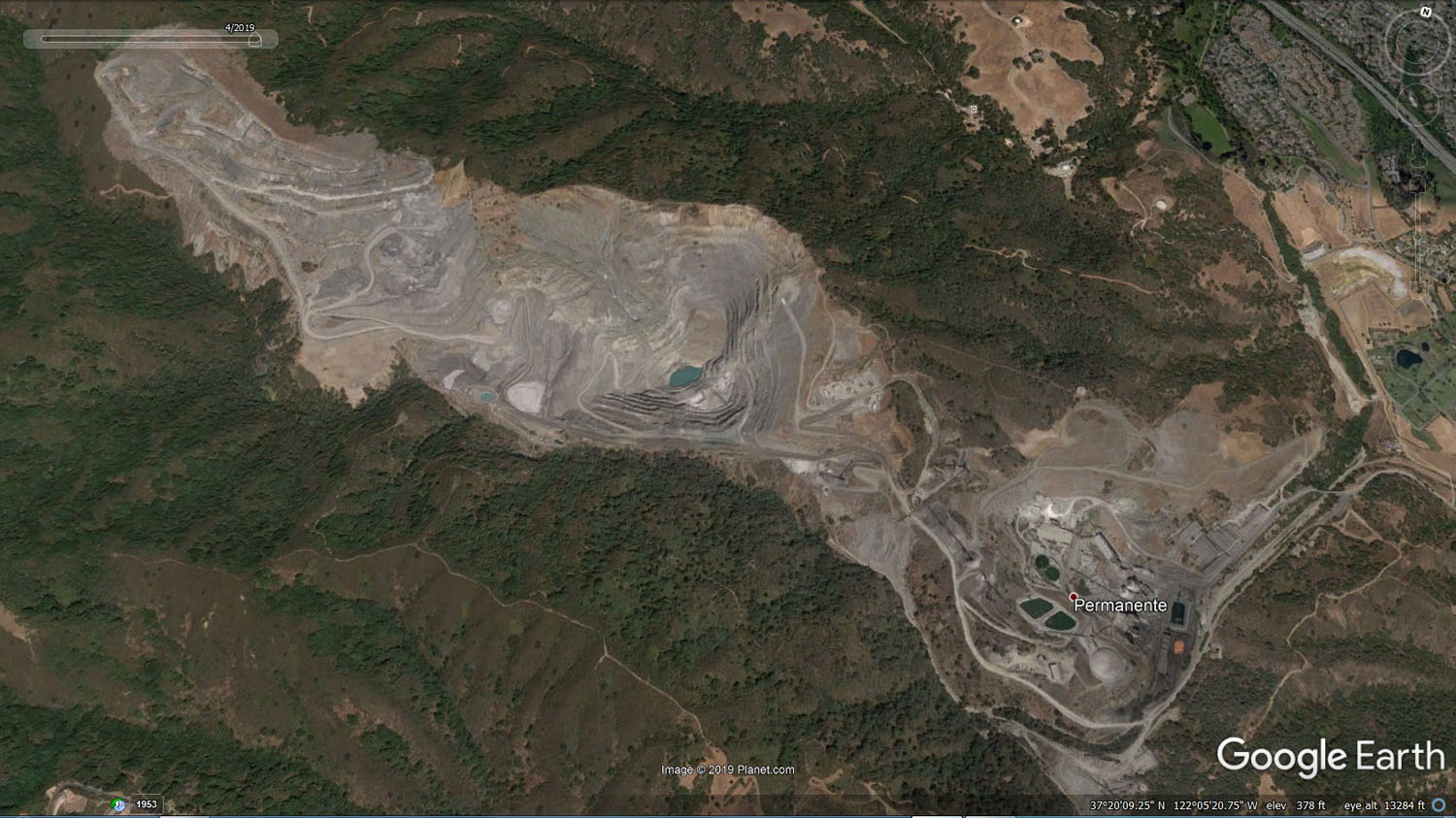
Aerial Photo - dated April 2019
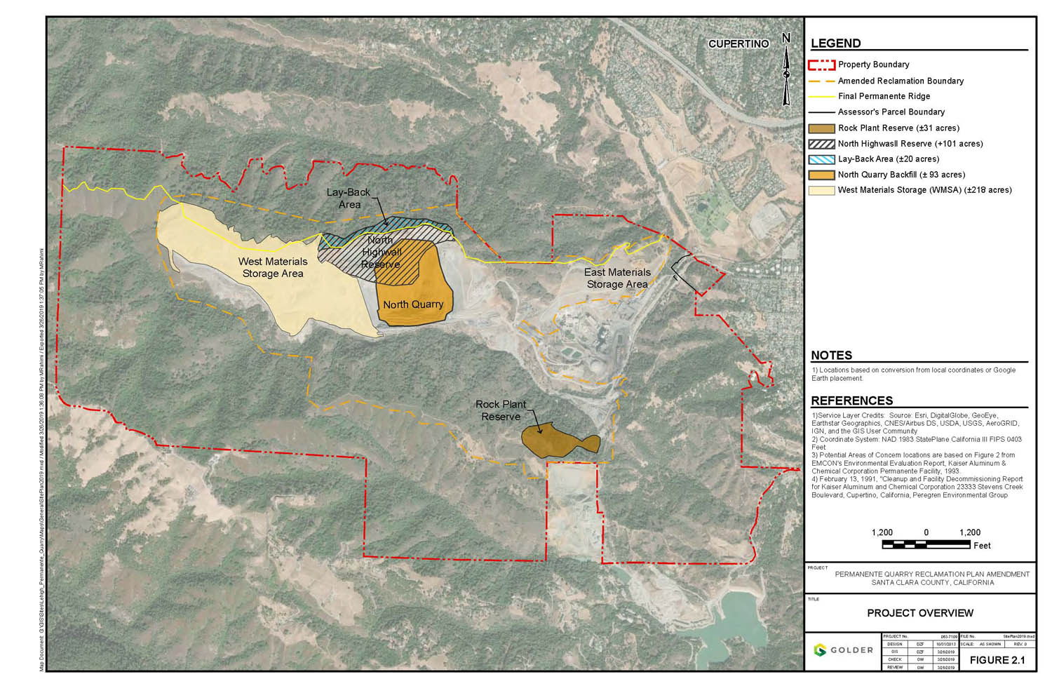
A project map of the site (Reclamation Plan - dated April 2019)