Various Maps and Aerial Photos of the Area - Reflecting Different Eras
The main eras after the period of the early Mexican land grants may be summarised as follows:
- An area of large opulent "Country Estates" established by the elite of San Francisco as week-end retreats in the country, easily accessible by train to Los Altos
- The "Country Estates" progressively give way to large orchard farms
- The large orchards are sub-divided into suburban lots - becoming a "rural environment suburb" of high-end homes, housing some of the "Captains of Industry" working in what once had been the "Valley of The Heart's Delight" and was now changing into "Silicon Valley".
Wherever you see this symbol on the page below, clicking on that symbol will bring up a larger or more detailed version of the relevant map or photograph on the screen. Depending on your viewing platform or device, the (very large image) may have been down-sized to fit your screen - in which case you can click anywhere on the image to expand it to its "full size" - at which point you will need to scroll around the screen by means of the scroll bars or "dragging" the image - depending on your platform..
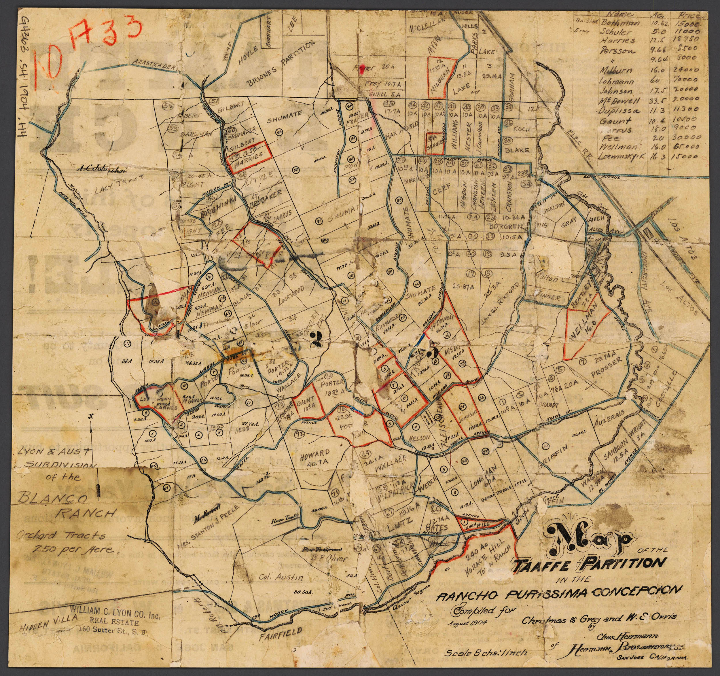
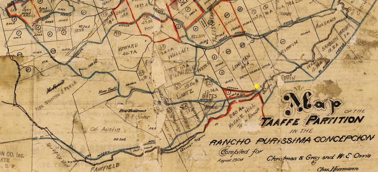
In the beginning of "development" of the area - An extract from the 1904 subdivision map of the "Taaffe Partition". Hand-written annotations identify the owners of the large estates along Moody Road, note the names Lohman and Griffin which are still identified with Foothill College today.
While the area closer to the Railway Depot was initialy subdivided into a series of relatively small rectangular lots of around 17 acres, the south-west area along Moody Road was subdivided into less geometric shapes and larger parcels anywhere between 40 and 150 acres.
The yellow dot on the map marks where the three roads come together - El Monte, Moody, and what was then still seen as an extension forming the end of Purissima, but today forms the end of Elena.
Expanded version of the above Map showing the whole document. (Click on the document after it has loaded to zoom in)
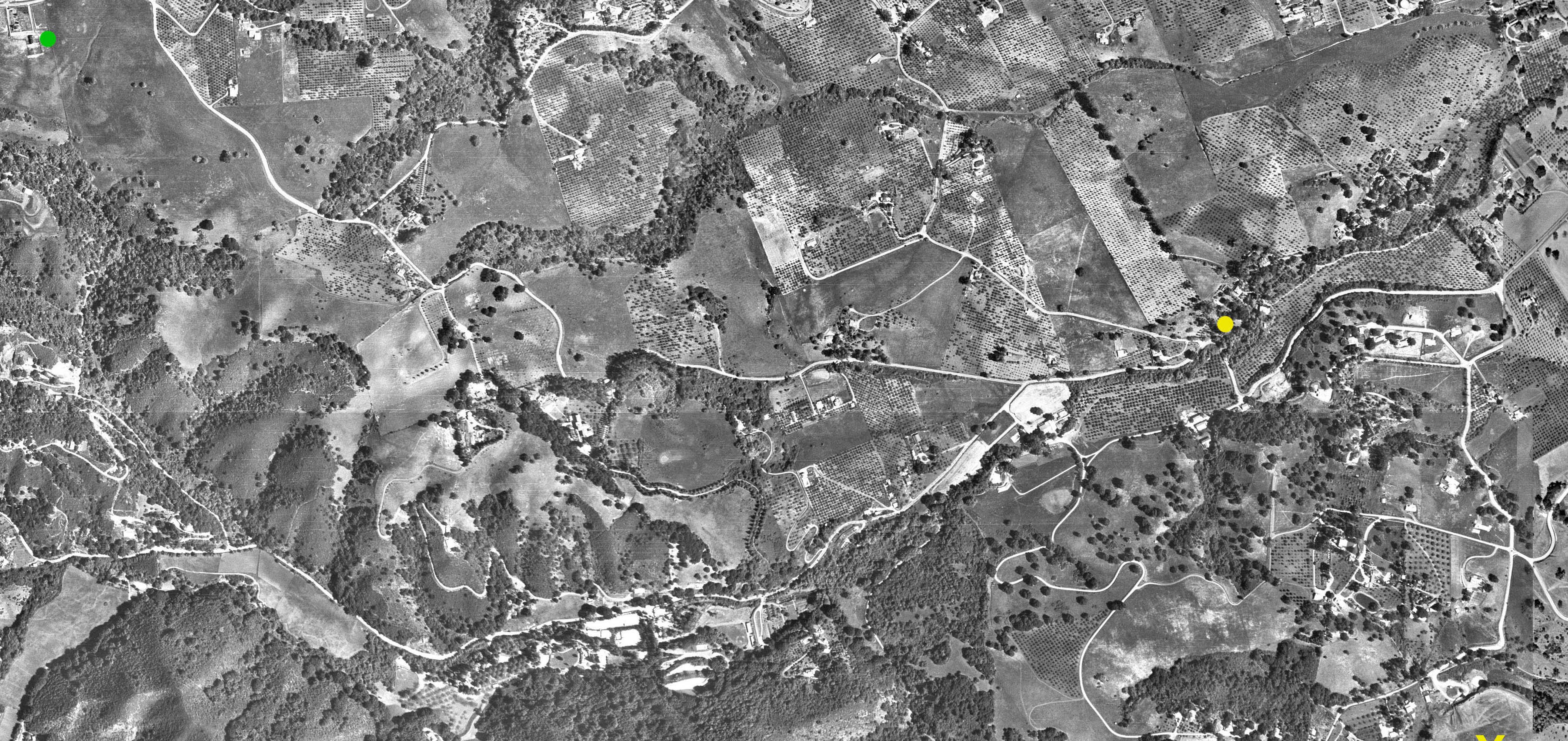
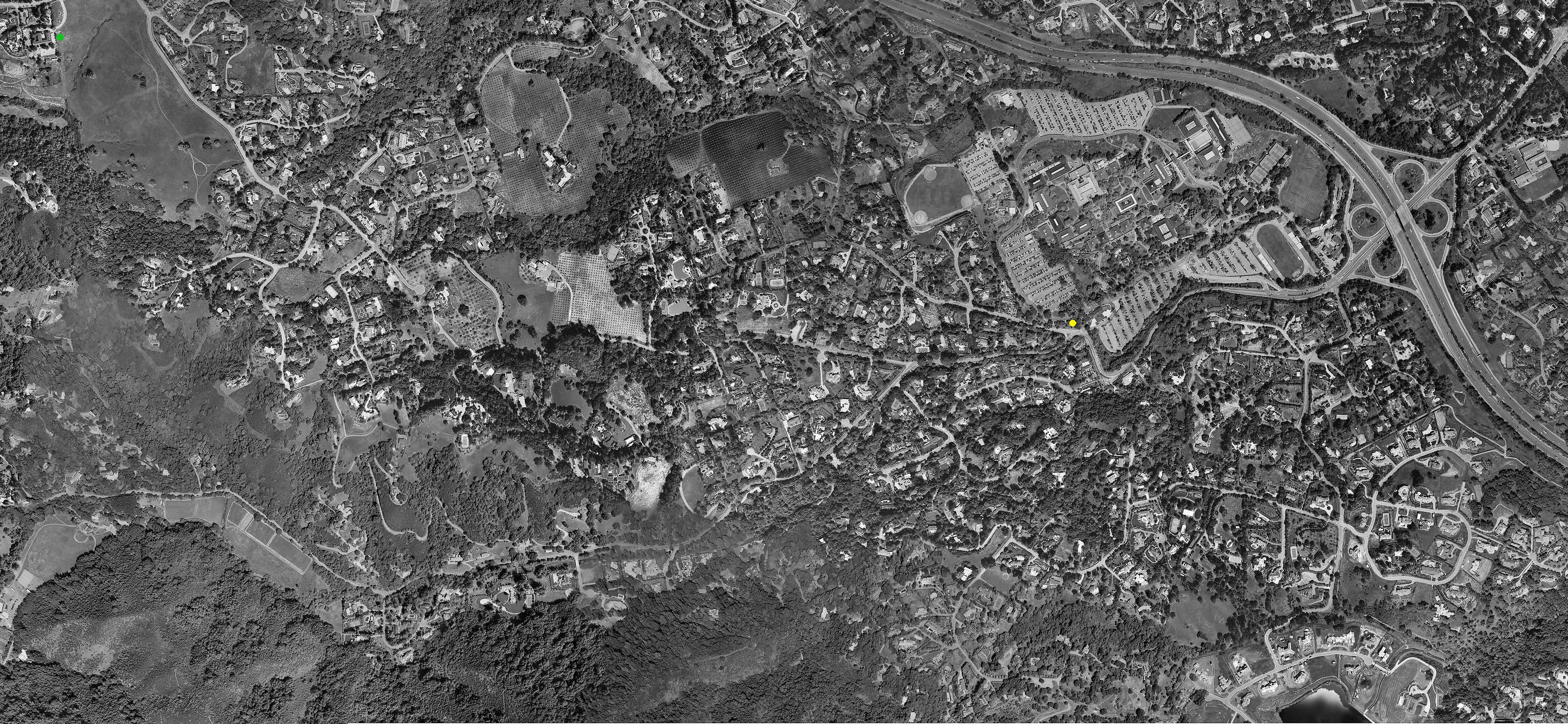
Aerial photograph taken in 1947 - perhaps the zenith of the "Orchard Era" The yellow dot on the map marks where the three roads come together - El Monte, Moody, and what is today seen as the end of Elena. The Green dot (top left of the image) is Westwind Barn next to Byrnes Preserve.
Note the externsive orchards in the area of what is now Foothull College (both sides of Adobe Creek) as well as the area know today as "The Packard Orchard" spanning roughly the center third of the image near the top.
Full resolution (more detailed) version of the above Aerial photo. (Click on the image after it has loaded to zoom in)
A road map of the general area from 1952. Note that Altamont still does not exist as a continuous road from Page Mill to Moody - what was to eventualy become the lower end of Altamont is still a separate road named after Elizabeth (one of the Taaffe daughters). Adobe Creek is identified on this map as "Yeguas" Creek - in other early maps it is also sometimes referred to as "Llagas Creek".
We do not know for sure what the red arrows along the roads denote. There appear to be two routes named LA1 and LA2, so these could possiny be "postal routes" taken by Post Office delivery trucks.
Expanded version of the 1952 Road Map showing a larger portion of Los Altos Hills as well as downtown Los Altos. (Click on the document after it has loaded to zoom in)
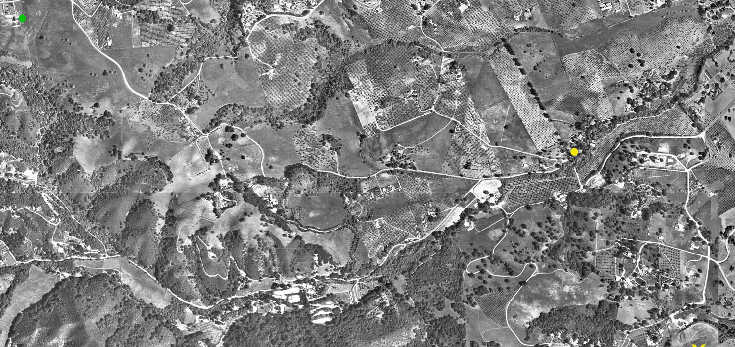
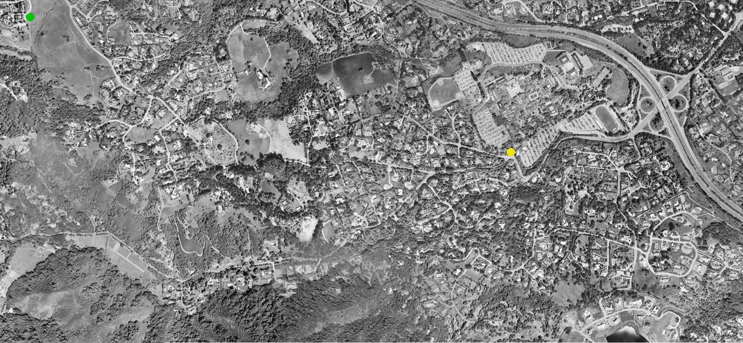
Aerial photograph taken around 2000 (exact date unknown) - the orchards have all but disappeared - with the notable exception of "The Packard Orchard" which can be seen in the center third of the image near the top. The yellow dot on the map marks where the three roads come together - El Monte, Moody, and the end of Elena. The Green dot (top left of the image) is Westwind Barn next to Byrnes Preserve.
Full resolution (more detailed) version of the above Aerial photo. (Click on the image after it has loaded to zoom in)