We have a number of miscellaneous images and text files with historic value that are worth archiving, but for which we may not have
a physical "hard copy" counterpart. Also because there may not be enough of any type/subject to form their own cohesive grouping
in a separate album, they have been collected here in this "Grab Bag" to assure there is a copy in the archives - rather than loose
track of them.
| Link |
Date |
Key Words or Digest |
| Miscellaneous Photos (un-categorized) |
|
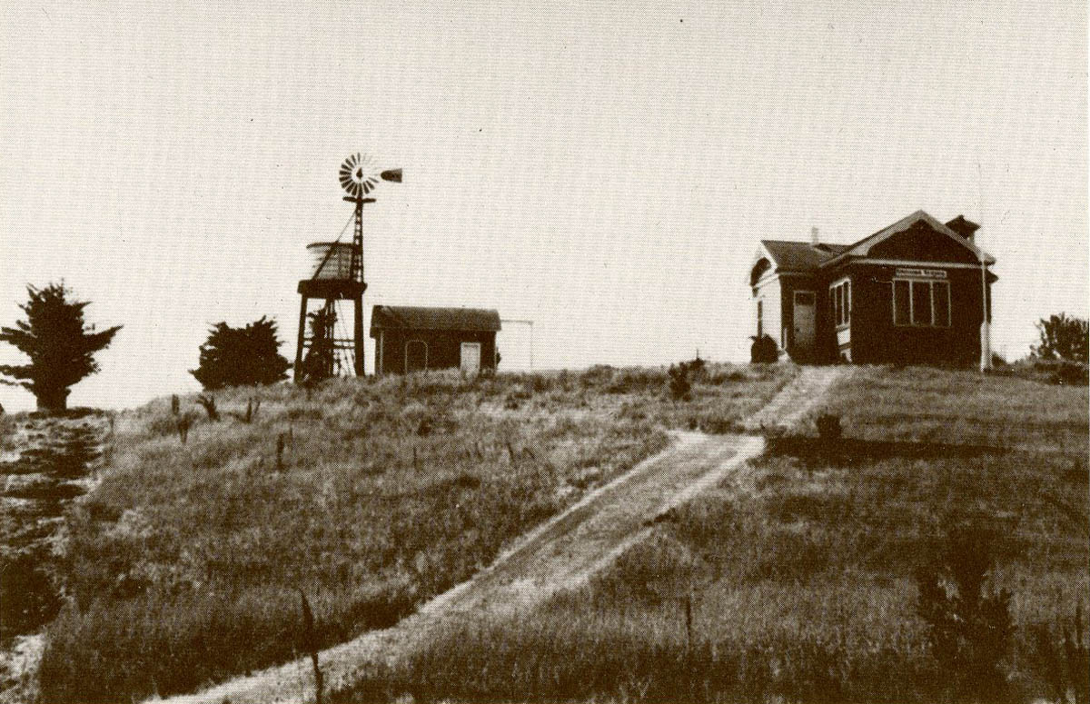
| PurissimaSchool.jpg |
Unknwn |
Photo of original one-room schoolhouse - Purissima School - Where first Town Meetings were held - extended and modified to become St Luke's Chapel in The Hills |
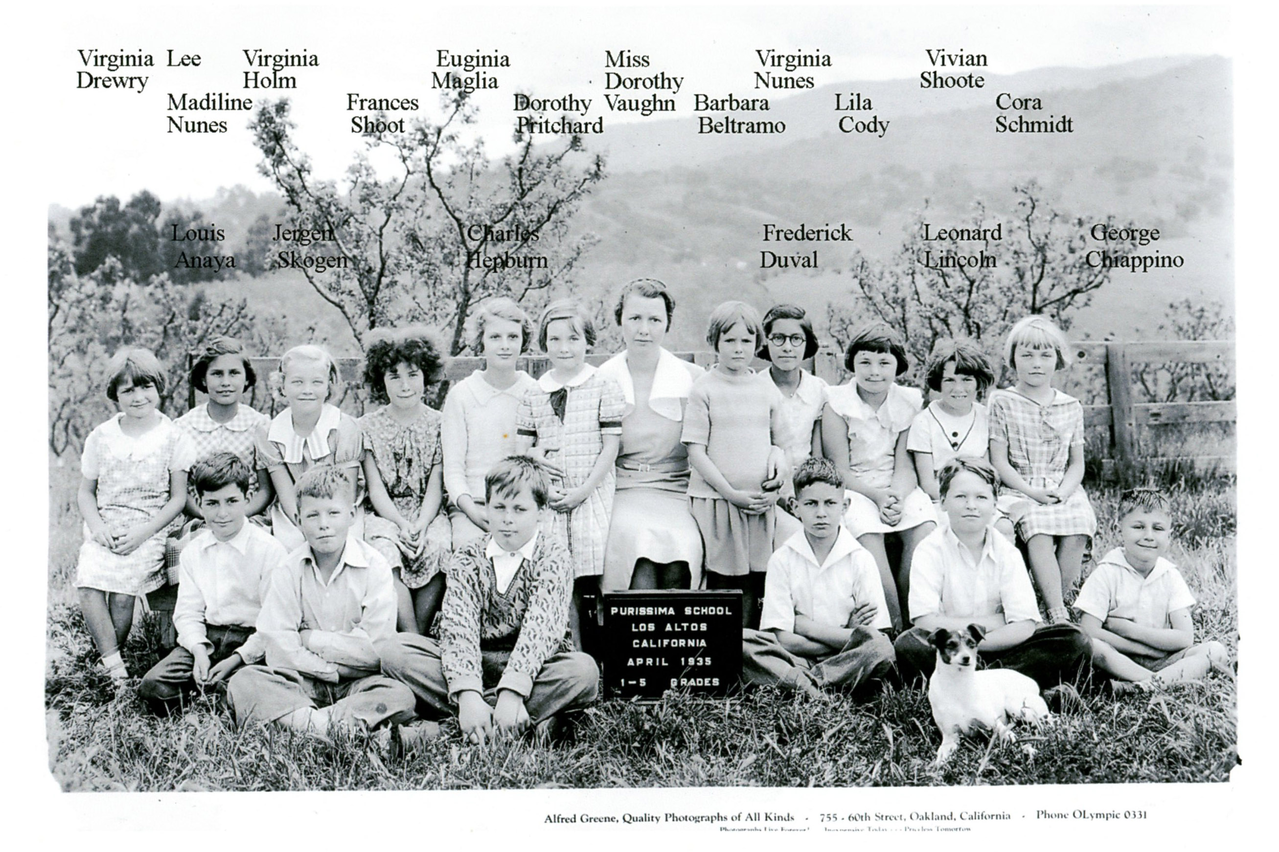
| School_1935.jpg |
04/01/35 |
Class photo of Grades 1-5 Purissima School - 1935 |
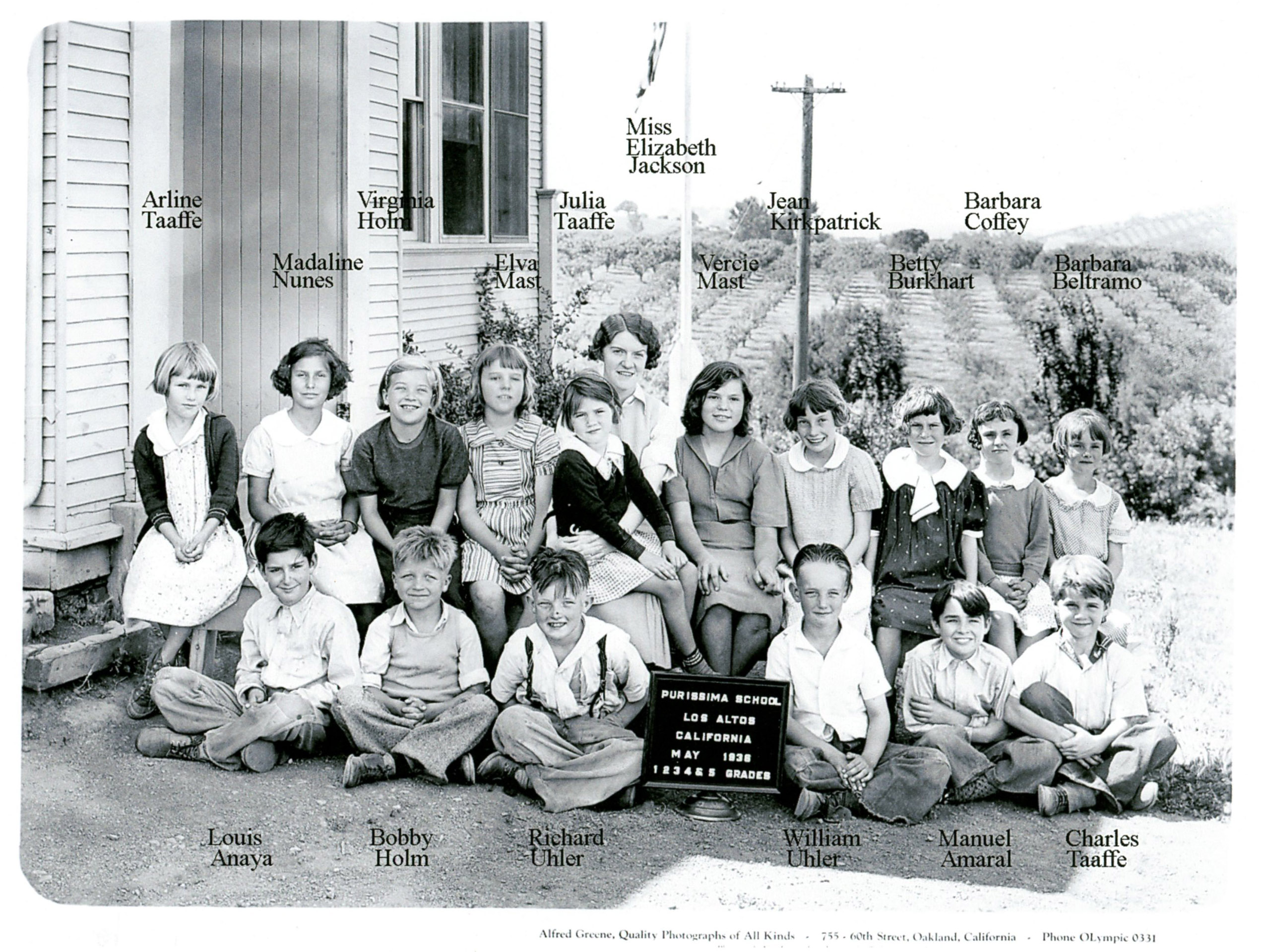
| School_1936.jpg |
05/01/36 |
Class photo of Grades 1-5 Purissima School - 1936 |
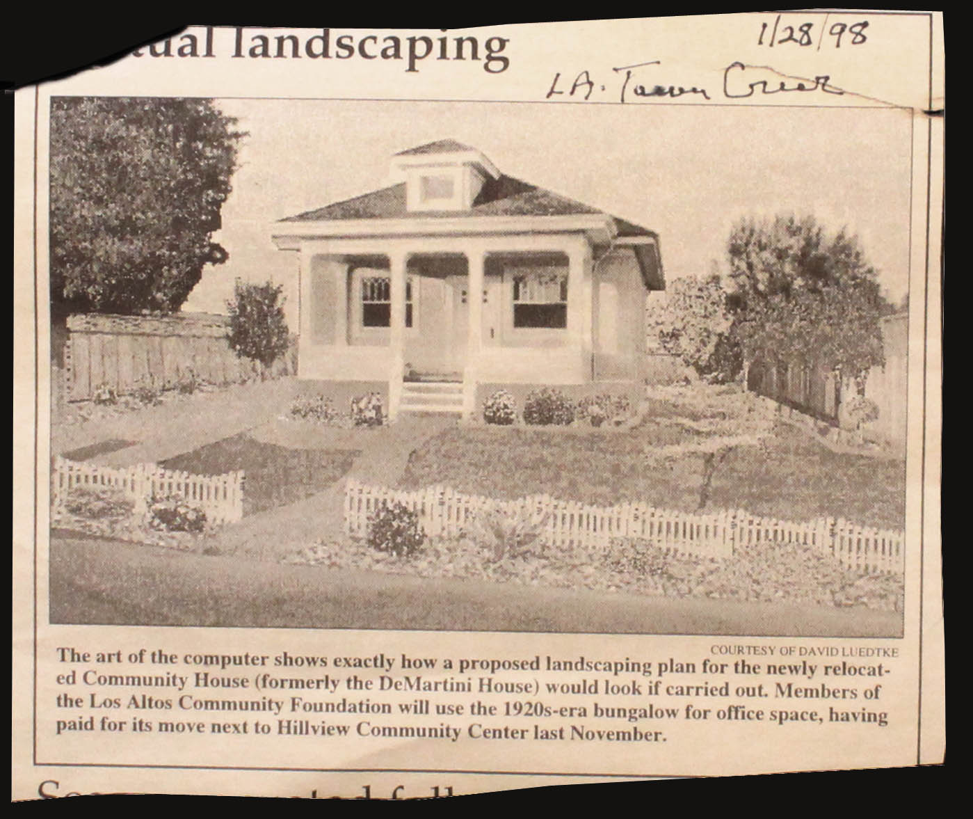
| CommunityHouse.JPG |
01/28/98 |
Photo of Community House (home of the Los Altos Community Foundation) - with simulated landscaping |
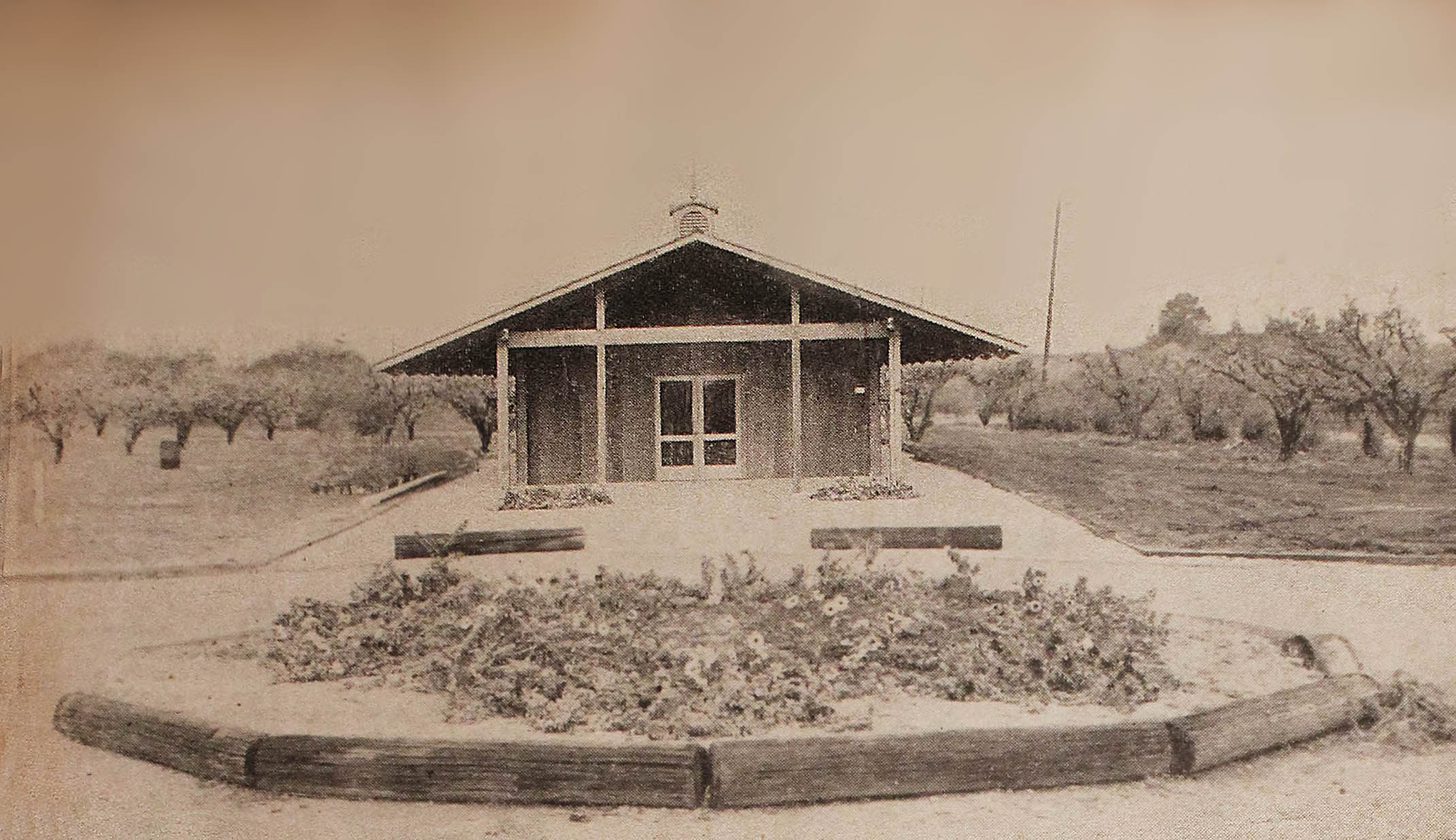
| TownHall.jpg |
Mar-56 |
Photo of Town Hall in Apricot Orchard |
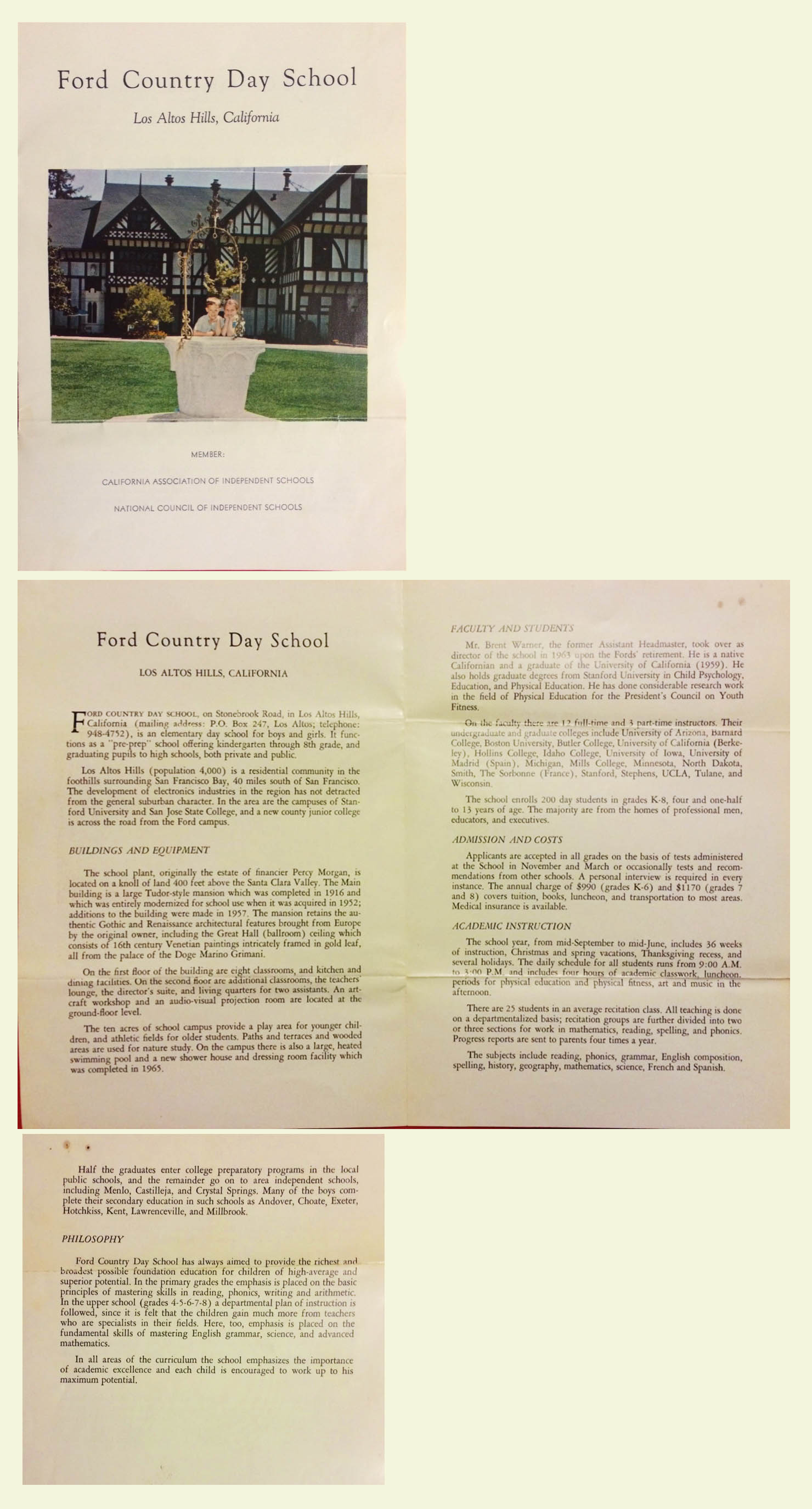
| ShoolProspectus.jpg |
1968 |
School Prospectus for The Ford Country Day School |
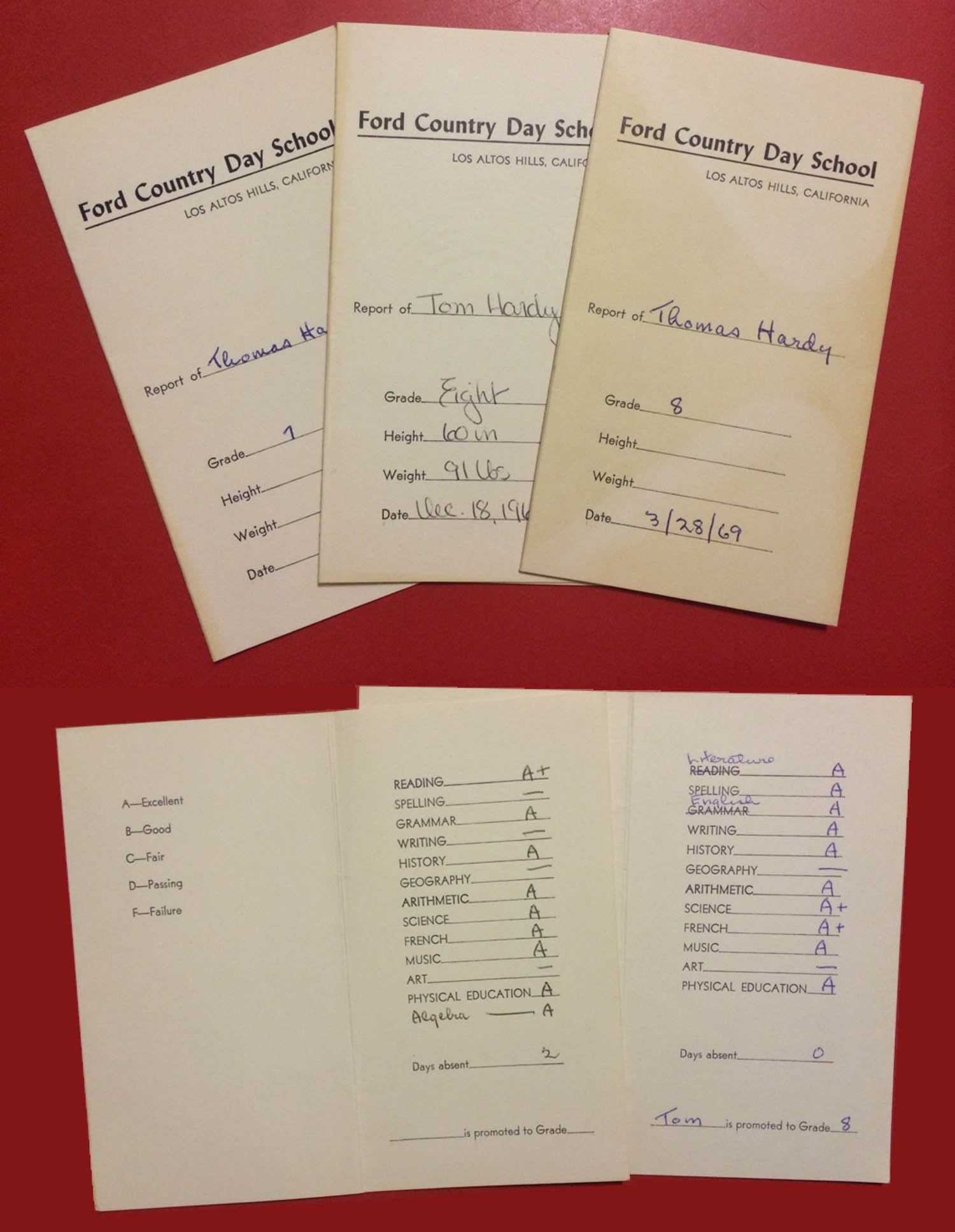
| SchoolReport.jpg |
1968 |
School Reports from The Ford Country Day School |
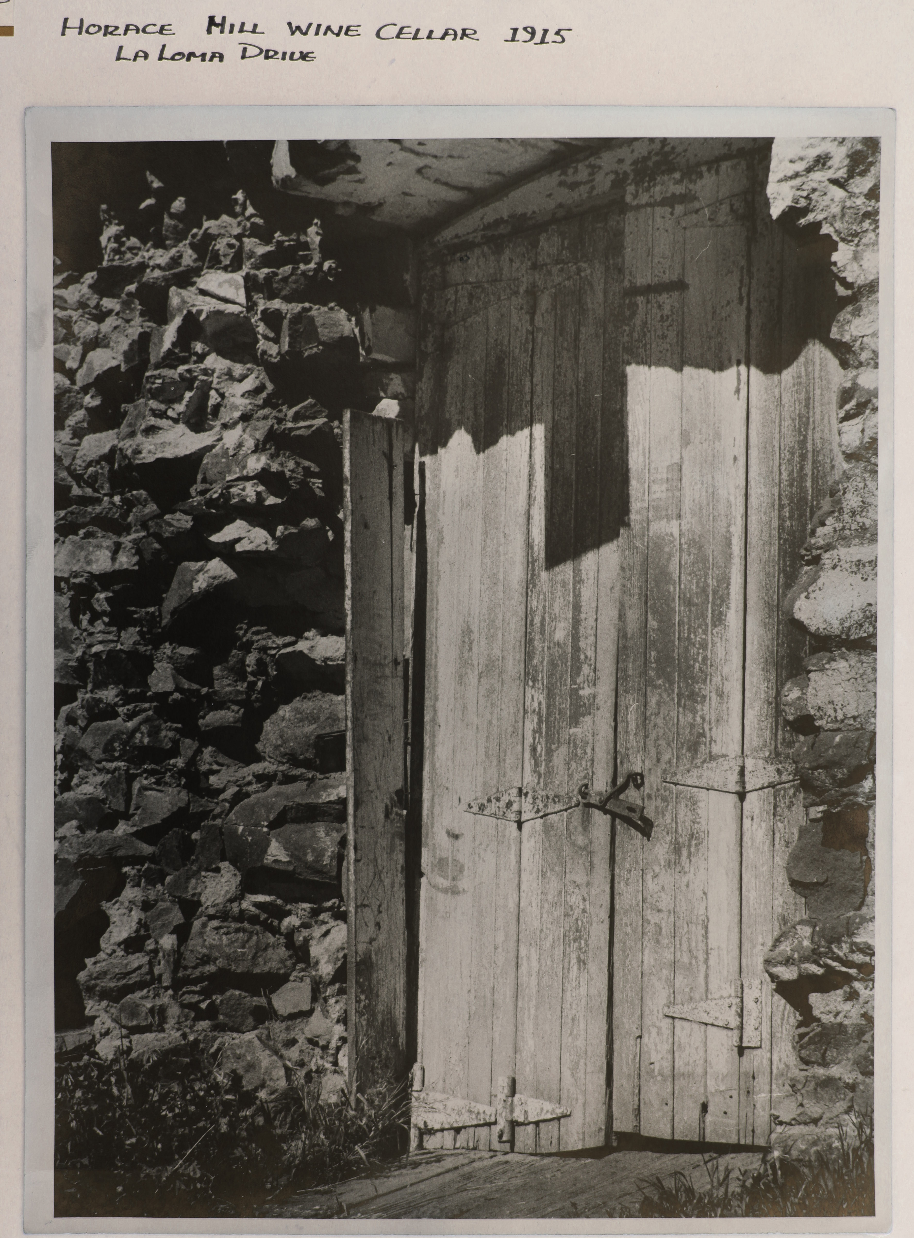
| HoraceHillWineCellar.jpg |
1915 |
Photo of Doorway into Horace Hill Wine Cellar - dug into hillside, dated 1915 |
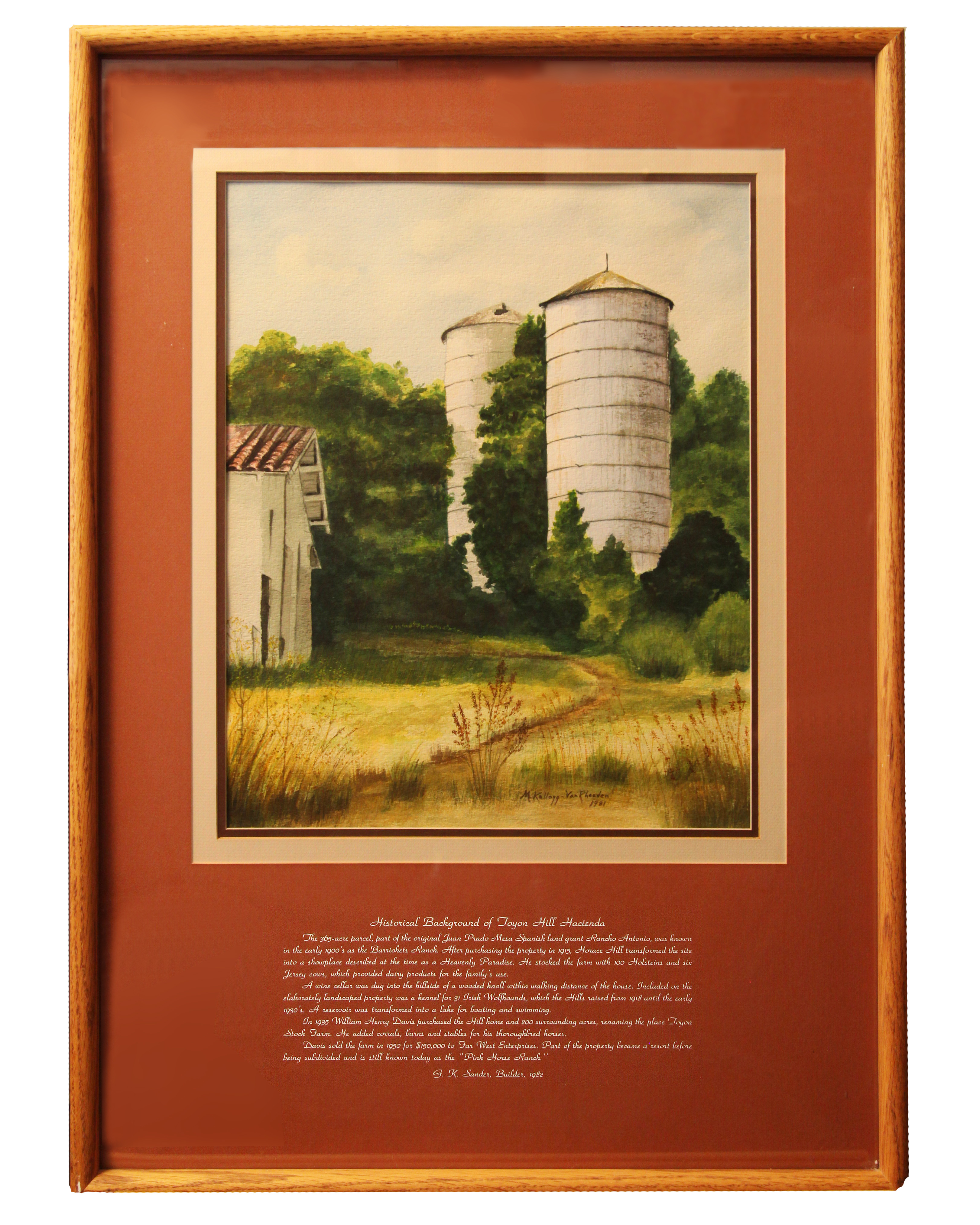
| Horace_Hill_Silo_Painting.jpg |
1981 |
Painting of Horace Hill silos by Marjorie Kellog |
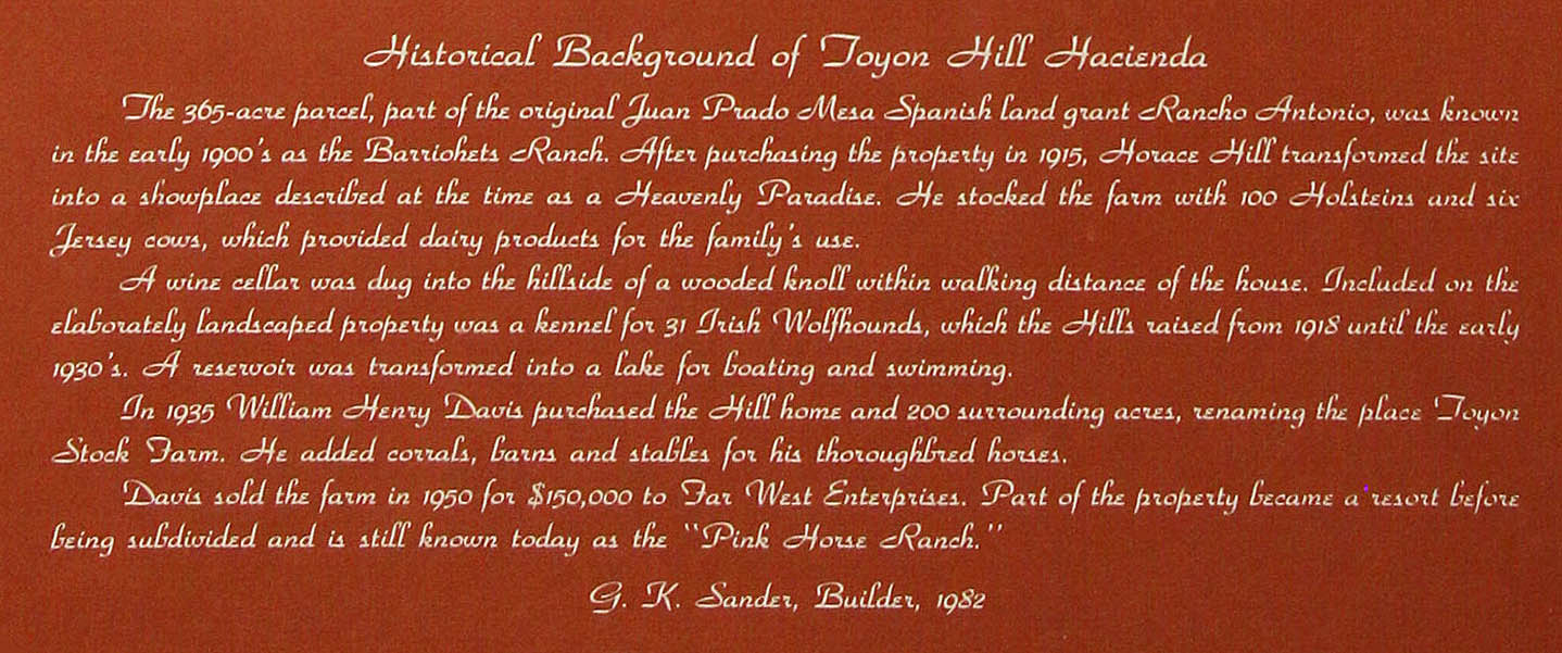
| Horace_Hill_Silo_Inscription.jpg |
1981 |
Detail of caption inscription of Horace Hill silos painting |
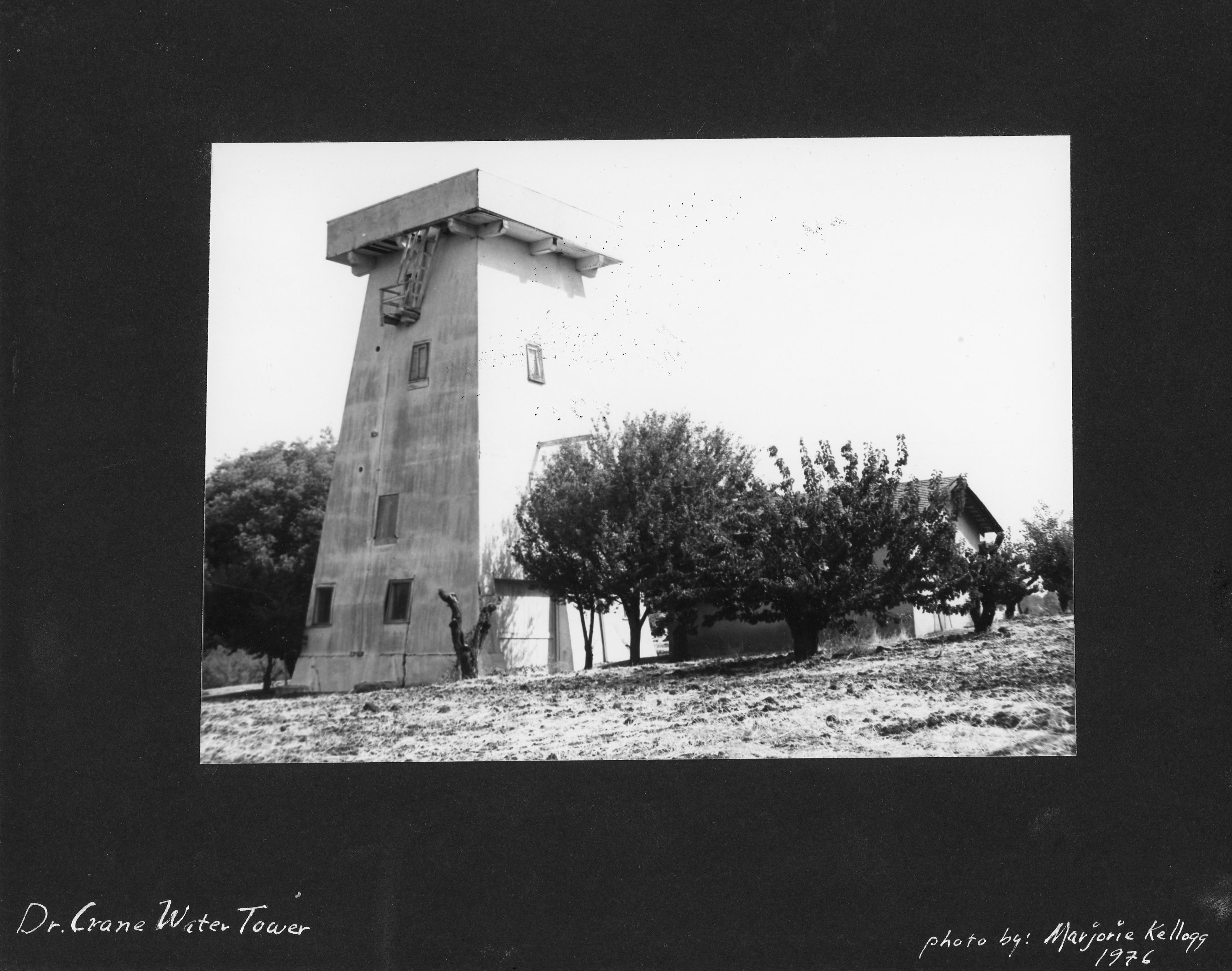
| Crane_Water_Tower.jpg |
1976 |
Photo of Dr. Crane Water Tower |
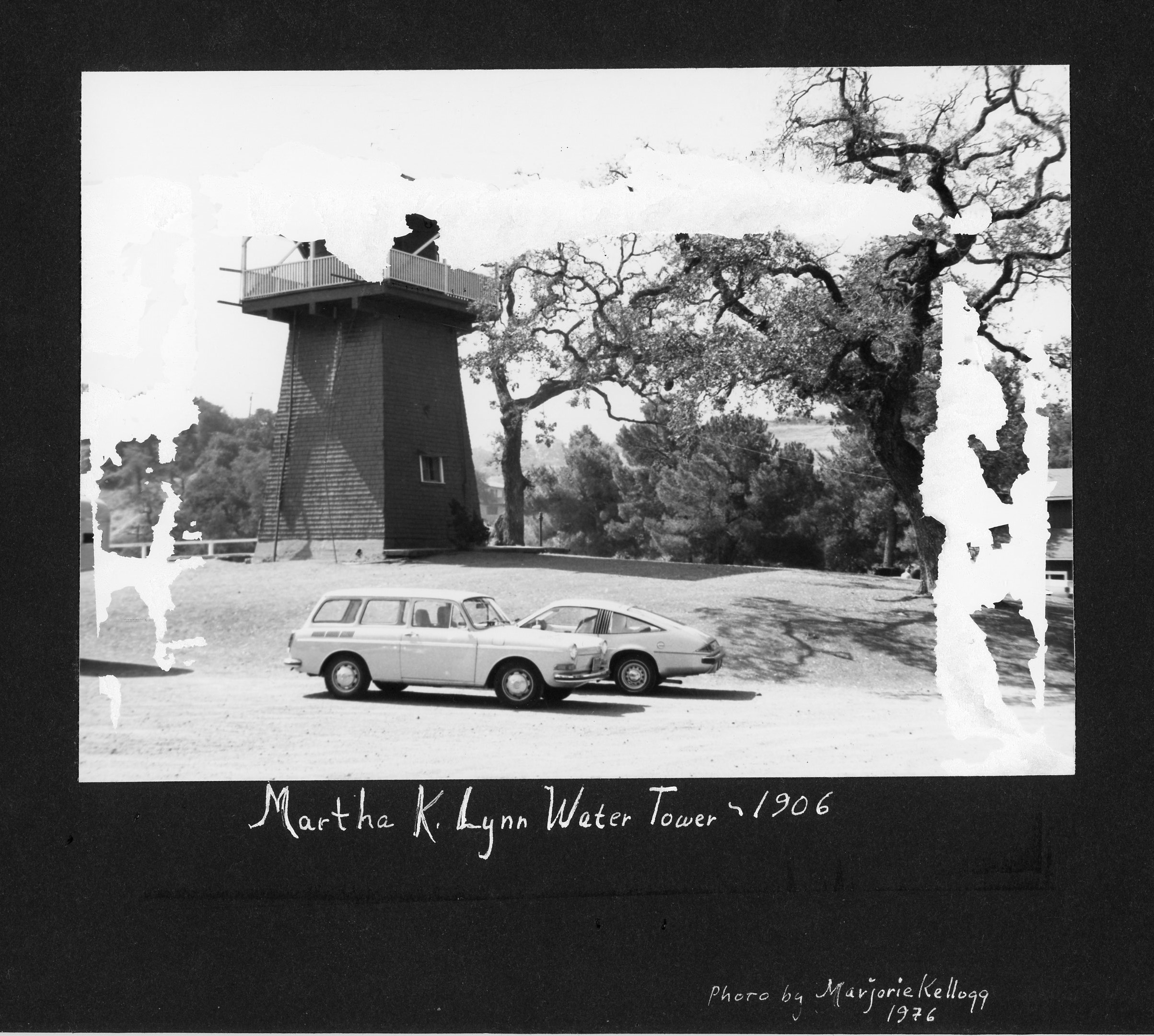
| Lynne_Water_Tower.jpg |
1976 |
Photo of Martha K. Lynne Water Tower dated 1906 |
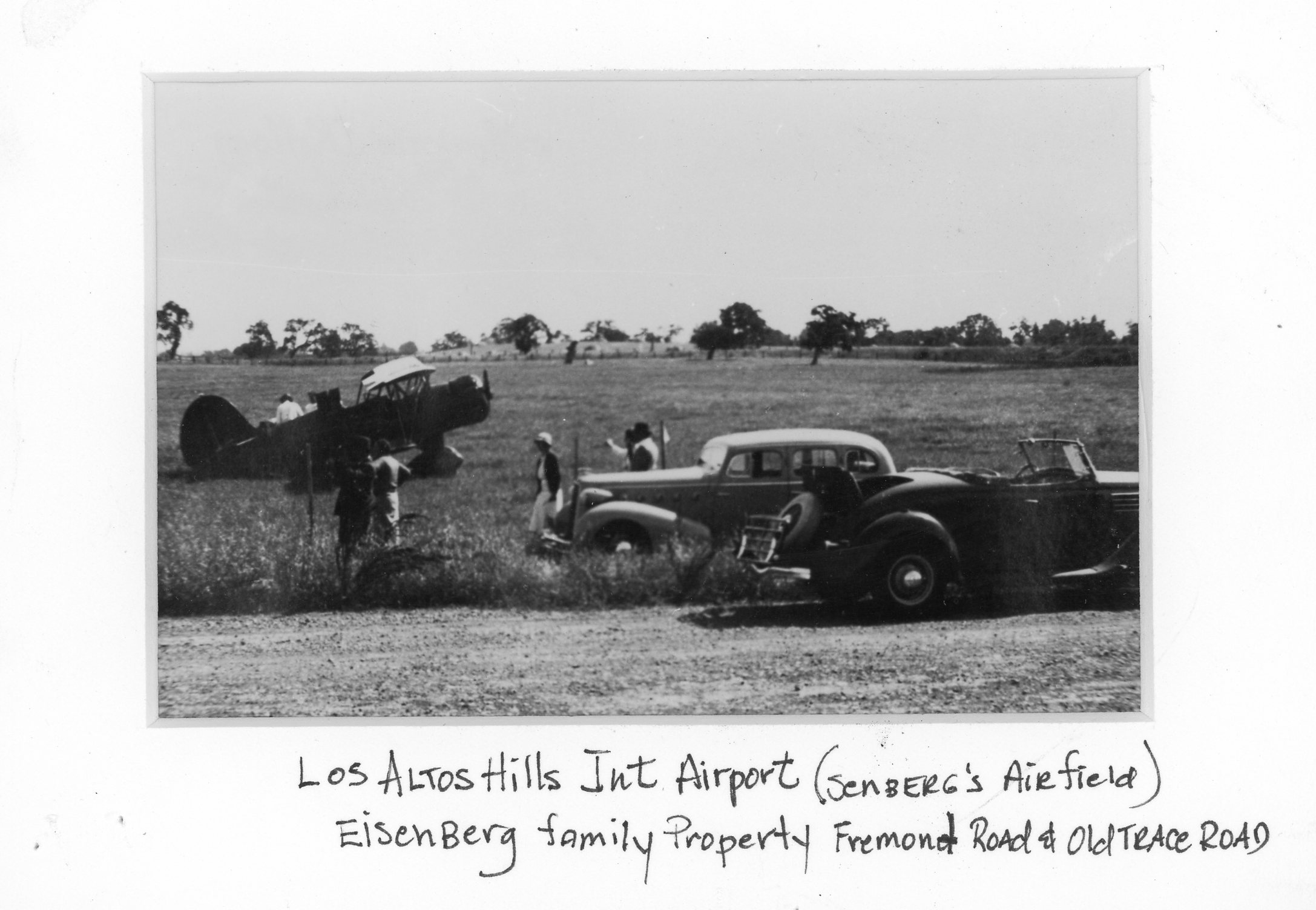
| LAH_Airport.jpg |
Unknwn |
Photo of Biplane at "Senberg's Airfield, Eisenberg Property, corner of Fremont and Old Trace Road" |
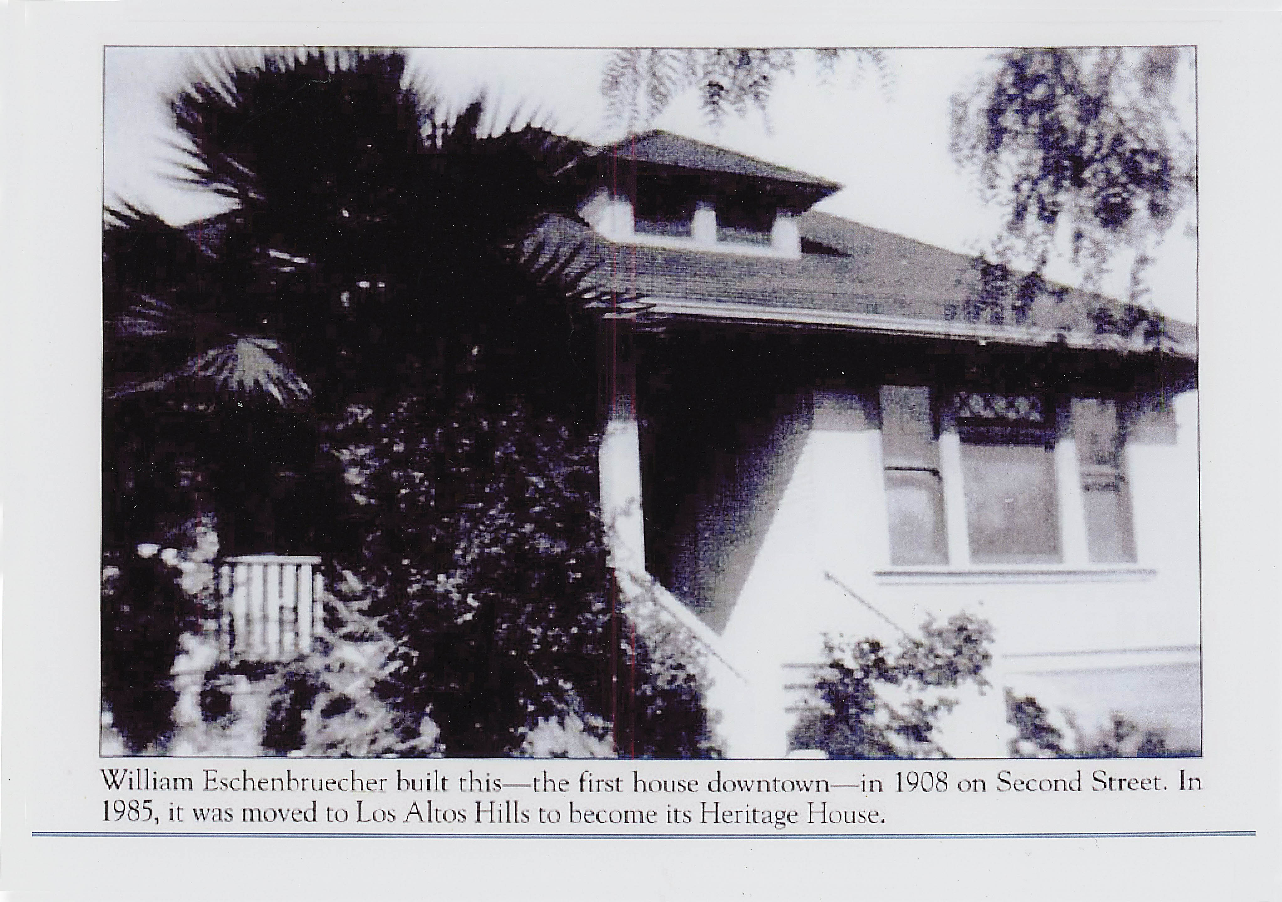
| Eschenbruecher1.jpg |
Unknwn |
The Eschenbruecher House in Los Altos - became The Heritage House next to Town Hall |
| LAH_Birthplace_Location.jpg |
11/17/2015 |
The first organizational meetings to incorporate the Town of Los Altos Hills were held here. (Dori Lane and Robleda). Structure was destroyed
by the overhanging oak limb a few years after this picture was taken. |
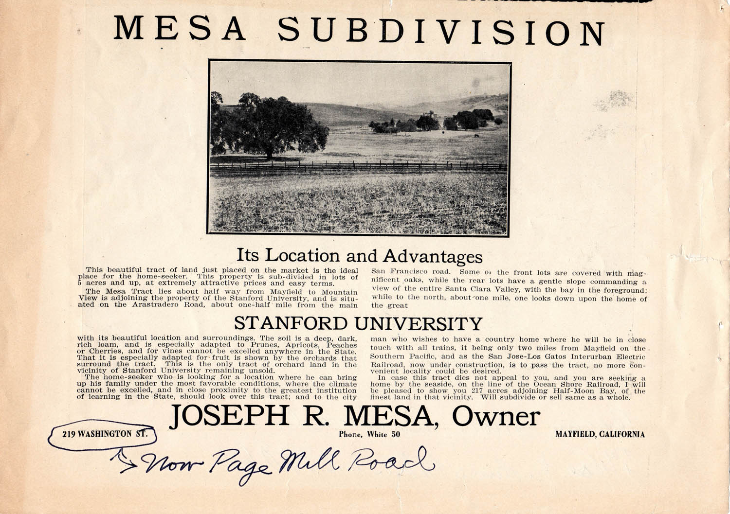
| Mesa_Advertisement.jpg |
1906? |
Advertisement for sale of lots in the Mesa Tract sub-division - located at the North
end of today's Manuella and Miranda Avenues (or where Arastradero crosses Foothill Expressway)
and stretching over into Palo Alto. |
| Mesa_Ad_Detail.jpg |
1906? |
More detailed view of Photo and Text of previous entry (Mesa Tract advertisment). |
| Eclipse.htm |
04/08/2024 |
Sequence of images of Partial Solar Eclipse as seen in Los Altos Hills. |
| Short Histories, Personal Memoirs, and Important Documents |
|
| Greensheets
|
1955 |
The original founding documents of our Town. Presented in multiple formats, both as photo images of the original six sheets as well as
textually encoded files. Also includes the "Platform for Incorporation", derived from the Green Sheets as the formal statement in support of
the ballot measure to incorporate the Town of Los Altos Hills.
|
| LAH-Thumbnail.htm |
2023 |
Brief overview description of The Town of Los Altos Hills - useful as a template from which to draw when such info is needed. |
| PHWD01.htm |
11/2/2012 |
Brief history of Purissima Hills Water District on 50th anniversary by Ernie Solomon, Board Director |
| Irma_Goldsmith.pdf |
Unknwn |
Irma Goldsmith biography (Instigator of Town's Pathway System) |
| Lachenbruch_1.pdf |
1967 |
Original 4-page document by Art Lachenbruch where he explains and defines the "Slope Density" formula adopted by the town to
control development density and including an extra page of tables to demonstrate the effect on different average slope values |
| Lachenbruch_2.pdf |
1980 |
Subsequent document by Art Lachenbruch discussing proposed ordinance changes to do with slope density and their effects
with some pen annotations adjusting some numbers to reflect code changes in 2001 |
| Lachenbruch_3.htm |
2002 |
A formal paper by Art Lachenbruch and some colleagues at USGS discussing urban development on hilly or sloped land - and which was adopted as an Appendix
to the Land Use Element of the General Plan for Los Altos Hills
|
| Lachenbruch_NAS_Bio.pdf |
2024 |
A Biographical Memoir of Art Lachenbruch, as published by the National Academy of Sciences, to which he was elected in 1975
|
| H_Johnson_Editorial.htm |
06/19/2002 |
Guest Editorial Opinion (S.J. Mercury News) by Huey Johnson, on the importance of preserving Open Space |
| OpenSpaceInitiative.htm |
12/20/2002 |
Residents "Open Space Initiative" as accepted and incorporated into the Town's General Plan |
| CGF_OpenSpaceInitiative |
03/01/2003 |
Article in the Magazine of The Committe For Green Foothills (CGF) tells the story behind The Open Space Initiative |
| Cranstons_of_LAH_Slides.pdf |
09/11/2016 |
Slide presentation "The Cranstons of LAH, 1914-Present" by Kim Cranston. Sponsored by LAH History Committee |
| Gardiner_Open_Space/index.htm |
09/20/2016 |
Dedication of Rex Gardiner Open Space (Located on Moody Road at intersection with Old Snakey) |
| First_Fifty_Years.pdf |
10/9/2019 |
Slideshow (57 slides) outlining the major issues that went into the formation and evolution of Los Altos Hills in its first half-century. (PDF File) |
| Lemes |
2019 |
“Memories of Hidden Villa” - Materials collected and assembled by Karen Lemes in preparation for a panel presentation by early Moody Road Residents” |
| Bredo-Growing_up_in_LAH.pdf |
2020 |
Memoirs about growing up in Los Altos Hills by Eric Bredo - written version of presentation prepared for "Tales of Page Mill Road"
|
| Nancy Couperus Bio |
2025 |
A brief account of involvement by Nancy Couperus in the governance of the Town over a 50 year period and their impact
|
| Peek_into_the_Past.pdf |
03/17/2021 |
A slide show that takes a look at some of the stories in the History of Los Altos Hills |
| Morgan_Stele.htm |
5/10/2021 |
A old Gravestone Memorial is found on the former Morgan property known as "Little Gables" |
| Liddicoat |
7/1/1985 |
A collection of Newspaper articles about the Liddicoat Fire in Los Altos Hills |
| StLukesFlagPole |
8/15/2021 |
Deciphering the words on a brass plaque at the base of the flagpole at St. Lukes Little Chapel in The Hills |
| Perspectives_of_Los_Altos.pdf |
11/09/2021 |
Talk given by Kim Cranston at a meeting of the LAH Club |
| FremontAve.htm |
05/07/1914 |
The convoluted history of West Fremont Avenue - The primary artery of The Town of Los Altos Hills |
| Annex_Failure |
01/07/1959 |
Northernmost tip of Los Altos Hills is missing. Failure to annex. |
| Moody_Walk_History/index.htm |
1904-2023 |
Historic anecdotes, notes, and maps, accompanying a set of walks in the vicinity of Lower Moody Road that ere sponsored by the History Committee |
| History_Walk |
2024 |
Some pictures taken during a "Historic Walk" sponsored by the History Committee starting at The Heritage House and ending at the Ball Fields on Purissima. |
| Maps and Deeds |
|
| Morgan01.jpg |
12/14/1908 |
Percy and Fanny Morgan (of Morgan Manor) Map of the Oneonta sub-division - corner of Stonebrook and Magdalena |
| Morgan02.jpg |
1/20/1909 |
Contract where Fanny and Percy Morgan sell lots 5,6,12 of the Oneonta sub-division to Laura Morgan (wife of Cosmo Morgan) for $10 in gold coin |
| Morgan03.jpg |
4/21/1949 |
Contract (Quitclaim deed) where John and Charlotte Held sell two parcels in the Oneonta sub-division to Max and Marion Twentier for $10 in hand |
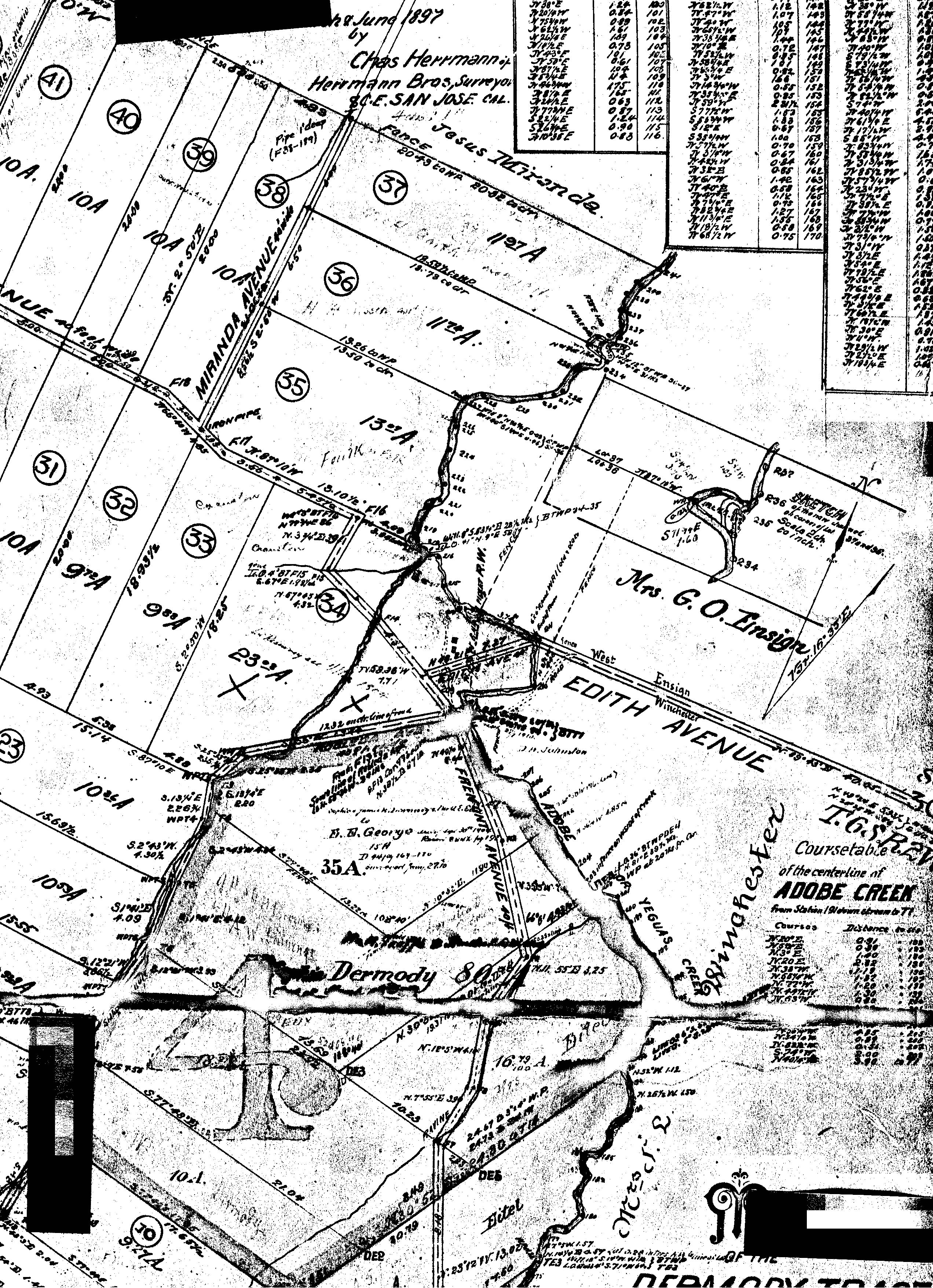
| TaaffeMap.jpg |
7/15/1897 |
Map of subdivision of parcel 4 of the Taaffe Partition, recorded 7/15/1897 (around where Adobe Creek encounters original Edith Avenue) |
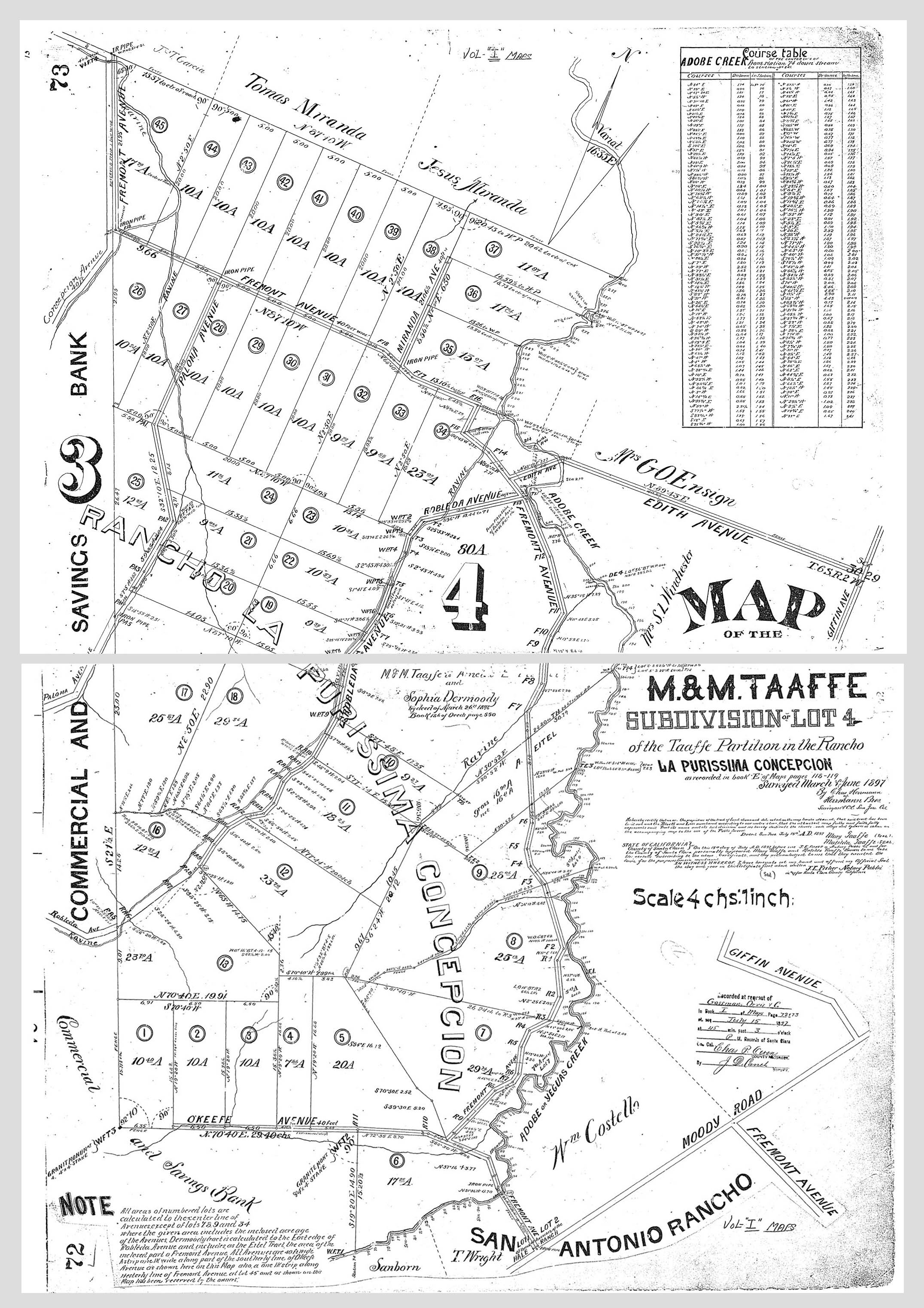
| TaaffeMap_IM72.jpg |
7/15/1897 |
A center-fold spread (i.e. two pages) of a larger and cleaner map of the Taaffe Subdivision (i.e Lot 4) in the Rancho La Purissima Concepcion
as recorded in Map Book I Pages 72 and 73. Note that at this point in history, Fremont Ave is depicted as continuing all the way South to intersect with Moody,
A further discussion of this can be seen here.
|
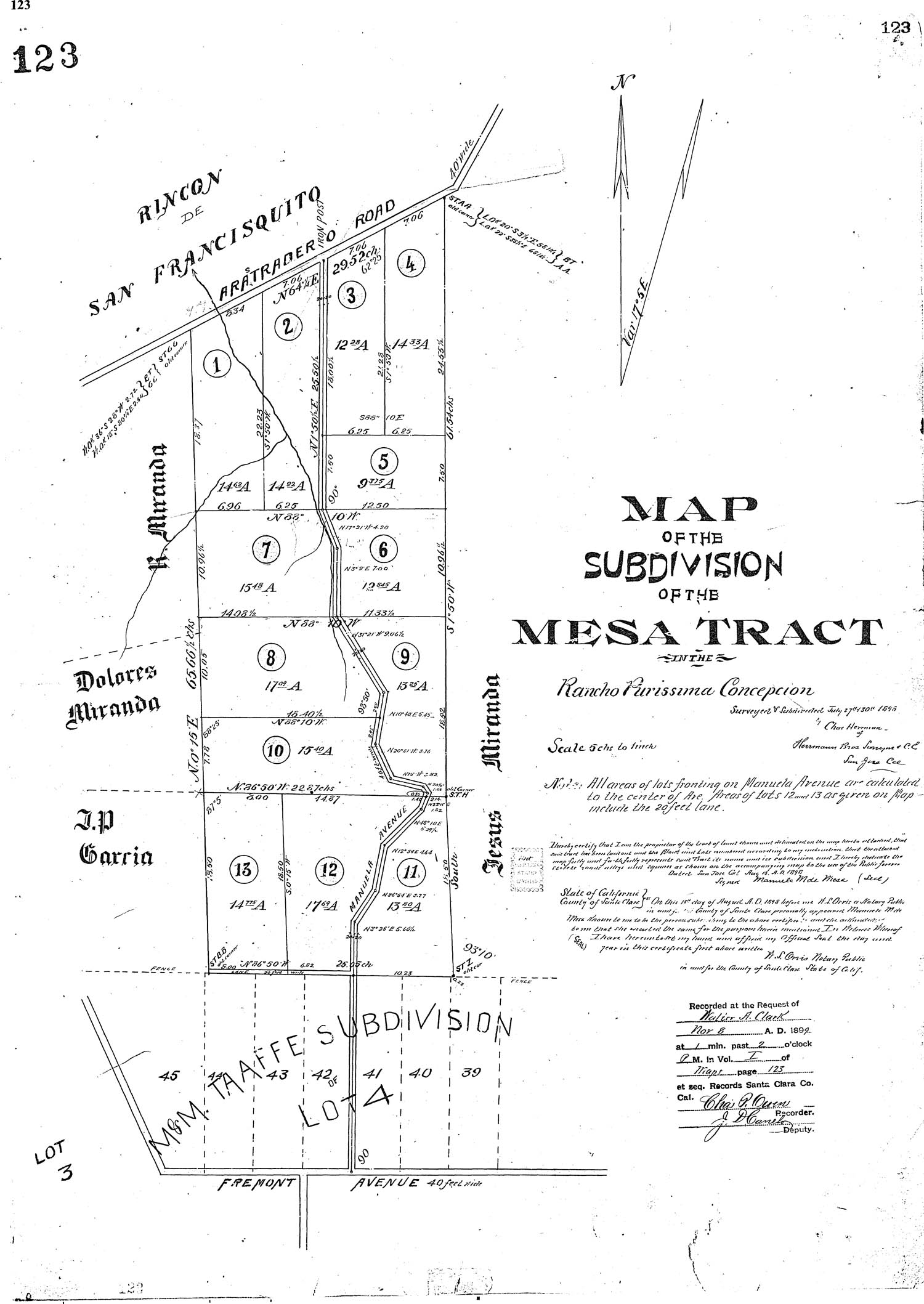
| Mesa_Tract_Map.jpg |
11/8/1899 |
Subdivision Map of the Mesa Tract, recorded 11/8/1899 (Originaly part of the Rancho Purissima Concepcion) located along Manuela
Avenue up to where it meets Arastradero. An advertisement offering lots in this tract for sale may be seen here. |
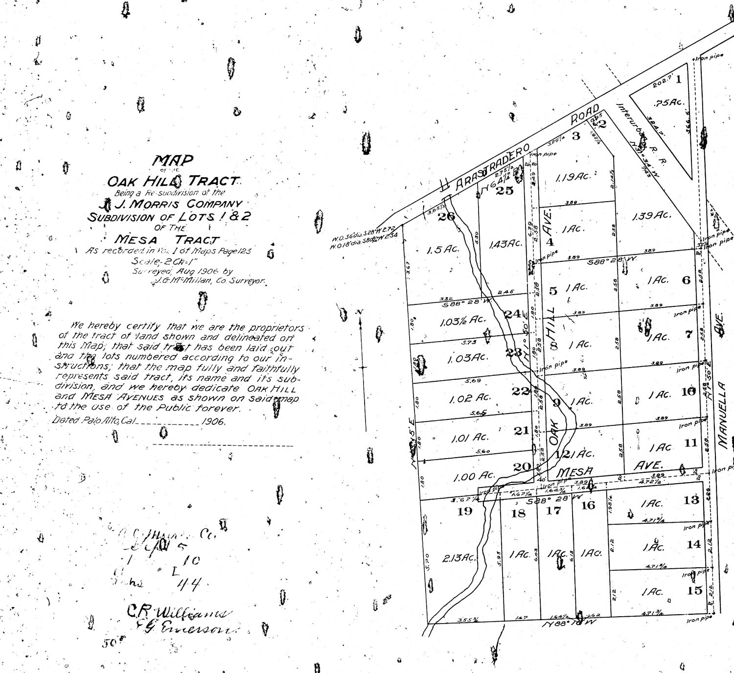
| Oak_Hill_Tract_Map.jpg |
8/1906 |
Subdivision Map of the Oak Hill Tract (Originaly lots 1 and 2 of the Mesa Tract), located at the Northern
end of thee Mesa Tract where it abuts Arastradero Road and the planned route of the Interurban Railroad, which later became Foothill Expressway |
| RanchoBlancoMap.jpg |
1905 |
Map of The Rancho Blanco section of Town (Upper Moody Road up to where it joins Page Mill Road) |
| 1952Map.jpg |
1952 |
Road map of Los Altos and Los Altos Hills |
| Los_Altos_Map_1947 |
1947 |
Brochure and Road Map map of Los Altos and Vicinity extolling the area as a place to live |
| LAMap1947Medium.htm |
1947 |
Medium sized version with improved detail - Road Map map of Los Altos and Vicinity from brochure shown in previous entry |
| LAMap1947Large.jpg |
1947 |
Large sized version with improved detail - Road Map map of Los Altos and Vicinity from brochure shown in previous entry |
| |
Documents containing historical descriptions of houses within Los Altos Hills.
(A few of these were created as part of an evaluation process to determine eligibility for some kind
of official historic status, others were created by interested residents who were researching the history of their property.)
|
|
| 13651_Burke_Rd.pdf |
8/4/2014 |
Historical Report prepared for application to subdivide property at 13651 Burke Road (18 Mb PDF File) |
| 12355_Stonebrook.pdf |
1/1/2019 |
Historic Resource Evaluation of 12355 Stonebrook Drive (George Cosmo Morgan "Little Gables") (17 Mb PDF File) |
| 14120_Miranda.pdf |
4/1/1997 |
A History of the Charles Henry Blake House (aka Sunnyhill Farm) 14120 Miranda (10 Mb PDF File) |
| 14700_Manuella.pdf |
8/1/2022 |
Request for Landmark designation for 14700 Manuella Rd (Hills Brothers Coffee) |
| Bridgman-Stephens |
8/1/2022 |
Historic notes about the Bridgman-Stephens home on Robleda Road. (Designed by Lilian Bridgman - colleague of Berkley Architects Bernard Maybeck and William Knowles) |
| Carriage_House |
4/11/2023 |
A series of pictures documenting the evolution of the original Carriage House located on today's Foothill College Campus. |
| Griffin House - Nomination National Register |
4/13/1977 |
A PDF File (38 Mbytes) of the Nomination form submitted to place the Griffin House (and associated Carriage House) in
the inventory of the National Register of Historic Places. |
|
| Aerial Photographs |
|
| LAHills_Locality.jpg |
1947 |
Aerial photo of Los Altos Hills - extending from Page Mill to Moody Road, and Cupertino border. (Large 15 Mb jpg file, 9000-by-8000 px) |
| LAHills_Locality_Small_.jpg |
1947 |
Aerial photo of Los Altos Hills - same as previous but lower resolution with reduced file size (5.45 Mb jpg file, 5000-by-4500 px) |
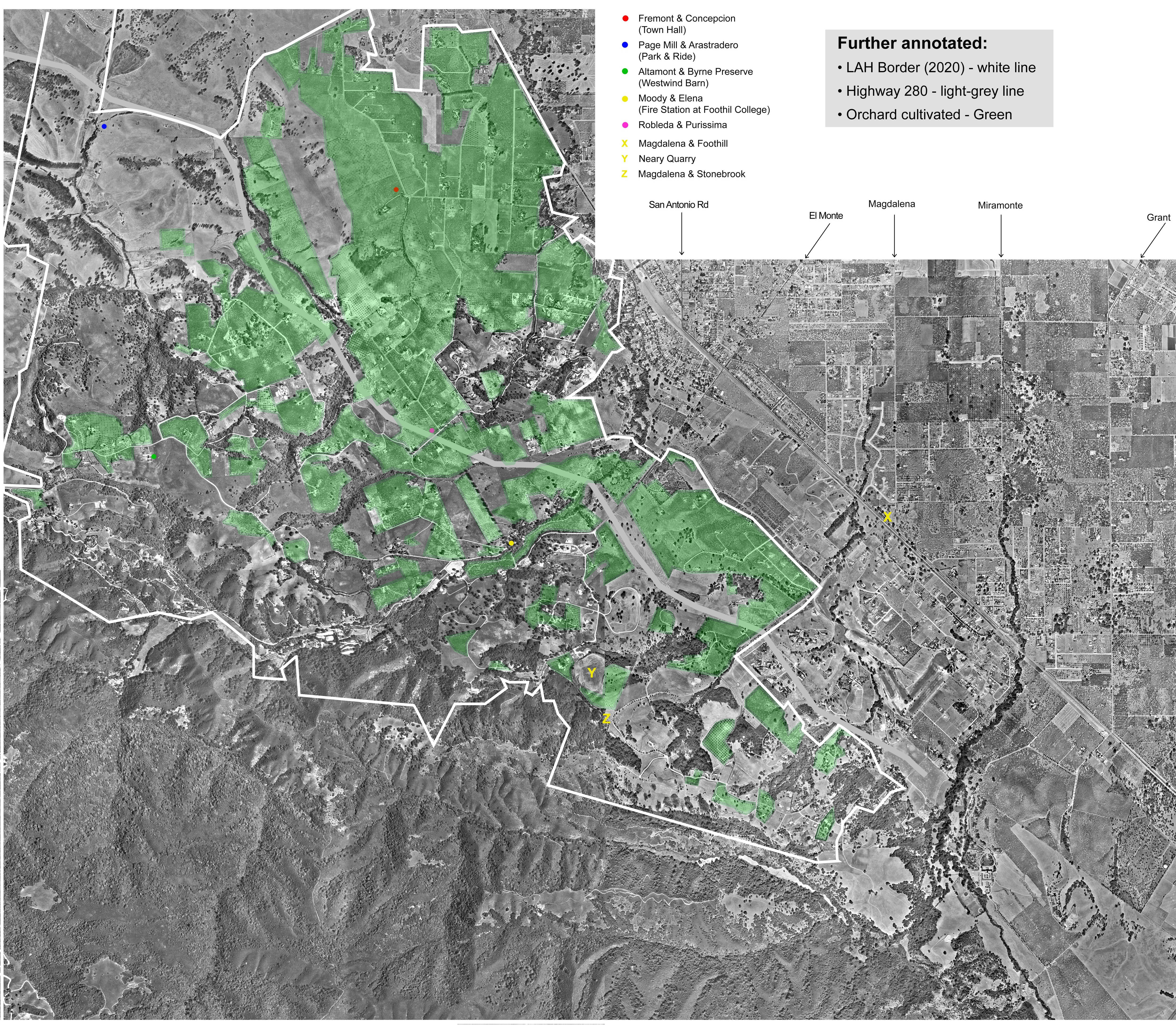
| LAHills_Locality_Annotated.jpg |
1947 |
Aerial photo of Los Altos Hills - same as previous (lower resolution) with notation added showing Town Border, Highway 280 and Area in cultivation as orchards) |
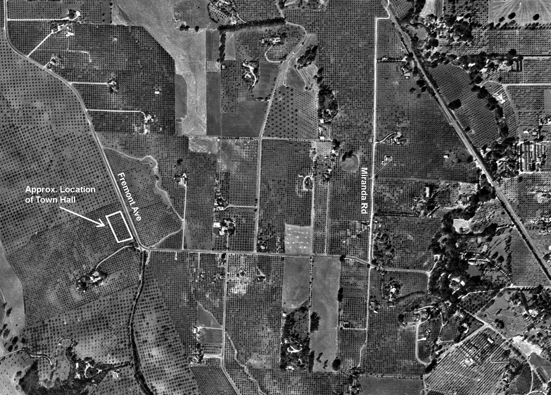
| TownHallAerial.jpg |
1947 |
Aerial photo of Town Hall Neighborhood believed to have been taken around 1947 (from California Aerial Survey) |
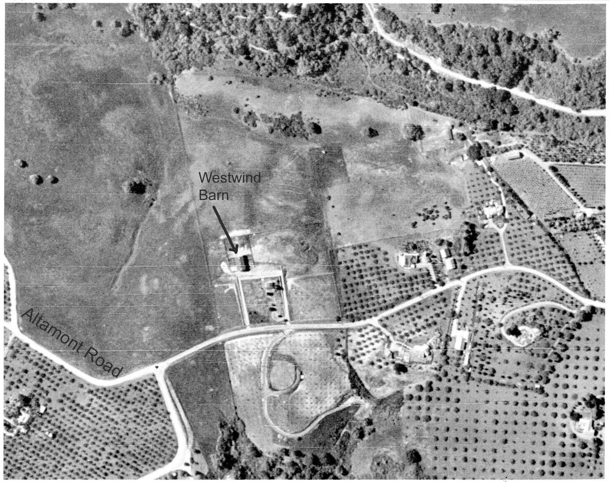
| WestwindAerial1947.jpg |
1947 |
Aerial photo of Westwind Barn neighborhood believed to have been taken around 1947 (from California Aerial Survey) |
| ElMonte1.jpg |
1947 |
Aerial photo of where El Monte turns into Moody Road - approx area where Foothill College is today |
| ElMonte2.jpg |
1947 |
Aerial photo of where El Monte turns into Moody Road - same as previous image but with annotations showing current landmarks |
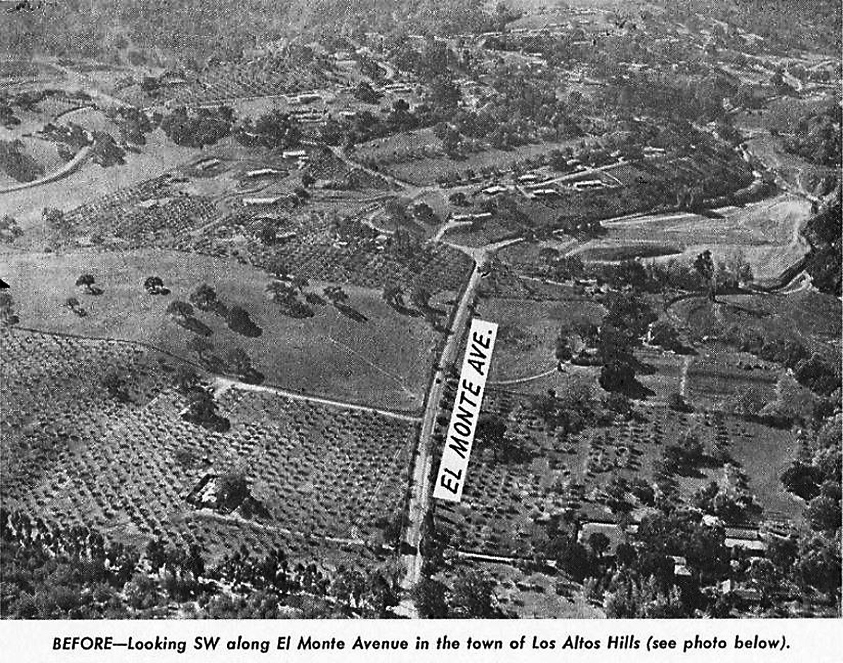
| El_Monte_280.jpg |
± 1964 |
From Brochure about proposed new Hiway 280 - Location of proposed El Monte Intersection |
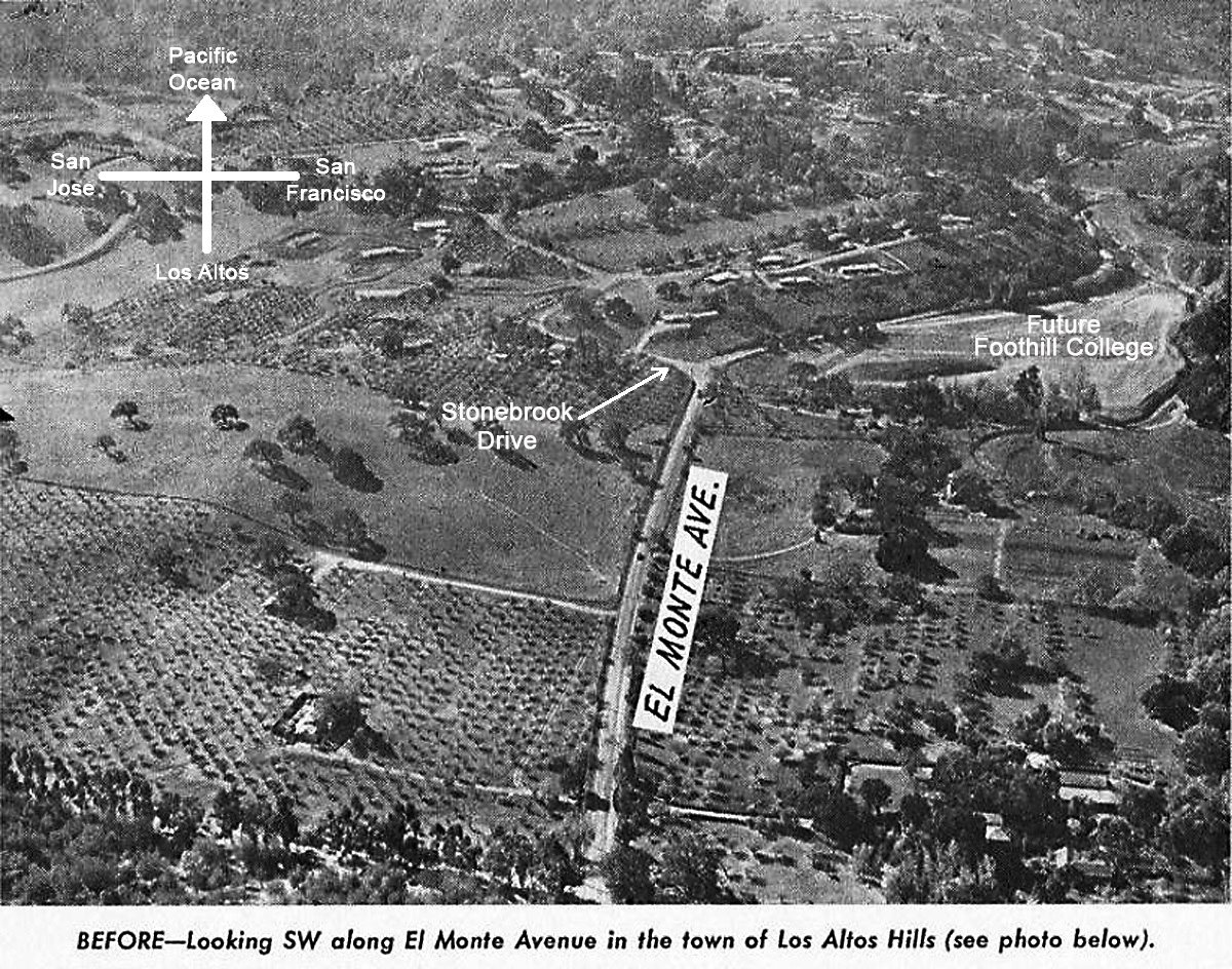
| El_Monte_280_Annotated.jpg |
± 1964 |
From Brochure about proposed new Hiway 280 - same as previous image but with annotations showing current landmarks |
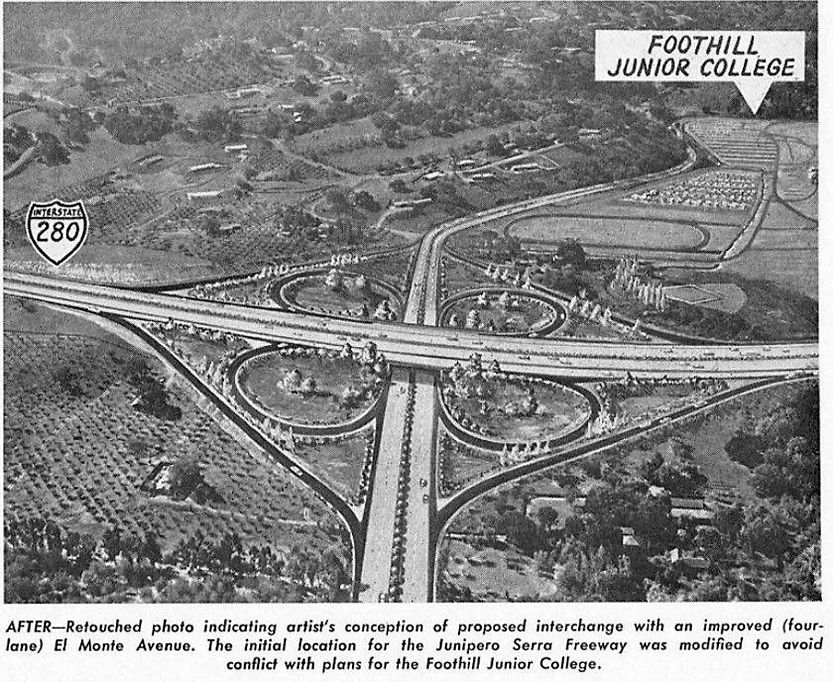
| El_Monte_Interchange_280.jpg |
± 1964 |
From Brochure about proposed new Hiway 280 - Artist's impression of proposed El Monte Intersection |
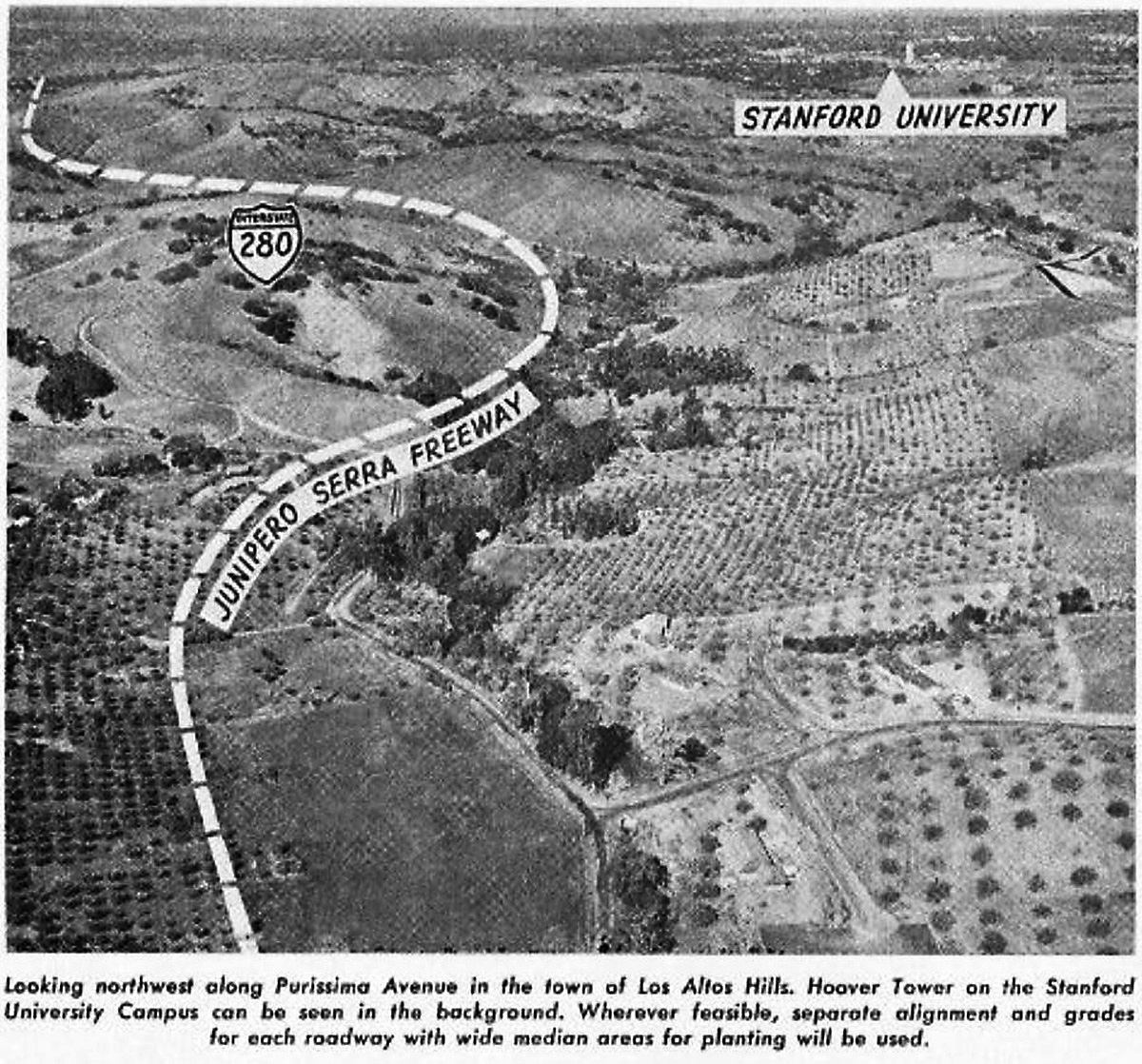
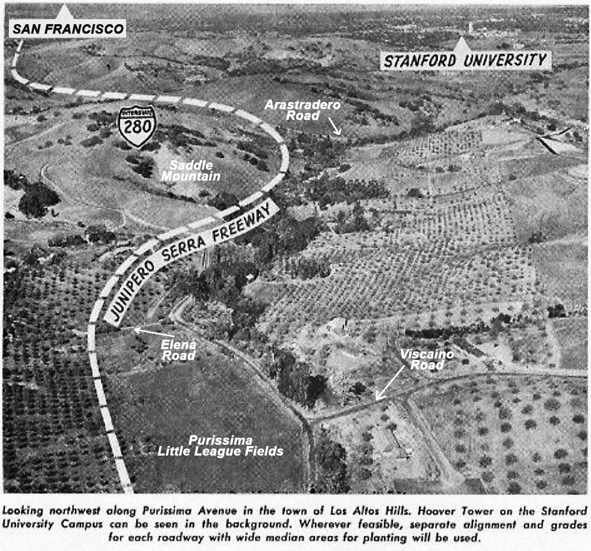
| SaddleMountain_280.jpg |
± 1964 |
From Brochure about proposed new Hiway 280 - Proposed Hiway algnment along Purissima and SaddleMountain |
| SaddleMountain_280_Annotated.jpg |
± 1964 |
From Brochure about proposed new Hiway 280 - same as previous image but with annotations showing current landmarks |
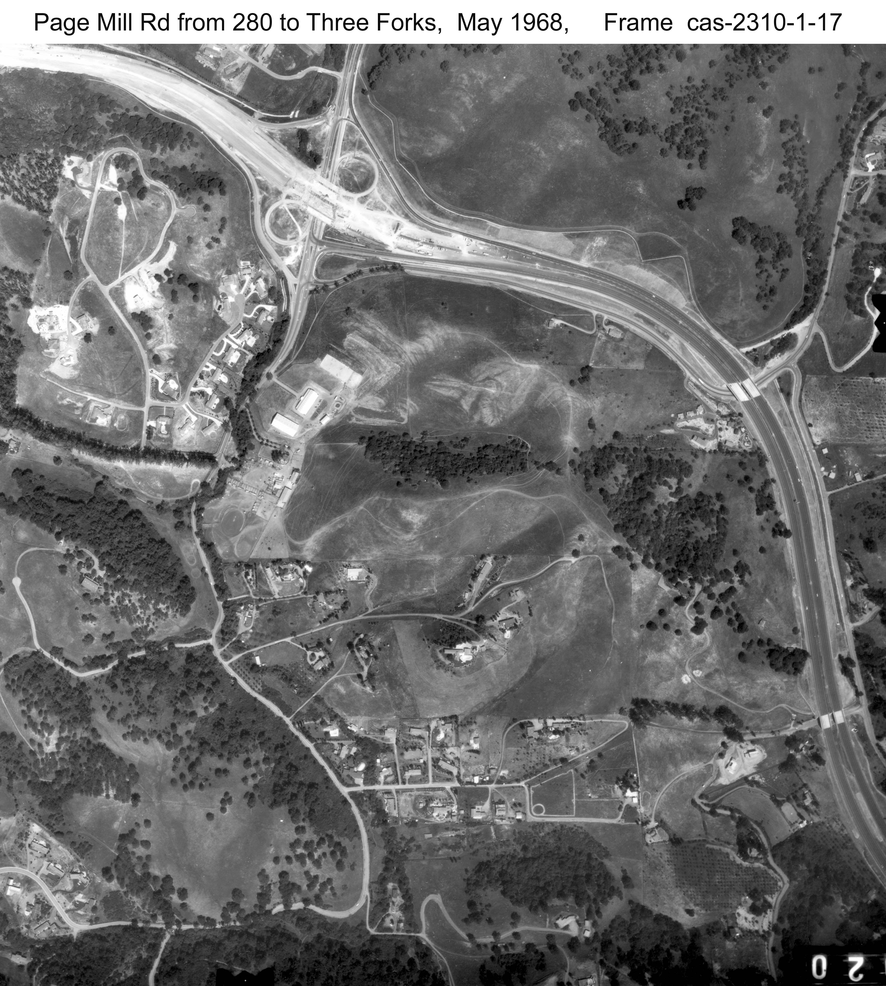
| PageMill-280-to-ThreeForks.jpg |
3/23/1966 |
Aerial of the section of Page Mill Road between 280 (where the intersection is under construction) and Three Forks Lane (Large file - click on image to zoom in) |
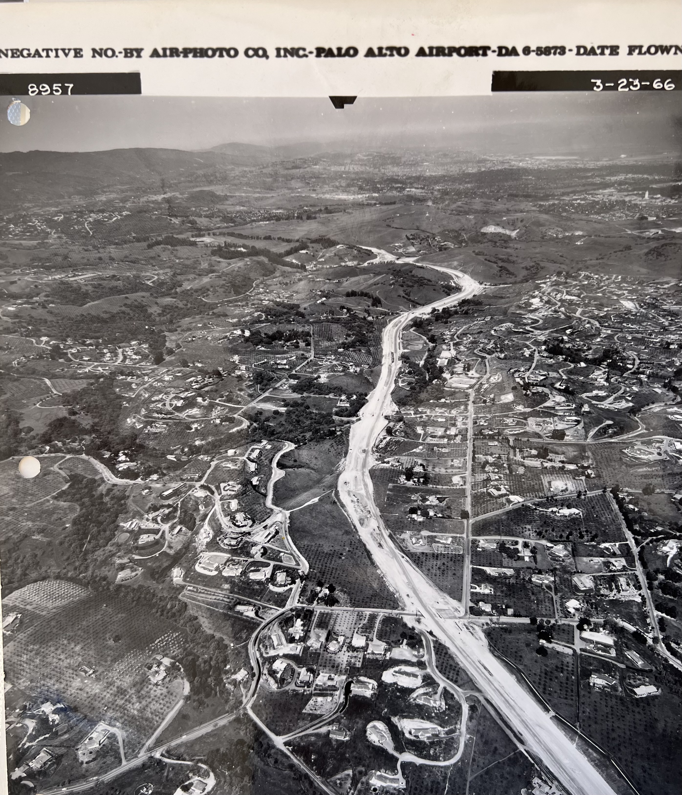
| Aerial_280_Construction.jpg |
3/23/1966 |
Aerial of 280 under construction near Robleda and Purissima (Chapel In The Hills) (Large file - click on image to zoom in) |